The role of collaboration in city planning: 2026 guide
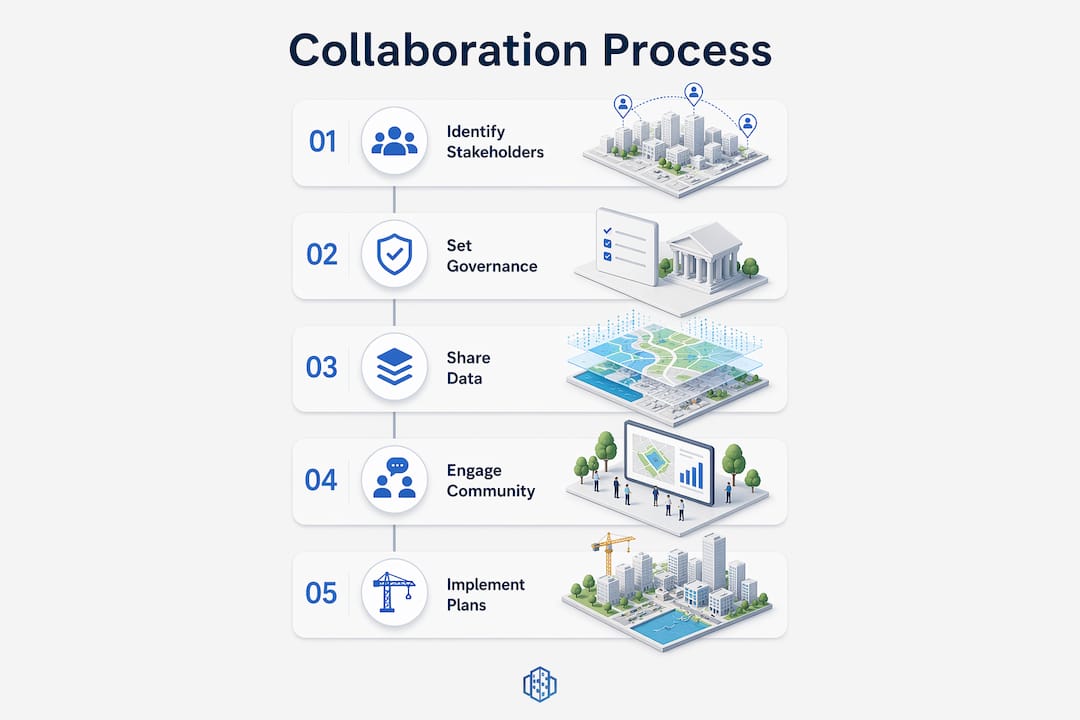
Collaboration in city planning is defined as the coordinated, multi-stakeholder effort by municipalities, developers, urban planners, architects, and communities to shape urban environments through shared data, structured governance, and participatory tools. The industry term for this practice is participatory urban planning, though professionals increasingly use collaborative city governance to reflect the cross-sector nature of modern projects. When done well, this approach replaces fragmented, top-down decision-making with a process where GIS data, 3D scenario models, and community-defined metrics sit at the centre of every major decision. Platforms such as 3D Cityplanner have made it practical to run these processes at scale, giving planners, developers, and municipal officials a shared environment in which to test, compare, and communicate spatial scenarios before committing to costly physical changes.
How does shared data improve decision-making in city planning?
Integrated digital collaboration platforms improve communication efficiency by 40% and speed approval processes by 30% compared to traditional methods. That figure reflects a structural shift: when all stakeholders work from the same 3D city model rather than exchanging static PDFs and disconnected CAD files, misunderstandings surface earlier and at far lower cost.
The mechanism is straightforward. Multi-user editing environments allow a municipal engineer, a private developer, and a transport consultant to annotate the same massing model simultaneously. Visual annotation tools replace lengthy written comments with georeferenced markers directly on the 3D model, cutting the review cycle from weeks to days. Real-time collaboration also enables public stakeholders to explore scenarios interactively, rather than passively receiving a rendered image at a public meeting.

The contrast with traditional workflows is significant:
| Workflow element | Traditional approach | Digital collaborative approach |
|---|---|---|
| Data sharing | Static PDFs and email chains | Live GIS-linked 3D model accessible to all |
| Stakeholder feedback | Written consultation responses | Georeferenced annotations on shared model |
| Scenario comparison | Sequential presentations | Side-by-side 3D scenario viewer |
| Approval timeline | 30% slower on average | Accelerated through shared sign-off tools |
| Community engagement | Single public meeting | Ongoing portal with asynchronous input |
The table above illustrates why urban planning software with strong collaboration features has become a procurement priority for forward-thinking municipalities. Shared 3D visualisations of building massing, green space, sunlight access, and parking capacity give every participant a common reference point, which is the precondition for productive disagreement and genuine co-creation.
Pro Tip: Set up a shared 3D model environment at project inception, not after the first round of consultation. Stakeholders who explore scenarios visually from the start are far less likely to raise fundamental objections at planning committee stage.
What governance frameworks support meaningful stakeholder involvement?
Structured governance is what separates productive urban planning collaboration from a series of well-attended but inconclusive meetings. Defining roles with a RACI matrix at project inception reduces decision disputes and prevents delays caused by unclear accountability. A RACI matrix assigns each task a single Responsible party, one Accountable decision-maker, named Consulted contributors, and Informed observers. Applied to a masterplanning project, this means a developer cannot claim they were unaware of a zoning constraint, and a community group cannot be sidelined from a decision that directly affects their neighbourhood.
Beyond role clarity, effective collaboration requires shifting from top-down control to moderated processes where diverse interests productively clash. This is a harder organisational change than adopting a new software platform. It requires city officials to accept that community groups and private developers have legitimate, sometimes conflicting, interests that must be reconciled rather than overruled.
A practical governance structure for a major urban development project typically follows four stages:
- Scoping and role assignment. Convene all key parties, agree on a RACI matrix, and document a risk register covering land ownership disputes, infrastructure constraints, and community opposition triggers.
- Co-creation workshops. Use physical and digital tools together. A physical scale model alongside a live 3D Cityplanner scenario allows participants with varying technical literacy to engage meaningfully.
- Iterative review cycles. Schedule formal review points at defined milestones, supplemented by informal virtual walkthroughs. Documenting a risk register from project inception and conducting informal virtual walkthroughs reduce late-stage community opposition and rejection.
- Ongoing stewardship. Community engagement is an ongoing process with continuous feedback loops, not a single consultation event. Assign a named community liaison who reports back to the project board at every stage.
Power imbalances are a persistent challenge. Neutral facilitators, including AI mediation, can help manage these dynamics and ensure equitable dialogue among stakeholders. This is particularly relevant in mixed-tenure regeneration projects where housing associations, private developers, and long-term residents each bring different levels of technical knowledge and institutional influence.
Pro Tip: Embed collaboration norms in the project charter, not just the governance appendix. When all parties sign a document that explicitly describes how disagreements will be resolved, the first difficult conversation is far less likely to derail the project.
How do cities move from dialogue to measurable implementation?
Productive conversation without a concrete activity plan is one of the most common failure modes in participatory city planning. Successful city-to-city collaborations in 2026 focus on co-developing concrete action plans with clear timelines, defined roles, and financial projections. The Urban-Act city pairing workshops in Bangkok demonstrated that cities which arrive at collaboration with pre-agreed implementation frameworks progress to delivery significantly faster than those treating the workshop as an exploratory exercise.
Modern collaborative urban planning uses community-defined success metrics such as social cohesion, perceived safety, and green space access alongside conventional planning indicators. These metrics matter because they make the benefits of collaboration legible to residents, not just to planners and developers. A project that delivers 2,000 square metres of new public green space is more persuasive to a community group when that outcome was defined by the community itself at the outset.
Converting collaborative dialogue into measurable project progress requires a structured approach:
- Define milestones with shared ownership. Each milestone should have a named responsible party from the RACI matrix and a date visible to all stakeholders in the shared project environment.
- Attach financial projections to spatial scenarios. When a 3D scenario includes development capacity calculations and infrastructure cost estimates, stakeholders can evaluate trade-offs rather than simply approving or rejecting a design.
- Set community-defined KPIs. Agree on three to five measurable outcomes at the start, such as percentage of households within 400 metres of green space, and track them through each design iteration.
- Schedule implementation reviews. A quarterly review that compares actual progress against the agreed activity plan keeps all parties accountable and surfaces emerging risks before they become delays.
- Document decisions in the shared platform. Every agreed change to the spatial scenario should be logged with a rationale, so late-joining stakeholders and future project teams have a clear audit trail.
Which digital tools best support urban planning collaboration?
The effectiveness of digital tools depends on organisational learning, cross-departmental integration, and trust-building feedback mechanisms. A technically capable platform deployed in an organisation without clear data governance will underperform a simpler tool used consistently by a well-coordinated team.
3D Cityplanner is a browser-based platform that integrates GIS data, 3D city models, and scenario planning tools in a single environment. Its 3D urban visualisation capabilities allow planners to model building massing, sunlight, visibility, parking, and green space simultaneously, giving all stakeholders a spatially accurate picture of proposed changes. The platform supports both synchronous and asynchronous collaboration, which matters practically: a municipal official reviewing a scenario at 09:00 and a community group member providing feedback at 20:00 are both contributing to the same live model.
Key capabilities to look for in any collaborative urban planning platform:
- Multi-user editing with version control. Prevents conflicting edits and provides a clear record of who changed what and when.
- Role-based access control. Allows sensitive financial or ownership data to remain confidential while spatial scenarios remain open to all participants.
- Synchronous and asynchronous modes that accommodate stakeholders’ diverse schedules and improve participation rates.
- GIS and BIM integration. Connects planning data to existing municipal datasets, reducing duplication and improving accuracy.
- Stakeholder portals. Provide non-technical participants with a simplified view of the 3D model, enabling genuine community engagement in city design without requiring GIS expertise.
‘Phygital’ strategies, which combine physical models with real-time 3D digital twins, enable broad participation while protecting sensitive information through role-based access. This approach is particularly effective in public exhibitions where residents can interact with a physical scale model while planners simultaneously update the digital twin in response to feedback.
Pro Tip: Before selecting a platform, audit your current data environment. Identify which GIS layers, BIM files, and planning databases need to connect to the new tool. A platform that cannot ingest your existing data formats will create a parallel workflow rather than replacing the fragmented one.
What are the main pitfalls in city planning collaboration?
Fragmented modelling and communication tools cause 25% of project delays due to coordination issues. This is the most quantifiable consequence of poor collaboration infrastructure, but it is far from the only one.
Organisational silos remain the most persistent structural barrier. Transport, housing, and environmental departments within the same municipality often operate on different data standards, procurement cycles, and political priorities. A shared 3D platform addresses the data problem but not the organisational one. Cross-sector partnerships in planning require explicit agreements about data sharing, joint decision-making authority, and shared accountability for outcomes.
Common pitfalls and how to address them:
- Tokenistic community engagement. Holding a single public consultation and calling it participation does not constitute co-creation. Mitigate this by embedding community representatives in the project governance structure from the start, not just at consultation stages.
- Green gentrification risk. Adding parks and green infrastructure without addressing affordability can displace the communities the improvements were intended to benefit. Include housing affordability metrics alongside environmental KPIs from the outset.
- Stakeholder fatigue. Overly frequent or poorly structured engagement sessions erode participation. Use asynchronous digital tools to reduce the burden of attendance while maintaining continuous input.
- Technology adoption gaps. Not all stakeholders have equal digital literacy. Provide training sessions and simplified portal views to prevent the collaboration platform from becoming a barrier rather than an enabler.
- Undocumented decisions. Verbal agreements made in workshops that are not recorded in the shared platform become sources of dispute months later. Assign a project secretary responsible for logging every agreed change.
Key takeaways
Effective collaboration in city planning requires shared data infrastructure, structured governance, and continuous community engagement working together from project inception to delivery.
| Point | Details |
|---|---|
| Shared data accelerates decisions | Integrated platforms improve communication efficiency by 40% and cut approval times by 30%. |
| RACI matrices prevent disputes | Assigning clear roles at project inception reduces accountability gaps and costly delays. |
| Community metrics drive trust | Defining success as social cohesion and green space access makes outcomes legible to residents. |
| Digital tools need organisational readiness | Platform effectiveness depends on cross-departmental integration and consistent data governance. |
| Engagement is continuous, not episodic | Ongoing feedback loops, not single consultations, build the trust needed for project delivery. |
Why I think we underestimate the organisational side of collaboration
After working across multiple masterplanning and redevelopment projects, the pattern I keep observing is this: teams invest heavily in selecting the right digital platform and almost nothing in preparing the organisation to use it. The RACI matrix conversation is the most revealing moment in any project kick-off. When a room full of experienced professionals cannot agree on who is accountable for a zoning decision, no amount of shared 3D visualisation will save the project from a governance crisis six months later.
The ‘phygital’ approach genuinely changes community engagement quality. I have seen residents who disengaged entirely from digital-only consultations become active contributors when a physical scale model sits alongside a live 3D screen. The combination respects different ways of understanding space and signals that the project team is willing to meet people where they are, not just where the technology is most convenient.
The hardest lesson I have learned is that community engagement treated as a compliance exercise produces exactly the outcomes you would expect: low-quality feedback, late-stage objections, and projects that technically consulted but never genuinely listened. The cities and developers who treat engagement as a continuous design input, not a sign-off requirement, consistently deliver projects with stronger community support and fewer post-approval revisions.
On digital tool selection: the question is rarely which platform has the most features. The question is which platform your team will actually use consistently, and which one your least technically confident stakeholder can navigate without assistance. Start with that constraint and work backwards.
— Anne Dullemond
How 3D Cityplanner supports collaborative urban planning
3D Cityplanner brings GIS data, 3D city modelling, and scenario planning into a single browser-based environment, giving municipalities, planners, and developers a shared platform for every stage of a project. From early-stage feasibility studies to masterplanning and stakeholder presentations, the platform supports multi-user editing, role-based access control, and side-by-side scenario comparison.
Whether you are coordinating a mixed-use redevelopment or preparing a public engagement session, 3D Cityplanner’s urban design platform gives every stakeholder a spatially accurate, data-driven view of proposed changes. Explore the platform’s digital twin capabilities or request a free trial to see how shared 3D scenarios can replace fragmented workflows in your next project.
FAQ
What is the role of collaboration in city planning?
Collaboration in city planning is the coordinated engagement of municipalities, developers, planners, architects, and communities using shared data and participatory tools to improve urban decision-making. It replaces fragmented, top-down processes with structured, multi-stakeholder governance that produces more durable and widely supported outcomes.
How does a RACI matrix help urban planning projects?
A RACI matrix assigns Responsible, Accountable, Consulted, and Informed roles to every key decision at project inception, reducing disputes and preventing delays caused by unclear accountability. Research confirms it is one of the most effective tools for managing the complex stakeholder relationships typical of urban development projects.
What are community-defined success metrics in city planning?
Community-defined success metrics are measurable outcomes agreed with residents at project inception, such as social cohesion scores, perceived safety ratings, and the percentage of households within 400 metres of green space. These metrics make the benefits of participatory planning legible to communities, not just to technical professionals.
Why do fragmented tools cause project delays?
Fragmented modelling and communication tools cause 25% of project delays due to coordination failures, version conflicts, and miscommunication between teams working on disconnected platforms. Consolidating workflows onto a single integrated environment with GIS and 3D modelling capabilities directly reduces this risk.
What is a phygital engagement strategy in urban planning?
A phygital strategy combines physical scale models with real-time 3D digital twins to enable broad community participation while protecting sensitive project data through role-based access control. This approach is particularly effective at public exhibitions where residents with varying levels of digital literacy need to engage meaningfully with complex spatial proposals.