Top 3 Site Analysis Software Alternatives 2026
Finding site analysis software that integrates 3D modelling, GIS layers, and collaborative scenario planning is often difficult. Many digital twin platforms restrict browser access or demand costly licences, making early stakeholder communication and iteration cumbersome. This comparison covers pricing and scenario workflows so urban planners, developers, and consultants can match a tool to site feasibility work.
Table of Contents
3D Cityplanner
At a Glance
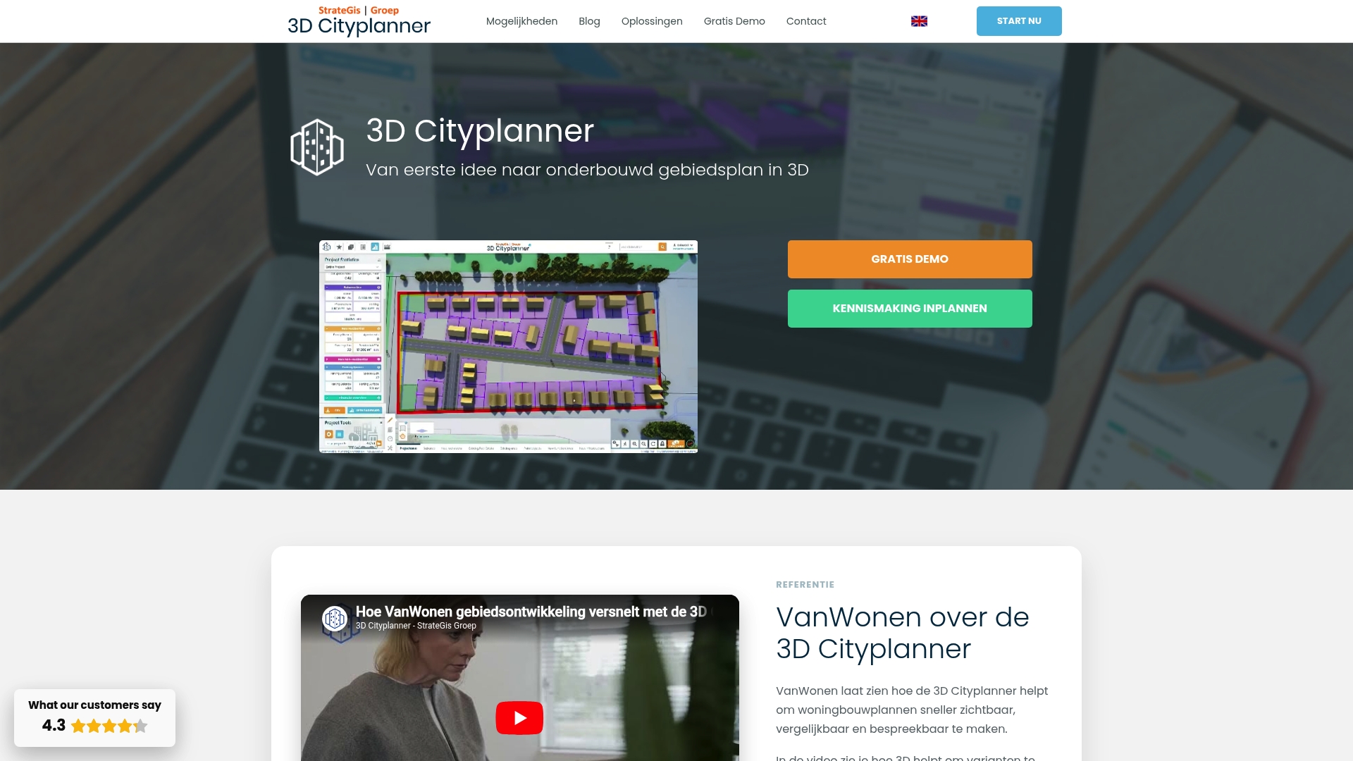
It runs entirely in the browser and functions as a digital twin that brings GIS data and 3D city models together with automated scenario generation. The platform supports sun shadow and environmental impact analysis alongside visibility, parking and development capacity checks. That combination speeds early feasibility and stakeholder discussion for site evaluation and masterplanning.
Core Features
3D Cityplanner embeds AI-driven location analysis and an Automatic urban scenario generator inside a browser based 3D environment, letting teams produce and compare massing variants quickly. The tool includes sun shadow and environmental impact workflows and basic financial and programme calculation tools to test viability. It also supports a digital twin approach by integrating existing spatial data and 3D city models for context aware analysis.
Key Differentiator
The decisive difference is the browser based 3D environment that couples scenario generation with layered spatial data. Teams do not need a desktop GIS to produce comparable alternatives and visualisations. That setup shifts iteration earlier in the planning process and keeps stakeholders working from the same live model.
Pros
The platform enables rapid visual comparison across alternative proposals, which helps choose development capacity and building massing before detailed design starts. Its AI and automated generators reduce manual layout work and shorten the time spent on preliminary feasibility analysis. Browser based collaboration improves stakeholder engagement because councillors, developers and consultants can view the same 3D scenarios without installing software.
Cons
- Primarily suited for early and mid stage planning; it does not provide detailed construction design features and may require handover to specialised CAD or BIM tools for technical delivery.
Who It’s For
Urban planners, city officials and planning consultants who need fast site appraisal and clear 3D visualisations will find it useful. Real estate developers and architects focused on early feasibility and stakeholder workshops will also benefit. Local authorities aiming to test zoning, sunlight or parking outcomes before committing to detailed design will gain the most.
Unique Value Proposition
Because the scenario generator and project calculations run inside the browser with integrated spatial layers, teams iterate feasibility without repeated data exports or desktop installs. That workflow reduces friction when testing multiple development programmes and sunlight constraints on the same parcel. The result is faster consensus in early stage decision making.
Real World Use Case
Van Wonen uses 3D Cityplanner to visualise variant schemes and analyse environmental impact during early project stages. The team runs several massing options, checks sun shadowing and shares results with neighbours and council officers. That transparency shortens review cycles and focuses later technical work.
Pricing
Pricing is not published in the supplied materials. The vendor describes the tool as informational only for initial enquiries. Contact the vendor to discuss licence models, tiers and deployment options.
Website: https://3dcityplanner.com
VU.CITY
At a Glance
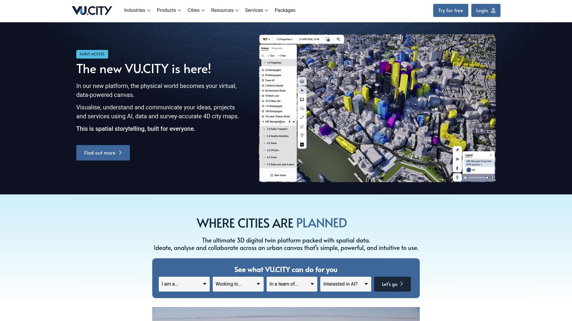
High-fidelity, survey-accurate 4D city maps form the core of VU.CITY. The platform combines detailed city models with time-aware visualisation and generative AI for design support. This mix targets teams that need precise context for impact analysis and public consultation.
Core Features
VU.CITY offers layered 3D city modelling with time-sensitive visualisation and microclimate layers for context-aware analysis. It supports common model formats and imports and exports like FBX and glTF, and it embeds generative AI tools to assist early-stage design exploration. Collaborative presentation tools and a knowledge base help teams present proposals to stakeholders.
Key Differentiator
The product’s standout claim is its survey-accurate 4D city maps paired with AI-driven analysis and stakeholder collaboration tools. That pairing aims to reduce uncertainty during feasibility and consultation phases. For teams that prioritise high-precision urban context, that focus is hard to match in other modelling tools.
Pros
The platform delivers highly detailed urban models across multiple cities, which speeds visual checks for sightlines and massing. Its support for major 3D packages such as Revit and SketchUp eases model exchange for architects and consultants. Analysis tools for sunlight, shadow, and zone of theoretical visibility assist environmental assessment and consultation workflows.
Cons
- Pricing transparency is limited until the platform’s 2026 pricing update is announced.
- Scene management and advanced model styling features are listed as in development or rolling out on newer builds.
- Heavy reliance on internet access can interrupt work in low-connectivity situations.
When It May Not Fit
Organisations needing fixed, clearly published licensing tiers today will find the current pricing note unhelpful. Teams that require mature scene management or very advanced styling may prefer platforms that already ship those features. Projects running in offline-first settings will see operational friction because the platform depends on online data access.
Notable Integrations
- Revit
- SketchUp
- Blender
- FBX and GLB model formats
Who It’s For
VU.CITY suits urban planners, local authorities, architects, and developers who require survey-grade urban context for feasibility studies and consultation. It is useful for teams that exchange models with Revit or SketchUp workflows. Local planning teams that rely on precise sunlight and visibility analysis will gain the most value.
Real World Use Case
City planners load a proposed scheme into VU.CITY to run shadow studies across seasons and to create stakeholder-ready visualisations. The team exports a massing model to SketchUp for architect refinement. Planners then use the platform’s presentation tools during a public consultation to show time-based impacts.
Pricing
Vendor materials state that pricing is not specified online and that the platform is transitioning to a new pricing structure in 2026. Prospective buyers are asked to contact VU.CITY for licensing details and quotes. Larger municipal or developer deployments typically require a tailored commercial agreement.
Website: https://vu.city
TestFit
At a Glance
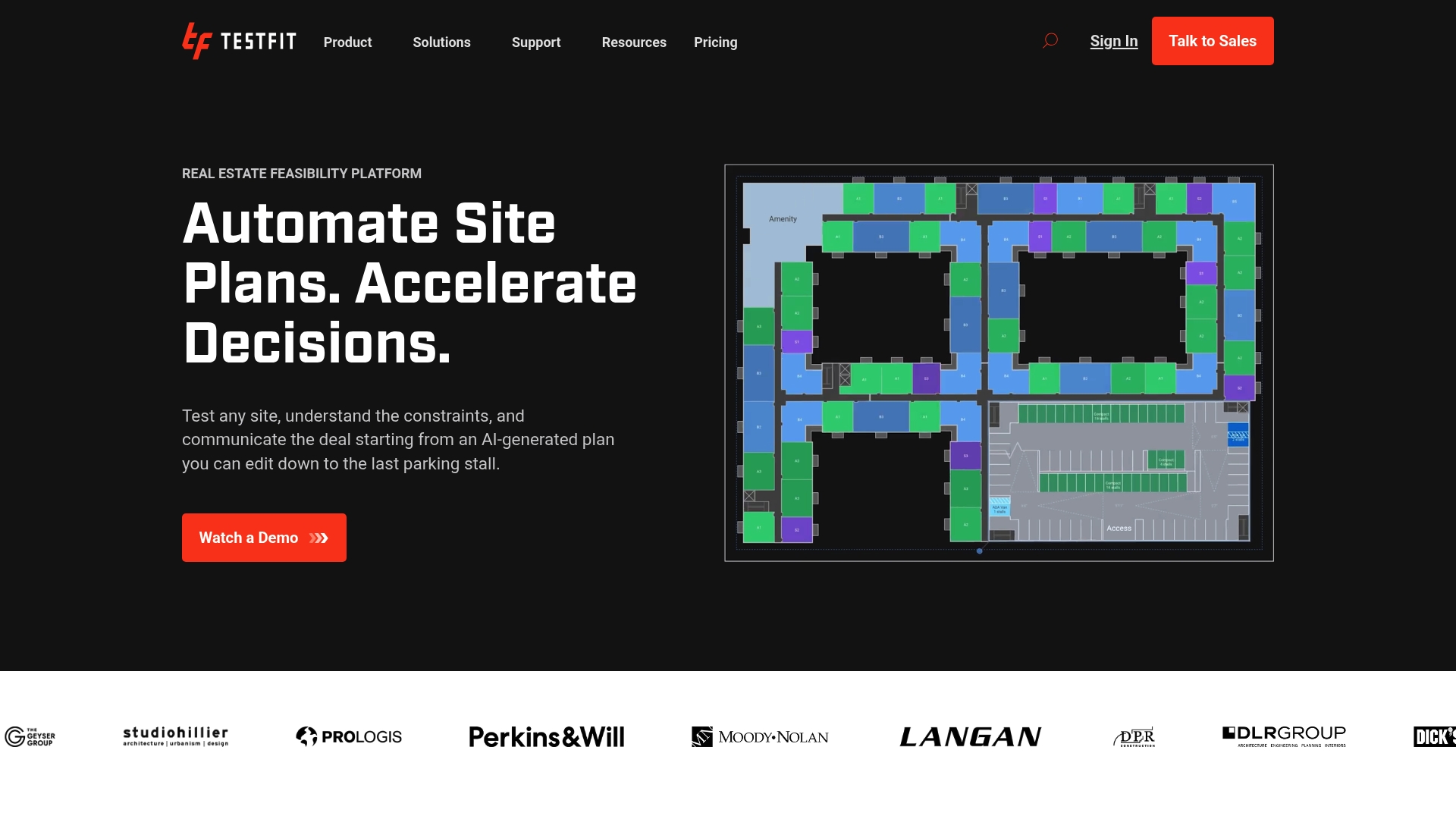
Pricing starts at $2,100/year for the Parking Solver, with Site Solver and Site Solver Portfolio priced at $10,000/year and $15,000/year respectively. The platform generates multiple site layouts rapidly using AI powered generative routines and exports models into design tools. That speed turns early feasibility work into an iterative exercise rather than a single upfront task.
Core Features
TestFit combines parcel drawing and site mapping with 3D massing visualisation, zoning checks, and environmental layer support in one interface. Automated parking and drive aisle design, quantity takeoffs, and live pro forma synchronisation let you test yield and cost scenarios without switching tools. Exports to Revit, AutoCAD, and SketchUp support handoff into detailed design and cost modelling.
Key Differentiator
The standout is fast, AI powered site plan generation paired with scenario modelling that lets you compare many permutations quickly. That capability is designed to move deal evaluation from spreadsheets into spatial iterations. It is most useful where you need rapid trade off analysis between parking, massing, and unit counts.
Pros
TestFit automates repetitive feasibility tasks and so saves planning hours that are normally spent on manual layouts. Rapid generation of multiple schemes helps you find higher yield options and test zoning permutations before committing to purchase or permitting. Exports to common CAD and BIM formats support collaboration with architects and engineers, and live pro forma links let financial assumptions follow the geometry as you change the scheme.
Cons
- Requires familiarity with land development and site planning workflows; beginners face a steep learning curve.
- Several advanced capabilities appear only on higher tier subscriptions, which raises the entry cost for larger projects.
- Limited support for non English language interfaces and some international data layers reduces usefulness outside primary markets.
When It May Not Fit
Teams that need a simple mapping tool without feasibility analysis will find TestFit more complex than necessary. Practices that lack experience in yield analysis or unit mix modelling may struggle to extract value quickly. Organisations that require multi language interfaces across all project stakeholders should consider alternatives.
Notable Integrations
TestFit connects directly to major design platforms used by architects and engineers. The listed integrations are Revit, AutoCAD, and SketchUp, which lets you export massing and parking layouts for detailed design. These connections reduce manual redraw and keep geometry aligned with your BIM and CAD workflows.
Who It’s For
The product suits real estate developers, urban planners, architects, and civil engineers who run early stage site feasibility studies. It matches teams that require rapid iteration on massing, parking, and pro forma outcomes. Practice groups focused on preparing acquisition or permitting packages will gain the most immediate benefit.
Real World Use Case
A developer evaluates a mixed use block by generating several massing and parking configurations in a single afternoon. The team compares zoning outcomes, tests parking counts, and updates cost assumptions in the live pro forma. The preferred scheme then exports to Revit for detailed design and contractor tendering.
Pricing
Licences start at $2,100/year for the Parking Solver, $10,000/year for Site Solver, and $15,000/year for Site Solver Portfolio. Vendors offer add ons and customised packages for enterprise needs, so procurement should include a conversation about site counts and export requirements.
Website: https://testfit.io
Comparison of alternatives
Among the leading site analysis software solutions, each product offers unique features suitable for specific planning requirements and workflows. This analysis contrasts these offerings to guide urban planners, developers, and city authorities in selecting the most suitable tool.
Feature differentiation
3D Cityplanner offers a browser-based 3D environment designed for scenario planning, combining integrated GIS data and automated urban analysis workflows. This feature simplifies early feasibility and stakeholder collaboration without using specialised desktop-based software. Conversely, VU.CITY provides highly precise survey-grade 4D city maps with capabilities for time-sensitive visualisation, making it ideal for precision-demanding urban planning tasks. TestFit focuses on rapid feasibility assessments, allowing for multiple CRM-integrated layout scenarios primarily for private developers needing expedited outputs.
Real-world application scenarios
In real-world applications, 3D Cityplanner demonstrates its effectiveness with Van Wonen by facilitating rapid scenario visualisation and enabling council discussions, which hastens project timelines. VU.CITY supports city planners during public consultation phases, leveraging its advanced visualisation and integrated model exchange capabilities. TestFit finds strength in commercial development, enabling developers to assess multiple configurations within a single workday, effectively aiding cost and layout decisions.
Best fit
- For urban planners engaged in early-stage feasibility studies requiring browser-accessible scenario generation and collaboration, 3D Cityplanner is tailored to deliver comprehensively.
- When high precision is a priority, such as for sightline or visibility analysis in urban planning, VU.CITY’s survey-grade 4D city maps provide indispensable accuracy.
- Developers who must experiment with rapid site iterations and align financial forecasting simultaneously will find TestFit’s capabilities.
Our pick
3D Cityplanner emerges as an exceptional choice for urban planners and real estate developers prioritising rapid, browser-based feasibility assessments and stakeholder engagement during early development phases. Its ability to handle initial studies with ease sets it apart as an accessible and efficient tool for projects requiring collaboration before moving to detailed design. However, VU.CITY or TestFit may better suit scenarios involving thorough precision mapping or advanced site yield modelling, respectively. Thus, the selection ideally aligns with the specific needs of the project and teams involved.
The comparison below highlights the key differences among leading digital twin urban planning platforms, emphasising their strengths and limitations to support informed decision-making.
| Platform | Key Differentiator | Best For | Pricing | Notable Limitation |
|---|---|---|---|---|
| 3D Cityplanner | Browser-based with integrated AI scenario generation | Early feasibility and stakeholder workshops | Price not published | Lacks detailed construction design capabilities |
| VU.CITY | 4D survey-accurate city maps with AI tools | Feasibility studies requiring precision | Price not published | Reliance on internet access impacts use in low-connectivity environments |
| TestFit | Rapid AI-generated site plans and pro formas | Early-stage feasibility analysis for developers | $2,100/year (basic) | Requires advanced experience in development workflows |
Challenges in Choosing Site Analysis Software for Early-Stage Planning
Urban planners, municipalities, real estate developers, and planning consultants often face difficulty in rapidly testing multiple development scenarios within a single, shared environment. Key challenges include combining GIS data with 3D city models, analysing sunlight and parking impacts, and communicating findings clearly with stakeholders. These steps usually require multiple desktop applications and lengthy data transfers, which slow down decision-making and hinder collaborative feasibility studies.
3D Cityplanner offers a browser-based platform that integrates automated scenario generation, environmental impact analysis, and financial calculations. It enables design, analysis, and comparison of spatial development options in 3D from one digital twin, removing the need for desktop GIS installations. This approach reduces friction in early-stage evaluation and supports quicker consensus among diverse teams.
Explore how 3D Cityplanner supports data-driven urban development and creates a shared visual context for stakeholder engagement. View the 3D Cityplanner demo to see practical scenario planning in action and begin evaluating your sites with precise digital twin technology.
FAQ
How does 3D Cityplanner support early-stage planning decisions?
3D Cityplanner enhances early-stage planning decisions through its browser-based platform that integrates GIS data and 3D urban models. This tool allows fast scenario generation, sun shadow analysis, and environmental impact assessments, making it easier for urban planners to visualise multiple options. Users can efficiently iterate on development scenarios, speeding up the decision-making process.
What is the difference between VU.CITY and 3D Cityplanner?
VU.CITY offers survey-accurate 4D city maps along with generative AI features that are particularly beneficial for detailed impact analysis and consultation phases. In contrast, 3D Cityplanner excels in providing a digital twin approach focused on rapid scenario generation and collaboration, making it more suited for feasibility studies. Planners should choose based on their specific needs for precision versus speed.
Can I use VU.CITY for public consultations?
Yes, VU.CITY is designed for public consultations with its detailed 4D modelling and stakeholder collaboration tools. This capability is essential for teams needing to present high-precision proposals effectively. If you’re looking for a user-friendly starting point, consider trying 3D Cityplanner for assessing scenarios without complex installations.
How does TestFit automate feasibility tasks compared to 3D Cityplanner?
TestFit automates repetitive feasibility tasks and rapidly generates multiple site layouts using its AI-powered routines. While 3D Cityplanner also offers scenario generation, TestFit’s focus on parking and site design makes it ideal for those prioritising layout efficiency. Urban planners should evaluate their primary needs in site analysis to choose appropriately.
What unique features does 3D Cityplanner provide for urban planners?
3D Cityplanner features AI-driven location analysis and an automatic urban scenario generator that work within a browser environment. This allows urban planners to create and compare multiple proposals quickly, facilitating better stakeholder engagement and faster iterations. The streamlined process is beneficial during the early phases of project planning.