What is zoning simulation? A guide for planners

Zoning simulation is defined as a computational modelling process that encodes zoning regulations into spatial datasets to forecast how changes in planning rules affect urban development outcomes. The industry term for this practice is land use simulation, though “zoning simulation” is the phrase most planners and developers use when searching for practical tools. Platforms such as UrbanSim, the Terner Housing Policy Simulator, and 3D Cityplanner each apply this methodology to test scenarios ranging from height limit changes to density uplifts, giving planners a data-driven basis for decisions before a single planning application is submitted.
What is zoning simulation and how does it work?
Zoning simulation works by combining three core inputs: spatial datasets, encoded zoning rules, and predictive algorithms. The spatial datasets typically include parcel boundaries, existing land use classifications, building footprints, and infrastructure networks. Zoning regulations, such as floor area ratio (FAR), maximum building height, setback distances, allowable uses, and parking requirements, are encoded as parameters within the model. The algorithm then calculates what development is theoretically possible under those rules across every parcel in the study area.

The modelling approaches behind zoning simulation vary by platform and purpose. Econometric land use models estimate the probability that a given parcel will be redeveloped, based on zoning capacity and local market conditions. Cellular automata methods, by contrast, simulate urban growth by applying neighbourhood rules iteratively across a grid, factoring in environmental constraints and existing zoning classifications. Both approaches produce outputs that show where development is likely to occur, at what density, and in what form.
Scenario testing is where zoning simulation becomes most useful for planners and developers. A typical workflow runs as follows:
- Define the baseline scenario. Load existing zoning codes, parcel data, and current land use into the model to establish what is permitted today.
- Adjust zoning parameters. Modify FAR, height limits, setbacks, density caps, or allowable uses to reflect a proposed policy change or development brief.
- Run the simulation. The model recalculates development capacity outcomes across all affected parcels, showing changes in buildable floor area, unit counts, and massing.
- Compare scenarios side by side. Multiple variants, such as a low-density option versus a transit-oriented densification option, can be evaluated against each other.
- Analyse second-order impacts. Outputs feed into transport, infrastructure, and environmental models to assess traffic generation, open space provision, and sunlight impacts.
Pro Tip: Calibrate your model against historical permit data before running forward-looking scenarios. UrbanSim’s Real Estate Development Model (REDM) demonstrates that zoning capacity variables calibrated to permit records produce far more credible long-range forecasts than uncalibrated zoning maps alone.
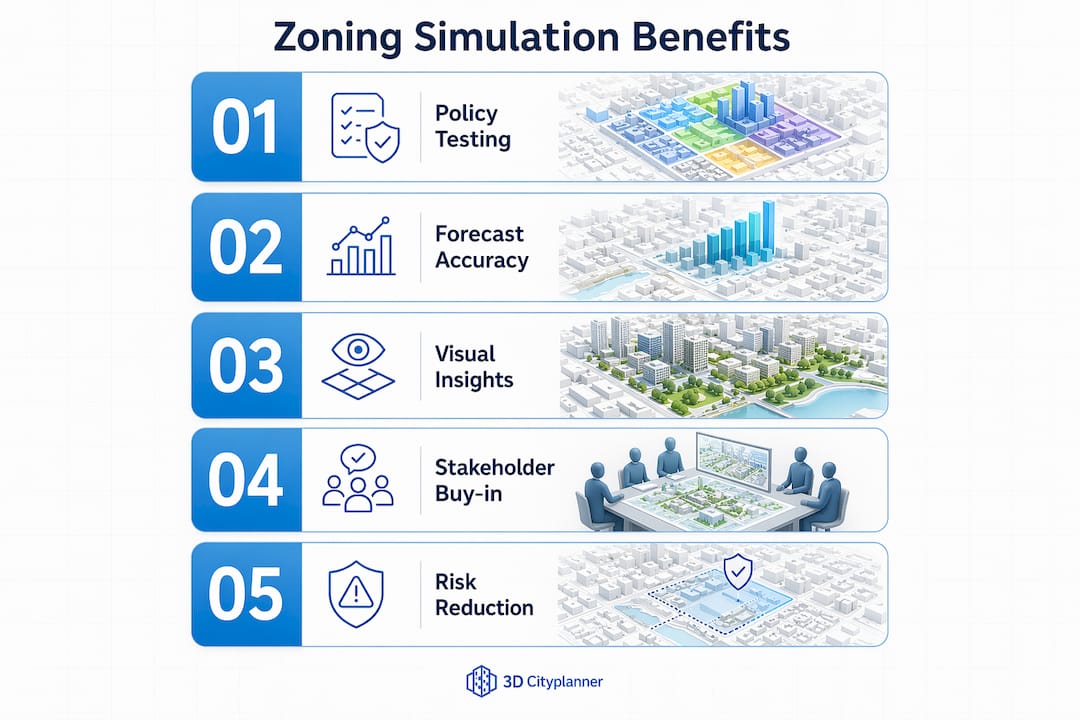
What are the key benefits of zoning simulation?
Zoning simulation gives planners and developers a structured way to test policy options before committing to a course of action. The core benefits fall into three areas: development capacity assessment, policy impact forecasting, and stakeholder communication.
On development capacity, simulation models calculate the total buildable floor area, unit yield, and programme mix that a site or zone can accommodate under different regulatory scenarios. This is directly useful for real estate developers running early-stage feasibility studies, where understanding the ceiling on development potential shapes acquisition decisions. The Terner Housing Policy Simulator, for example, uses local market data alongside zoning rules and financial metrics to estimate how many housing units a policy change is likely to produce, not just how many it permits.
The benefits for policy impact forecasting are equally significant:
- Redevelopment likelihood. Models identify which parcels are most likely to be redeveloped given current market conditions and proposed zoning changes, helping planners prioritise intervention areas.
- Housing affordability modelling. Simulation outputs show how upzoning or density bonuses affect housing supply and, by extension, affordability metrics across a neighbourhood.
- Infrastructure demand. Zoning changes that increase density generate additional demand for roads, utilities, schools, and open space. Connected systems modelling links zoning outputs to transport and environmental models to quantify these second-order effects.
- Environmental impact screening. Scenarios can be tested against sunlight, wind, and green space metrics to identify designs that meet sustainability targets before detailed design begins.
- Compliance checking. Simulation flags parcels or proposals that breach setback, height, or use restrictions, reducing the risk of abortive design work.
Visualisation is a critical output of any zoning simulation. Stakeholders use maps, charts, and 3D scenario comparisons to communicate complex results clearly. A 3D massing model showing the difference between a four-storey and an eight-storey zoning envelope is far more persuasive in a public consultation than a table of FAR figures.
Zoning simulation software: which tools do planners use?
The choice of zoning simulation software depends on the scale of analysis, the available data, and whether the workflow requires open-source flexibility or commercial integration. The table below compares the three most widely referenced platforms.
| Platform | Type | Core strength | Best suited for |
|---|---|---|---|
| UrbanSim | Open-source | Parcel-level econometric modelling, REDM calibration | Long-range metropolitan land use forecasting |
| Terner Housing Policy Simulator | Web-based tool | Housing unit yield under policy scenarios, market integration | Housing policy analysis, upzoning assessment |
| 3D Cityplanner | Commercial, browser-based | 3D scenario visualisation, GIS integration, development capacity | Site feasibility, masterplanning, stakeholder communication |
UrbanSim is the most technically rigorous option for long-range planning. Its REDM treats zoning capacity as a probabilistic predictor for redevelopment, validated against permit data. The trade-off is that it requires significant data preparation and technical expertise to configure and run.
The Terner Housing Policy Simulator is purpose-built for housing policy analysis. It integrates local market conditions, historic development patterns, and financial viability metrics to show how zoning changes translate into realistic unit delivery, not just theoretical capacity. This distinction between permitted capacity and likely delivery is one of the most important nuances in zoning simulation practice.
3D Cityplanner operates as a browser-based digital twin platform. It combines GIS data, 3D city models, and zoning analysis tools to let planners design and compare development scenarios interactively. Its strength lies in visualisation and stakeholder communication: planners can adjust building heights, programme mix, parking provision, and open space in real time and see the results rendered in 3D.
Pro Tip: For early-stage feasibility work, a browser-based platform like 3D Cityplanner is often faster and more practical than a full econometric model. Reserve UrbanSim-level complexity for metropolitan-scale forecasting where calibration data is available and long-range accuracy is the primary goal.
What are the main challenges in zoning simulation?
Zoning simulation produces credible outputs only when the underlying model is properly calibrated and its limitations are understood. Several challenges recur across projects of all scales.
The most common mistake is treating zoning allowance as equivalent to development feasibility. A parcel may be zoned for twelve storeys, but if land values, construction costs, and achievable rents do not support that density, the development will not proceed. Simulation models that incorporate financial viability alongside regulatory compliance produce far more realistic forecasts than those that simply map what the rules permit.
Calibration quality directly determines forecast credibility. Models that are not validated against historical permit and development data tend to overestimate growth in areas with strong zoning capacity but weak market demand. The practical consequence is that planners may recommend infrastructure investment in locations where development is unlikely to materialise for decades.
Additional challenges include:
- Data gaps. Parcel-level datasets are often incomplete or outdated, particularly for older urban areas where subdivision histories are complex.
- Market volatility. Zoning simulations built on market conditions from one economic cycle can produce misleading outputs when conditions shift significantly.
- Model complexity versus transparency. Highly complex models are difficult to explain to elected officials and community stakeholders, reducing their influence on actual decisions.
- Sensitivity to input assumptions. Small changes in FAR thresholds or density parameters can produce large swings in forecast outputs. Sensitivity analysis is the standard method for testing how robust conclusions are to these variations.
Planners should treat simulation outputs as a range of plausible futures, not precise predictions. Scenario comparisons with sensitivity analysis identify which conclusions hold across multiple assumptions and which depend on specific conditions being met.
How to implement zoning simulation in a development project
Implementing zoning simulation in a real project follows a clear sequence. The steps below apply whether you are assessing a single brownfield site or testing a borough-wide densification strategy.
- Assemble the spatial dataset. Collect parcel boundaries, existing land use, building footprints, infrastructure networks, and topography. GIS formats such as shapefiles or GeoJSON are standard inputs for most platforms.
- Encode the zoning rules. Translate the applicable planning code into model parameters: FAR, maximum height, setback distances, allowable uses, parking ratios, and open space requirements. This step requires careful reading of the local development plan.
- Establish the baseline scenario. Run the model on current zoning to confirm it replicates observed development patterns. If the baseline diverges significantly from reality, recalibrate before testing alternatives.
- Design the test scenarios. Define the policy or design variants you want to evaluate. Typical scenarios include a by-right baseline, a density uplift option, a mixed-use conversion, and a transit-oriented development variant.
- Run and compare outputs. Generate development capacity figures, unit yields, massing envelopes, and second-order impact metrics for each scenario. Use side-by-side comparisons to identify the strongest option.
- Visualise and communicate findings. Export results as 3D models, maps, and charts for use in planning reports, committee presentations, and public consultations.
3D Cityplanner supports steps 5 and 6 directly. Its browser-based environment lets planners compare urban development scenarios in 3D, adjust parameters interactively, and share results with stakeholders without specialist GIS software on the client side.
Pro Tip: Run at least three scenarios for every project: a conservative option that stays close to current zoning, a moderate uplift, and an ambitious densification case. The contrast between them is often more persuasive to decision-makers than any single preferred option.
Key takeaways
Zoning simulation is the most direct method planners and developers have for testing how changes in planning rules translate into real development outcomes before any design or application work begins.
| Point | Details |
|---|---|
| Core definition | Zoning simulation encodes planning rules into spatial models to forecast development outcomes under different scenarios. |
| Calibration is critical | Models validated against historical permit data produce credible forecasts; uncalibrated models overestimate growth. |
| Capacity versus feasibility | Zoning allowance and development feasibility are not the same; financial viability must be modelled alongside regulatory compliance. |
| Visualisation drives decisions | 3D scenario outputs and sensitivity analysis help stakeholders understand and act on simulation results. |
| Tool selection matters | Choose between open-source econometric platforms like UrbanSim and browser-based tools like 3D Cityplanner based on project scale and workflow. |
Zoning simulation in practice: what I have learned
The most persistent misunderstanding I encounter is the conflation of a zoning map with a zoning simulation. A map shows what is permitted. A simulation shows what is likely to happen, under what conditions, and at what cost to the surrounding urban system. That distinction is not semantic. It changes the quality of every planning decision that follows.
What I find genuinely underappreciated is the role of market calibration. Planners invest considerable effort in encoding regulatory parameters correctly, then accept uncalibrated market assumptions without question. The Terner Center’s work on the Housing Policy Simulator makes this point clearly: the same upzoning policy produces radically different unit delivery outcomes depending on local land values and construction economics. A simulation that ignores this is not a forecast. It is a regulatory inventory.
The shift towards digital twin urban planning is changing what planners can reasonably expect from simulation tools. Browser-based platforms now make it possible to run scenario comparisons in a client meeting, adjust height limits in response to a question from a councillor, and show the result in 3D within seconds. That capability used to require days of GIS work. The barrier to entry for rigorous zoning simulation has dropped significantly, and that is good for the quality of planning decisions across the board.
My honest recommendation: start with a well-calibrated baseline before you test any policy scenario. If your model cannot replicate what has already been built, it cannot reliably forecast what will be built next.
— Anne Dullemond
3D Cityplanner for zoning simulation and scenario planning
3D Cityplanner is a browser-based platform that brings zoning simulation into a practical workflow for planners, architects, and developers. It combines GIS data, 3D city models, and automated development capacity calculations to let you design and compare planning scenarios without specialist software.
The platform is particularly well suited to early-stage feasibility studies and masterplanning, where testing multiple zoning configurations quickly has direct value. You can adjust FAR, height, programme mix, parking, and open space in real time and see results rendered as a digital twin city model. Scenario outputs are ready to share with clients and planning committees without additional processing. Explore the platform with a free trial to see how it fits your project workflow.
FAQ
What is the zoning simulation definition?
Zoning simulation is a computational modelling process that encodes zoning regulations into spatial datasets to forecast how changes in planning rules affect development outcomes, land use patterns, and urban form.
How does zoning simulation differ from a zoning map?
A zoning map shows what regulations currently permit. Zoning simulation dynamically tests how changes to those regulations affect development likelihood, density, and infrastructure demand across a study area.
What data do you need to run a zoning simulation?
The core inputs are parcel boundaries, existing land use data, encoded zoning parameters (FAR, height, setbacks, allowable uses), and ideally historical permit records for model calibration.
Which zoning simulation software is best for urban planners?
UrbanSim suits metropolitan-scale econometric forecasting; the Terner Housing Policy Simulator is best for housing policy analysis; 3D Cityplanner is well suited to site feasibility studies and 3D scenario visualisation for stakeholder communication.
Why does calibration matter in zoning simulation?
Calibration validates the model against real development patterns. Without it, simulations tend to overestimate growth in high-capacity zones where market conditions do not support development, producing forecasts that mislead infrastructure and policy decisions.