What is smart city simulation? A guide for planners
Smart city simulation is defined as the creation of dynamic, data-fed virtual environments that replicate urban infrastructure, mobility systems, and spatial conditions, enabling planners to test scenarios and evaluate outcomes before any physical change is made. Powered by digital twin technology and real-time data integration, these environments allow city officials, urban planners, and researchers to move from reactive decision-making to predictive governance. Simulation reduces decision time from months to minutes, with some platforms delivering scenario results within seconds. The practical implications are significant: fewer costly planning errors, stronger stakeholder consensus, and spatial strategies grounded in evidence rather than assumption.
What is smart city simulation and how does it work?
Smart city simulation, often referred to in professional practice as urban simulation modelling, is the process of building a computational replica of a city or district and running scenarios through it to observe outcomes. The simulation environment ingests data from GIS layers, IoT sensors, BIM models, and transport networks to create a living representation of urban conditions. Unlike static maps or 2D masterplans, a simulation responds dynamically: change a zoning boundary, add a tram line, or increase building density, and the model recalculates traffic flows, solar access, microclimate conditions, and development capacity in near real time.
The technical foundation is the digital twin, a continuously updated virtual counterpart to a physical city system. Digital twins receive data from sensors, public datasets, and planning databases, which means the simulation reflects current conditions rather than a historical snapshot. This continuous feedback loop is what separates modern urban simulation from earlier generation planning models, which were largely static and required manual recalibration after every change.

Integrated architectures in mature smart city simulation systems link five layers: sensing, data platforms, analytics, service layers, and application scenarios. This structure enables cities to move from monitoring existing conditions to predicting the consequences of proposed interventions across transport, energy, land use, and public space simultaneously.
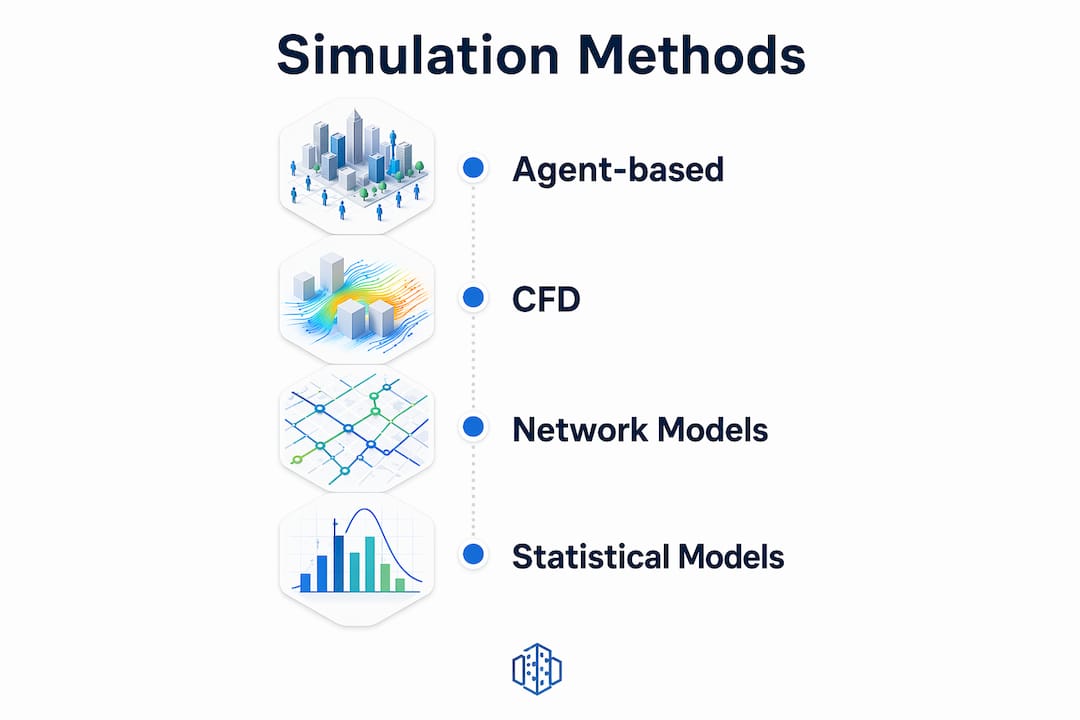
Core methodologies behind urban simulation modelling
Urban simulation models draw on four principal methodologies, each suited to different planning challenges. Understanding which method fits your objective is as important as choosing the right software platform.
| Methodology | Primary use case | Strength | Limitation |
|---|---|---|---|
| Agent-based modelling (ABM) | Human mobility, pedestrian flows, social behaviour | Captures emergent, complex behaviours across thousands of interacting agents | Computationally intensive; requires behavioural data |
| Computational fluid dynamics (CFD) | Wind, air quality, thermal comfort, pollution dispersion | High physical accuracy for microclimate and airflow analysis | Specialist setup; long processing times for large areas |
| 4D BIM | Construction sequencing, phasing, infrastructure delivery | Links spatial design to time, cost, and logistics | Limited to built environment; not suited for city-scale dynamics |
| Digital twins with IoT/GIS | Continuous monitoring, real-time scenario updates | Live data integration; supports ongoing operational decisions | Data governance and interoperability challenges |
Agent-based modelling deserves particular attention for resilience planning. Simulating thousands of agents reveals complex behaviours and rare “black swan” events that traditional steady-state models cannot detect. This means ABM is the methodology of choice when you need to understand how a city district performs under extreme conditions, not just average ones.
CFD is the standard approach for testing wind corridors between tall buildings, evaluating thermal comfort in public squares, or modelling pollution dispersion near busy junctions. 4D BIM, by contrast, is most valuable during the construction and phasing stages of a masterplan, where sequencing decisions carry significant cost implications.
Pro Tip: Select your simulation methodology based on the planning question you are answering, not the tool you already own. ABM for behaviour, CFD for climate, digital twins for ongoing monitoring. Mixing methodologies on the same project is both possible and often necessary.
How smart city simulations work in spatial planning practice
A typical simulation-driven planning project follows a structured workflow that moves from data collection through to scenario analysis and stakeholder communication. The stages below reflect how leading planning teams currently structure this process.
- Data collection: Gather GIS layers, existing 3D city models, transport network data, BIM files, and demographic datasets. The quality of inputs directly determines model reliability.
- Model construction: Build the base simulation environment, calibrating it against observed conditions such as current traffic counts, energy consumption, or pedestrian volumes.
- Scenario creation: Define the planning interventions to be tested. These might include rezoning a brownfield site, adding a cycling corridor, increasing building heights, or introducing green infrastructure.
- Simulation runs: Execute the model across each scenario, recording outputs for traffic flow, solar access, development capacity, microclimate, and any other relevant performance indicators.
- Comparative analysis: Evaluate scenario outcomes side by side, identifying trade-offs and optimal configurations.
- Stakeholder communication: Present findings through 3D visualisations, interactive maps, or VR walkthroughs to support public consultation and political decision-making.
The Naepo mobility digital twin in South Korea demonstrates this workflow at scale. PTV Visum and Vissim were used to combine strategic transport planning with operational traffic modelling, enabling multimodal scenario testing, VR visualisation, and real-time policy evaluation in a single integrated environment. The project linked citizen engagement directly to simulation outputs, allowing residents to review proposed transport changes before implementation.
Platforms like 3D Cityplanner support the scenario creation and comparative analysis stages through a browser-based interface that combines GIS data, automated 3D area generation, and spatial performance calculations. Planners can test building massing, greenery, parking provision, and development capacity across multiple scenarios without specialist GIS or BIM software skills.
Pro Tip: Invest the majority of your project time in data preparation and model calibration. A well-calibrated base model makes every subsequent scenario run faster and more defensible to decision-makers and the public.
What are the benefits and limitations of smart city simulation?
The efficiency gains from simulation are well documented. Planning cycles that previously required months of iterative design and consultation can be compressed significantly when scenario testing is computational rather than physical. Cost savings follow from identifying design conflicts, infrastructure bottlenecks, or zoning incompatibilities before construction begins rather than during it.
Decision quality improves because simulation allows planners to explore a far wider range of options than traditional methods permit. Testing hundreds of scenarios simultaneously distinguishes modern simulation from conventional planning, where resource constraints typically limit analysis to two or three alternatives. The ability to quantify trade-offs, such as the relationship between building density, sunlight access, and green space provision, gives planning teams a stronger evidential basis for recommendations.
Stakeholder engagement is another concrete benefit. 3D visualisation and VR tools democratise planning by allowing citizens and elected officials to review and challenge scenarios in accessible formats. This transparency builds trust and reduces the risk of late-stage objections derailing approved plans.
The limitations are equally real and should not be minimised.
“Simulations augment but do not replace expert judgement. Planners should avoid averaging results and critically evaluate scenario outcomes with human oversight to ensure logical, contextually relevant interpretation.” — Skyral, 2025
Model accuracy depends entirely on input data quality. Social behaviour remains difficult to predict with precision, and models calibrated on historical data may not capture emerging patterns. Interoperability, data governance, and scalability remain significant challenges limiting wider operational deployment of urban simulation models. Institutional barriers are also a factor: simulation requires cultural change within planning organisations, including new skills, new workflows, and a willingness to make planning processes more transparent.
Which smart city simulation tools are leading the field?
The market for urban simulation platforms has matured considerably, with tools now available across a wide range of budgets, technical requirements, and use cases. The table below summarises the principal platforms relevant to urban planning professionals.
| Platform | Core features | Typical applications | Accessibility |
|---|---|---|---|
| NVIDIA Omniverse | Real-time 3D simulation, physics-based rendering, multi-user collaboration | Large-scale digital twin visualisation, infrastructure planning | High technical requirement; enterprise pricing |
| PTV Visum and Vissim | Strategic and operational transport modelling, multimodal simulation | Mobility planning, traffic policy testing, transit design | Specialist transport planning software |
| VoxCity | Open-source 3D city model generation, microclimate and solar simulation | Environmental analysis, academic research, data preparation | Free; requires technical setup |
| 3D Cityplanner | Browser-based 3D scenario planning, GIS integration, automated area generation, spatial performance calculations | Masterplanning, feasibility studies, stakeholder communication, zoning analysis | No installation; accessible to non-specialists |
VoxCity provides an open-source framework for 3D city model generation and urban environmental simulation, supporting solar radiation, view index, and microclimate analysis compatible with ENVI-met, Blender, and Rhino. Its value lies in automating the data integration step that typically consumes the most project time. Automated 3D city modelling accelerates scenario building and promotes wider simulation adoption, particularly in municipalities with limited GIS capacity.
For planners who need to compare urban simulation platforms in detail before committing to a tool, the key evaluation criteria are: integration with existing GIS and BIM data, ease of scenario creation for non-specialist users, visualisation quality for stakeholder communication, and total cost of ownership including data preparation effort.
Browser-based platforms such as 3D Cityplanner address a specific gap in the market: the need for accessible, multi-user scenario planning tools that do not require specialist software installation or advanced technical training. This makes them particularly suitable for early-stage feasibility work, masterplanning, and public consultation processes where speed and accessibility matter more than simulation depth.
Key takeaways
Smart city simulation is most effective when it combines rigorous data inputs, the right modelling methodology, and structured stakeholder communication throughout the planning process.
| Point | Details |
|---|---|
| Definition is precise | Smart city simulation uses digital twins and real-time data to replicate and test urban scenarios before implementation. |
| Methodology selection matters | Choose ABM for behaviour, CFD for climate, 4D BIM for phasing, and digital twins for continuous operational monitoring. |
| Data preparation is the bottleneck | Model reliability depends on input quality; automation tools like VoxCity reduce manual GIS preparation effort. |
| Human oversight remains non-negotiable | Simulation outputs require expert interpretation; averaging results or ignoring context leads to poor planning decisions. |
| Accessibility drives adoption | Browser-based platforms lower the barrier to simulation for municipalities and planning teams without specialist technical staff. |
Why simulation is still a cultural challenge, not just a technical one
By Anne Dullemond
After working with urban planning teams across different scales and contexts, the pattern I see most often is this: organisations invest in simulation technology and then underuse it because the internal culture has not caught up with the capability. The tool exists. The data exists. But the planning process still runs on the assumption that two or three scenario options are sufficient, and that the purpose of visualisation is to present a decision already made rather than to genuinely test alternatives.
The most productive simulation projects I have encountered treat the model as a public-facing tool from the outset, not an internal technical report. When citizens and elected officials can walk through a proposed development in 3D, challenge assumptions about traffic, sunlight, or green space, and see the consequences of their preferred changes reflected in real time, the quality of the final decision improves. Simulation as a consensus-building tool is an underused application in most planning organisations.
The second issue I see consistently is over-reliance on average-case scenarios. Agent-based modelling exists precisely because cities do not behave according to averages. A transport network that performs well under normal conditions may fail catastrophically under a specific combination of events. Resilience planning requires testing the edges, not the centre. Planners who use simulation only to validate preferred options are missing the most valuable part of the capability.
My practical recommendation: integrate simulation at the earliest stage of a project, before spatial options are fixed. The cost of changing a scenario in a model is negligible. The cost of changing a planning decision after public consultation is not.
Explore smart city simulation with 3D Cityplanner
3D Cityplanner is a browser-based platform that brings digital twin city modelling and spatial scenario analysis within reach of any planning team, without specialist software or lengthy data preparation. The platform combines GIS data, automated 3D area generation, and spatial performance calculations to support building massing, zoning analysis, greenery, parking, sunlight, and development capacity across multiple scenarios simultaneously. Whether you are working on a feasibility study, a masterplan, or a public consultation, 3D Cityplanner gives you the tools to compare options clearly and communicate findings to stakeholders in accessible 3D. Explore the urban design platform or request a demo to see how simulation-driven planning works in practice.
FAQ
What is smart city simulation in urban planning?
Smart city simulation is the use of dynamic, data-fed virtual environments to replicate urban systems and test spatial scenarios before implementation. It combines digital twin technology, GIS data, and modelling techniques such as agent-based modelling and CFD to support evidence-based planning decisions.
How do smart city simulations differ from traditional planning models?
Traditional planning models are largely static and require manual recalibration after each change, whereas smart city simulations update dynamically as inputs change. Modern platforms can deliver scenario results within minutes rather than the weeks or months required by conventional methods.
What data is needed to run a smart city simulation?
A reliable simulation requires GIS layers, 3D city models, transport network data, demographic datasets, and where available, IoT sensor feeds. Data quality and calibration against observed conditions are the primary determinants of model accuracy.
Which methodology is best for mobility and transport simulation?
PTV Visum handles strategic transport planning at the network level, while PTV Vissim models operational traffic behaviour at the junction and corridor level. Together, as demonstrated in the Naepo digital twin project, they support multimodal scenario testing and real-time policy evaluation.
Can small municipalities use smart city simulation tools?
Browser-based platforms such as 3D Cityplanner make simulation accessible to smaller municipalities without specialist GIS or BIM staff. Open-source tools like VoxCity also reduce the data preparation burden, lowering the technical threshold for adoption.
Recommended
- How urban simulation models transform city planning – 3D Urban Development
- Smart city planning tips for urban professionals – 3D Urban Development
- Virtual urban simulation for smarter planning outcomes – 3D Urban Development
- Why simulation matters in urban planning: smarter cities – 3D Urban Development