Why simulation matters in urban planning: smarter cities

Urban planners once had to commit to costly infrastructure decisions based on static maps, gut instinct, and limited data. Today, simulation tools can model how a single road closure ripples through traffic patterns, air quality, and economic activity before a single brick is laid. Yet many professionals still treat simulation as a technical add-on rather than a core planning instrument. That gap between perception and practice is costly. This article sets out exactly what simulation offers urban development teams, where it delivers measurable results, and how to adopt it responsibly without overstating what these tools can currently achieve.
Key Takeaways
| Point | Details |
|---|---|
| Simulation drives better decisions | Simulations enable planners to test ideas and optimise designs before implementation. |
| Limitations require balance | Data gaps, costs, and unpredictable events mean simulations must be validated and not solely relied upon. |
| Community engagement is essential | Using simulation as a participatory tool fosters stakeholder trust and transparency. |
| Choose the right simulation | Selecting suitable methodologies and integrating feedback cycles ensures the real-world relevance of urban planning outcomes. |
The basics: what is simulation in urban planning?
Simulation, in an urban planning context, is a digital testbed. It lets you test strategies, interventions, and designs against modelled versions of real environments before committing to them. Think of it as a controlled space where failure is cheap and learning is fast. The scope is broad, covering everything from pedestrian flow in a new public square to wind pressure on a proposed tower.
Key methodologies include 4D BIM simulation, agent-based modelling (ABM), computational fluid dynamics (CFD), digital twins, geogames, and generative AI for spatial analysis, generation, and evaluation. Each serves a distinct purpose:
- 4D BIM simulation adds the time dimension to 3D building models, enabling project phase visualisation and construction sequence planning. Explore using 4D simulation to understand its full potential.
- Agent-based modelling (ABM) simulates the behaviour of individual actors, such as pedestrians or vehicles, to reveal emergent patterns at the system level.
- Computational fluid dynamics (CFD) models airflow, heat distribution, and pollutant dispersion around buildings and urban blocks.
- Digital twins create living, continuously updated replicas of urban environments that respond to real-time data. See how digital twins for city planning are reshaping practice.
- Geogames use game-based interfaces to engage communities in spatial decision-making.
- Generative AI accelerates design exploration by producing and evaluating large numbers of spatial configurations rapidly.
The key distinction between traditional planning models and advanced simulation is responsiveness. Traditional models are largely static: you input assumptions, you get an output. Advanced simulations are dynamic. They respond to changing variables, incorporate feedback loops, and allow planners to interrogate the why behind outcomes, not just the what.
| Approach | Static or dynamic | Key strength | Typical use case |
|---|---|---|---|
| Traditional GIS mapping | Static | Spatial visualisation | Land use analysis |
| 4D BIM | Dynamic | Time-phased planning | Construction sequencing |
| Agent-based modelling | Dynamic | Behavioural emergence | Mobility and crowd flow |
| CFD simulation | Dynamic | Environmental accuracy | Wind and air quality |
| Digital twin | Dynamic | Real-time responsiveness | City operations monitoring |
Pro Tip: When adopting AI-driven simulations, document every assumption and data source used. Transparency in your simulation methodology protects the credibility of your findings and makes stakeholder scrutiny far easier to manage.
How simulation transforms urban decision-making
Simulation does not just inform decisions. It changes the quality of the questions planners are able to ask. Instead of asking “Will this work?”, you can ask “Under which conditions does this work best, and for whom?”
The empirical evidence is compelling. Benchmarks show that simulations reduce car usage, cut CO2 emissions, and enable significant cost savings. CFD wind simulations have been validated with high accuracy, and agent-based policy assessments can model emission trade-offs while evaluating traffic efficiency simultaneously. These are not theoretical claims. They represent tested outcomes from real planning scenarios.
Consider how revolutionising urban planning with digital twins is already occurring in cities that use real-time data to manage traffic, energy, and public space allocation. The shift from reactive to predictive planning is measurable.
Real-world simulation impacts: key metrics
| Simulation type | Measured outcome | Reported result |
|---|---|---|
| CFD wind modelling | Correlation with real wind data | ρc = 0.985 (direction), 0.853 (speed) |
| Agent-based traffic policy | CO2 emission reduction | Significant reduction with trade-off analysis |
| Digital twin operations | Planning decision speed | Faster multi-scenario evaluation |
Here is a practical step-by-step approach for using simulation in multi-scenario policy design:
- Define the policy question clearly. What outcome are you trying to optimise? Mobility, emissions, density, or public amenity?
- Select the appropriate simulation methodology. Match the tool to the question. CFD for environmental factors, ABM for behavioural outcomes.
- Build at least three contrasting scenarios. A baseline, an optimistic intervention, and a stress-test scenario.
- Run sensitivity analyses. Identify which variables most strongly influence outcomes.
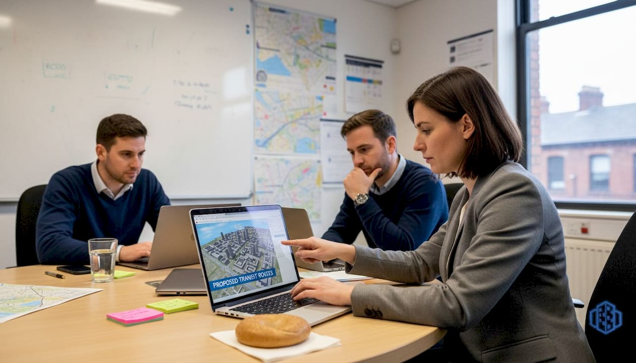
- Present findings visually. Use maps, animations, and dashboards to make results accessible to non-technical stakeholders.
- Iterate based on feedback. Treat the first round of results as a starting point, not a conclusion.
Pro Tip: Simulation outputs are powerful communication tools. Use them in public consultations to show communities what a proposed change will look and feel like. Visualised evidence builds trust far more effectively than written reports alone.
Limits and challenges: what simulations cannot (yet) solve
No simulation is a perfect mirror of reality. Professionals who understand this are better positioned to use these tools responsibly and to defend their findings under scrutiny.
Simulations face data integration challenges, high costs, scalability limits for city-wide use, and significant difficulty in modelling emergent complex behaviours or dispersed local knowledge. These are not minor technical footnotes. They are structural constraints that shape what simulation can and cannot tell you.
The main barriers fall into three categories:
- Technical barriers: Insufficient data granularity, incompatible data formats across agencies, and computational limits when scaling to full city environments.
- Organisational barriers: Lack of in-house expertise, fragmented procurement, and resistance to changing established planning workflows.
- Ethical barriers: Risk of encoding existing biases into model assumptions, potential misuse of simulation outputs to justify predetermined decisions, and limited representation of marginalised communities in data inputs.
“Digital twins and advanced simulations cannot fully model emergent systemic or social complexity. The city is not a machine, and treating it as one carries real risks for planning outcomes and community trust.”
Critics note that over-reliance on digital models, ethical risks, and limits for complex systems are genuine concerns, even as advocates highlight the optimisation and engagement value these tools deliver. The honest position sits between these poles. Simulation is a powerful aid to judgement, not a replacement for it.
Explore how AI tools for urban planning are being developed with these constraints in mind, and what responsible adoption looks like in practice.
Always validate simulation results against local empirical data. A model calibrated on data from one city may perform poorly when applied to another with different density patterns, infrastructure age, or cultural mobility habits.
Integrating simulation for effective, transparent urban planning
Knowing the limits of simulation is the starting point for using it well. The goal is not to avoid simulation where it is imperfect, but to build processes that account for its constraints from the outset.
Decision-makers should integrate simulations for multi-scenario planning, validate against empirical data, and weigh short-term gains against long-term unpredictability in complex urban systems. This requires a structured approach rather than ad hoc tool adoption.
Follow these steps to embed simulation responsibly into your planning lifecycle:
- Set clear objectives before selecting tools. Define what success looks like in measurable terms before choosing a simulation platform.
- Audit your data sources. Identify gaps, biases, and quality issues in the data you plan to feed into the model.
- Choose tools that match your team’s capacity. A powerful tool that your team cannot interpret confidently is a liability, not an asset.
- Engage stakeholders early. Involve communities, local experts, and policymakers in scenario design, not just in reviewing outputs.
- Conduct fairness audits. Check whether simulation outputs systematically disadvantage particular groups or geographies.
- Validate outputs empirically. Compare simulation predictions with observed real-world data wherever possible.
- Document everything. Record assumptions, data sources, model versions, and decision points for accountability.
The shift from rule-based to AI and ML-enhanced simulations improves behavioural realism significantly, but it also demands greater transparency, fairness audits, and critical oversight from planning teams. Adopting more sophisticated tools without upgrading governance practices creates new risks.
Review established digital twin practices and consider how using urban digital twins can support phased integration across project stages.
Pro Tip: Build formal feedback cycles into your simulation process. Schedule reviews with local experts and community representatives at key project milestones. Their on-the-ground knowledge will catch model blind spots that no dataset can fully capture.
Simulation’s true value: beyond technology to better communities
Most discussions about simulation focus on accuracy metrics, cost efficiency, and scenario counts. These matter, but they miss something more fundamental about why simulation is changing urban planning.
The deeper value is cultural. When simulation is used openly, with results shared and debated rather than presented as final answers, it creates new channels for participation. Communities can see proposed futures. They can challenge assumptions. They can point out what the model got wrong about their neighbourhood. That dialogue is not a side effect of good simulation practice. It is the point.
A technically brilliant simulation that sits in a consultant’s report, unread and unchallenged, achieves nothing for the communities it was meant to serve. Responsible simulation use builds institutional trust, surfaces local knowledge that data alone cannot capture, and creates a shared basis for difficult decisions. Explore digital twin city guidance to understand how leading cities are embedding this participatory approach into their planning frameworks.
Ethics and transparency are not constraints on simulation’s power. They are what make that power legitimate.
Take your planning process further
Simulation is only as effective as the platform supporting it. For urban development professionals ready to move beyond theoretical frameworks and into practical project delivery, the right tools make a measurable difference to outcomes, timelines, and stakeholder confidence.
3D Cityplanner’s platform brings together 4D planning, automated building generation, line-of-sight visualisation, sound impact simulation, and real-time collaboration in a single environment. It is designed for professionals who need to move quickly, communicate clearly, and plan responsibly. Whether you are managing a complex mixed-use development or leading a city-wide infrastructure review, the platform supports every stage of the process. Start with a trial period and see how simulation-led planning changes the quality of your decisions.
Frequently asked questions
What types of urban simulation are most effective today?
Leading simulation methods include 4D BIM, agent-based modelling, CFD, and digital twins, each addressing distinct challenges in mobility, sustainability, and urban design with proven results.
How accurate are urban simulations in predicting real-world outcomes?
Accuracy varies by method and data quality, but CFD validation results show wind direction correlations of ρc = 0.985 and speed correlations of ρc = 0.853, indicating strong real-world alignment when models are well-calibrated.
What are the main barriers to using urban simulation at city scale?
High costs, data integration issues, technical limitations, and the difficulty of modelling unpredictable social behaviours remain the primary constraints on city-scale simulation adoption.
How do ethics affect the adoption of simulation in urban planning?
Critics highlight risks including data bias, over-reliance on digital outputs, and potential misuse in policy nudging, all of which require careful stakeholder dialogue and transparent governance frameworks.
Recommended
- Urban Environment Simulation: Enhancing City Planning – 3D Urban Development
- Why urban planners use 4D simulation in 2026 – 3D Urban Development
- 3D city simulations: 5 leading examples for urban innovation – 3D Urban Development
- Why use digital urban planning for smarter design in 2026 – 3D Urban Development