How simulation transforms urban projects: tools and impact
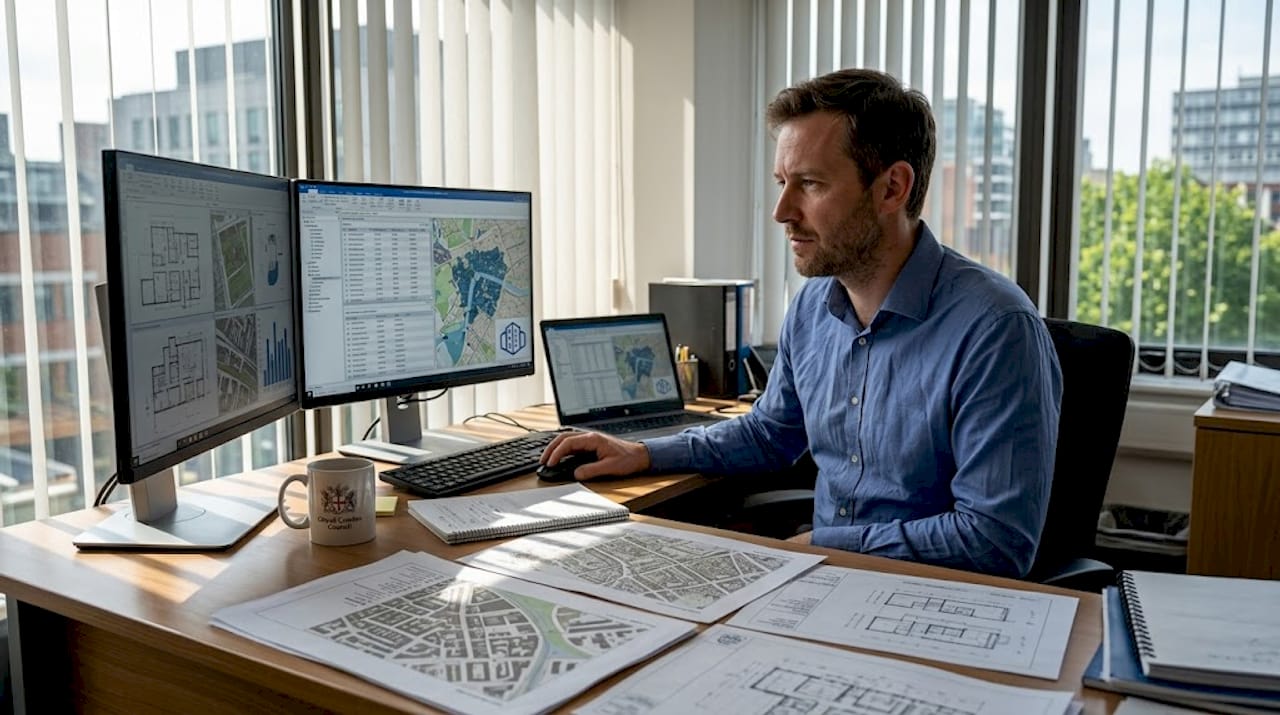
Despite decades of accumulated expertise, urban projects still run over budget, miss deadlines, and generate outcomes nobody anticipated. The gap between planning intent and built reality remains stubbornly wide. Yet simulation technologies are changing this, enabling risk-free scenario testing that improves project outcomes before a single foundation is poured. This article examines how different simulation methods work in urban development, what measurable benefits they deliver, where their limits lie, and how to embed them meaningfully into collaborative planning processes.
Key Takeaways
| Point | Details |
|---|---|
| Multiple simulation methods | Urban projects use agent-based models, CFD, 4D BIM, and digital twins for accurate preparation. |
| Tangible project improvements | Simulations lead to faster decisions, safer streets, and better land use in real case studies. |
| Limitations and best use | Knowledge of simulation boundaries—like data gaps and social complexity—prevents over-reliance. |
| Participatory planning edge | Bringing stakeholders into simulations ensures practical, accepted, and effective outcomes. |
| Human judgement is essential | Urban wisdom and local insight must complement simulation for successful city projects. |
Understanding simulation in urban development
Simulation is not simply visualisation with added polish. In urban planning, it means building dynamic, computational models that predict behaviour, test interventions, and quantify trade-offs under varying conditions. The term covers a broad family of methods, each suited to different planning questions.
Explorers of urban environment simulation will find that the field has evolved well beyond static maps and rendered fly-throughs. Today’s urban planning simulations draw on at least six established methodologies, as noted in the research literature on simulation methodologies including ABM, CFD, 4D BIM, digital twins, system dynamics, and FLUS.
Here is a summary of the core methods and their primary applications:
| Method | What it models | Typical urban use case |
|---|---|---|
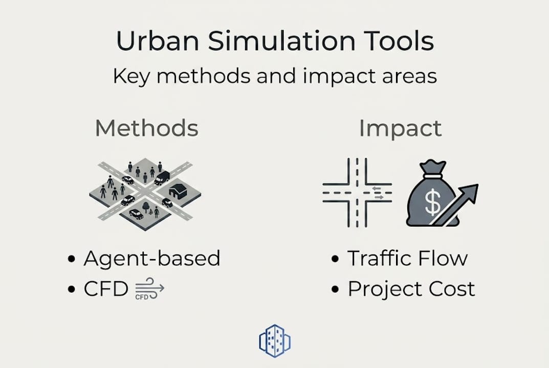
| Agent-based modelling (ABM) | Individual behaviours and interactions | Pedestrian flows, evacuation planning |
| Computational fluid dynamics (CFD) | Airflow, heat, and pollutant dispersion | Wind comfort, air quality assessments |
| 4D BIM | Construction sequencing over time | Phasing, logistics, on-site coordination |
| Digital twins | Live, responsive city replicas | Ongoing monitoring and scenario testing |
| System dynamics | Feedback loops across city systems | Population growth, infrastructure demand |
| Cellular automata (FLUS) | Land-use change patterns | Growth boundaries, zoning decisions |
Each method has a distinct role:
- Agent-based modelling (ABM) treats each pedestrian, vehicle, or resident as an autonomous agent with defined rules. This makes it ideal for studying emergent congestion or crowd behaviour at a granular level.
- CFD solves fluid mechanics equations to simulate how air moves around buildings, which informs decisions on ventilation, heat island mitigation, and street-level comfort.
- 4D BIM adds the dimension of time to three-dimensional building information models, letting project teams rehearse construction sequencing and spot clashes before they occur on site.
- Digital twins act as living simulation environments, continuously fed by sensor data to reflect the current state of a city and project future states under different policy choices.
- Cellular automata models, such as FLUS, simulate how land use evolves across a grid over time, supporting strategic decisions about urban growth boundaries.
Pro Tip: Match the simulation method to the planning question. Using CFD for pedestrian flow or ABM for air quality will produce misleading outputs. Choosing the right tool first saves significant rework later.
How simulation drives better urban project outcomes
Once the tools are understood, it is time to examine their real-world advantages. Evidence from applied research is compelling, and city planning simulation is now producing results that are empirically verifiable, not just theoretically plausible.
Consider traffic. Microsimulation of a turbo-roundabout can identify conditions that push throughput to ‘level of service F’, a failure state characterised by complete congestion, before the infrastructure is built. Planners can then adjust geometry, signal timing, or access arrangements in the model at negligible cost. According to empirical simulation benchmarks, simulations reduce decision time, prevent roundabout congestion, lower CO2, and optimise land use across a range of urban project types.

The table below illustrates measured outcomes from documented simulation applications:
| Application area | Key result |
|---|---|
| Traffic microsimulation | Prevented level-of-service F at key junctions |
| Restriction zone policy testing | Measurable reduction in vehicle trips and emissions |
| Longhu Town land-use modelling | +16.60% increase in economic-priority urban land |
| Participatory scenario planning | Faster stakeholder consensus and reduced revision cycles |
The Longhu Town case is particularly instructive. By running a FLUS cellular automata model calibrated to local growth drivers, planners identified a scenario that increased economically productive urban land by 16.60% compared to a baseline projection. That insight would have been impossible to generate through conventional spatial analysis alone.
Here is a practical sequence for leveraging simulation at key project stages:
- Define the question precisely. Identify what decision the simulation must inform before selecting a method.
- Gather and clean input data. Simulation quality is directly tied to data quality. Gaps introduce compounding errors.
- Run baseline and alternative scenarios. Compare outcomes systematically rather than testing only the preferred option.
- Quantify uncertainty. Present results as ranges rather than single-point predictions to support realistic decision-making.
- Engage stakeholders with results. Use real-time simulation in city planning outputs as conversation tools, not final verdicts.
This structured approach prevents the common failure mode where simulation outputs are treated as authoritative forecasts rather than as decision-support evidence.
Navigating the limits and risks of urban simulation
While the benefits are clear, simulation also presents crucial limitations and risks that every responsible practitioner must acknowledge. Ignoring them does not eliminate the risks; it simply shifts accountability.
The challenges of scaling simulation to city-level applications are well documented. Key constraints include:
- Data gaps. Models require consistent, high-resolution input data. Where data is absent or inconsistent, assumptions fill the void, and those assumptions carry the modeller’s biases.
- Computational cost. High-fidelity city-scale simulations demand significant processing power. This can price smaller authorities or consultancies out of the most sophisticated methods.
- Social complexity. Human behaviour does not follow physics equations. Culture, emotion, and local habit patterns are genuinely difficult to encode, and ABMs still struggle to replicate unexpected collective responses.
- Validation gaps. A model calibrated to historical data may perform poorly when conditions shift, as demonstrated repeatedly during rapid urban growth phases.
- False certainty. Polished simulation outputs can carry an unwarranted air of authority. Decision-makers sometimes treat model outputs as predictions rather than as structured guesses.
The ethical dimension is equally important. When a simulation encodes the assumptions of one professional team, it can systematically underrepresent the needs of groups who were not consulted during model construction. Digital twin validation processes must therefore include checks for embedded bias, not just technical accuracy.
“Validation, bias awareness, transparent assumptions, and hybrid models are essential to responsible simulation practice.” Responsible practitioners treat their models as working hypotheses, not settled science.
Experts consistently emphasise that transparent simulation assumptions and stakeholder validation are non-negotiable for trustworthy urban modelling.
Pro Tip: Always publish the assumptions behind your simulation alongside the outputs. This builds professional credibility and prevents outputs from being misread as certainties in planning inquiries or public consultations.
Integrating simulation into real-world planning and stakeholder engagement
For simulation to reach its potential, it must be embedded thoughtfully into collaborative urban planning practices. A technically excellent model that sits in a specialist’s laptop contributes little to the project if stakeholders cannot understand or interrogate its outputs.
Research confirms that simulations support participatory planning and require ongoing validation with real data. The following steps offer a practical framework for integration:
- Start with co-design. Involve stakeholders in defining the scenarios the model will test. This ensures the simulation addresses real concerns rather than assumed ones.
- Use accessible interfaces. Platforms such as using urban digital twins allow non-specialist participants to explore scenarios interactively, which dramatically improves engagement quality.
- Present multiple futures. Rather than one recommended scenario, show a range. This invites genuine deliberation rather than rubber-stamp approval.
- Update models as construction progresses. A simulation calibrated at planning approval will drift from reality as site conditions evolve. Build model-update cycles into the project programme.
- Close the feedback loop. Post-occupancy data should flow back into the model to improve future simulations on similar project types.
The digital twin for participatory planning offers a powerful vehicle for this kind of iterative engagement. When stakeholders can adjust inputs and immediately see projected outcomes, discussions shift from abstract policy arguments to concrete trade-offs. That shift accelerates consensus and reduces the revision cycles that inflate project costs.
Hybrid approaches combining simulation with direct observation and community engagement consistently outperform pure modelling exercises. The model provides structure; local knowledge provides nuance.
Why simulation will never replace urban wisdom
Reflecting on both the strengths and pitfalls, it is worth challenging one last myth: that sufficiently sophisticated simulation can substitute for professional judgement and local expertise. It cannot, and the distinction matters enormously.
Simulation reveals what may happen under defined conditions. It does not tell you what should happen, or which future a community actually values. Urban projects live or die on the ability to read a neighbourhood’s culture, navigate political realities, and adapt when conditions shift unexpectedly. No model encodes those capacities.
The ‘smart city’ narrative has sometimes oversold the idea that data-driven models can govern cities autonomously. The result, in several high-profile cases, has been technically optimised environments that felt sterile and disconnected from their residents. The lesson is not that simulation fails, but that simulation without human judgement produces inhuman outcomes.
As the evidence consistently shows, simulation as an aid to urban decisions should complement, not replace, professional judgement. The most effective practitioners treat urban planning simulations as a powerful lens, not a crystal ball. They interrogate outputs, share assumptions openly, and remain willing to override a model when lived experience points in a different direction. That combination of rigour and wisdom is what produces cities people actually want to live in.
Explore advanced simulation solutions for your next urban project
For those ready to put these insights into action, powerful solutions are within reach. Whether you are modelling traffic flows, testing land-use scenarios, or visualising construction phasing for stakeholder review, having the right platform makes a measurable difference to project outcomes.
3D Cityplanner brings together a suite of city-scale modelling capabilities, from 4D timeline planning to sound and sightline simulation, all within an accessible interface designed for urban development professionals. Explore the full range of simulation features in 3D Cityplanner to see how each tool maps to real planning challenges. Ready to experience it first-hand? Visit the future of urban development tools and request a trial without any upfront commitment.
Frequently asked questions
What types of simulation are most used in urban projects?
Agent-based models, CFD, 4D BIM, and digital twins are the core simulation types shaping city planning today, each addressing a distinct category of urban planning question.
How do simulations improve urban planning decisions?
They allow teams to speed up scenario testing, reduce costly mistakes on site, and optimise outcomes across land use, traffic, and environmental performance before any physical works begin.
Can simulation capture all the complexities of city life?
No. Current simulations still struggle with unpredictability and scalability, and do not fully capture the dispersed local knowledge and social nuance that shape how communities actually use urban space.
What are best practices for using simulation in urban projects?
Document all assumptions clearly, validate against real-world outcomes, involve stakeholders from the outset, and combine model outputs with observational data to build a more complete picture.
Recommended
- Why simulation matters in urban planning: smarter cities – 3D Urban Development
- Urban real-time simulation: transform city planning in 2026 – 3D Urban Development
- Urban Environment Simulation: Enhancing City Planning – 3D Urban Development
- 3D city simulations: 5 leading examples for urban innovation – 3D Urban Development


