BIM integration in urban planning: key benefits

Urban planners who rely solely on digital maps and 2D drawings are working with an incomplete picture. Building Information Modelling (BIM), the process of creating and managing intelligent 3D models packed with data about every component of a built environment, offers a fundamentally richer foundation for city-scale decisions. When integrated with spatial technologies, BIM helps you visualise projects more clearly, coordinate stakeholders more effectively, and model scenarios before a single brick is laid. This article covers what BIM integration means in practice, its measurable advantages, the real barriers you will face, and the best practices that lead to lasting results.
Key Takeaways
| Point | Details |
|---|---|
| BIM adds depth to planning | Integrating BIM boosts visualisation, scenario testing, and data consistency for urban planning projects. |
| Sustainability gains are proven | Case studies show strong reductions in energy use and emissions with BIM integration. |
| Barriers are surmountable | With the right training, standards, and policy support, BIM adoption challenges can be overcome. |
| Adapt processes for best results | Urban planners should blend digital tools with real-world knowledge for lasting impact. |
What is BIM integration in urban planning?
BIM stands for Building Information Modelling. At its core, it is a digital process that creates intelligent, data-rich 3D models of buildings and infrastructure. Each element in a BIM model carries information: materials, costs, energy properties, maintenance schedules, and more. This makes it far more than a visual tool. It becomes a single source of truth for everyone involved in a project.
Many urban planners are already familiar with GIS, Geographic Information Systems, which handle spatial data at a city or regional scale. GIS excels at broad context: land use, transport networks, topography, and population data. BIM, by contrast, operates at the building level, capturing detailed architectural and structural information. Neither tool is complete on its own. Together, they create something far more powerful.
The BIM-GIS integration methodology uses GIS for site analysis and broad spatial context, while BIM contributes detailed building models. Data exchange between the two relies on open formats such as IFC (Industry Foundation Classes) and CityGML, which act as common languages across different software platforms. This interoperability is what makes true integration possible.
To give you a clearer picture, here is how the three approaches compare:
| Feature | GIS | BIM | BIM-GIS integration |
|---|---|---|---|
| Scale | City/regional | Building/site | Both |
| Data type | Spatial/geographic | Structural/material | Combined |
| Visualisation | 2D maps, basic 3D | Detailed 3D models | Rich 3D city models |
| Stakeholder use | Analysts, planners | Architects, engineers | All disciplines |
| Scenario modelling | Limited | Strong | Very strong |
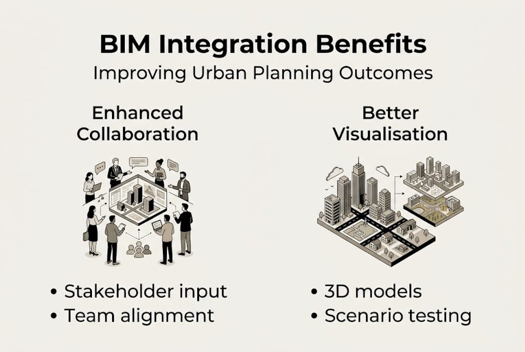
Key integration benefits for urban planning include:
- Data consistency across project teams and disciplines
- Richer 3D modelling that combines city-wide context with building-level detail
- Improved stakeholder communication through visual, interactive models
- Earlier clash detection, identifying conflicts between infrastructure systems before construction
- Stronger scenario testing, allowing planners to model alternatives and compare outcomes
For urban planners exploring the next level of integration, digital twins in city planning represent the frontier, where live data feeds into the model continuously. These digital twin cities act as living simulation environments, updating in real time as conditions change.
Top benefits of integrating BIM in urban planning
Once BIM’s role within an urban workflow is understood, the practical gains become genuinely compelling. The advantages span visualisation, sustainability, finances, and public engagement.
In terms of project visualisation, BIM allows planners and stakeholders to walk through a proposed development before any ground is broken. Clash detection automatically flags conflicts between systems, such as drainage pipes crossing structural beams, which would otherwise only appear on site. Scenario testing lets teams model what-if situations: what happens to sunlight if a building rises by three storeys? How does traffic flow change with a new junction?

The sustainability gains are striking. A BIM redevelopment in Rome office building reduced energy consumption from 276 kWh/m²/year to just 76 kWh/m²/year, a 72% reduction, while CO2 emissions fell by 78%, saving 604 tonnes per year. These are not marginal gains; they represent a transformation in how buildings perform.
On the financial side, the Den Haag Zuidwest Digital Twin case study shows how integrating BIM-like 3D data layers (including BAG and cadastral data) enables scenario modelling, financial viability analysis through the GREX tool, and stakeholder visualisation for urban renewal. This kind of financial modelling at the planning stage reduces costly surprises later.
Top benefits of BIM integration include:
- Accurate energy performance modelling leading to significant cost savings
- Transparent 3D visualisation that speeds up public consultation and approval
- Clash detection that reduces rework costs during construction
- Integrated financial modelling tools for better investment decisions
- Improved collaboration across architects, engineers, planners, and officials
Statistic to note: A single BIM-led redevelopment project in Rome cut CO2 emissions by 78% annually, demonstrating that digital modelling is not just convenient; it is a critical lever for meeting climate targets.
The comparison with traditional planning approaches is sharp:
| Aspect | Traditional planning | BIM-integrated planning |
|---|---|---|
| Visualisation | 2D drawings, static renders | Interactive 3D models |
| Clash detection | Manual, often late | Automated, early stage |
| Stakeholder review | Slow, paper-based | Real-time, visual |
| Energy modelling | Estimated post-design | Integrated from the start |
| Financial planning | Separate tools | Embedded in the model |
For a broader view of how these technologies are reshaping cities, explore ways digital twins revolutionise planning and see practical examples of urban redevelopment with 3D twins.
Pro Tip: Involve all stakeholders, including community groups, infrastructure providers, and finance teams, from the earliest modelling stage. Their input shapes better scenarios and reduces revision cycles significantly.
Challenges and barriers to BIM integration
Despite impressive results, the path to effective BIM integration is not straightforward. Understanding the hurdles is essential for realistic planning and securing the right resources from the outset.
Cost is frequently the first barrier. Licences for BIM software, hardware upgrades, and staff training all carry significant price tags. For smaller municipalities or SMEs (small and medium-sized enterprises), these upfront investments can be prohibitive. Research highlights challenges with BIM implementation including high costs, a lack of standards and training, interoperability issues between BIM and GIS platforms, weak legal frameworks, and critically low SME adoption, with only 13% uptake recorded in one Malaysian study.
Interoperability remains a persistent technical problem. Even with open formats like IFC and CityGML, data does not always transfer cleanly between platforms. Teams using different software can end up with models that do not align, undermining the very consistency that BIM promises.
Legal and contractual frameworks also lag behind the technology. In many jurisdictions, there are no clear standards for what a BIM deliverable should contain or how liability is assigned when models contain errors. This uncertainty slows adoption among cautious organisations.
There is also a conceptual limit worth acknowledging. Research on limitations in complex urban systems points out that digital twins and BIM work best for systems that are structured and predictable. Highly complex urban environments, with their emergent social dynamics and dispersed local knowledge, do not always reduce neatly to a model. This is not a reason to avoid BIM, but it is a reason to use it thoughtfully.
Major implementation hurdles include:
- High software and infrastructure costs
- Limited availability of trained BIM professionals
- Inconsistent data standards across platforms and regions
- Gaps in legal and regulatory frameworks
- Difficulty modelling unpredictable, adaptive urban behaviours
- Low adoption rates in smaller organisations and the public sector
“The transformation to BIM-enabled urban planning requires not just technology investment but organisational change, upskilling, and policy support at every level.”
For context on how these challenges relate to wider digital urban strategy, the discussion around urban digital twin benefits is a useful reference point.
Pro Tip: Advocate for policy mandates that require BIM on publicly funded projects. Mandates create market demand, which drives training provision and reduces costs through scale.
Best practices for successful BIM-driven urban planning
Having seen what holds back BIM adoption, the focus shifts to what actually works. The following steps reflect proven approaches drawn from real projects, including the Den Haag Zuidwest experience where early team involvement and careful tool selection were identified as critical success factors.
- Define project scope and objectives clearly. Before choosing any tools, establish what questions the BIM model needs to answer. Energy performance? Stakeholder communication? Financial viability? Clear objectives prevent scope creep and guide platform selection.
- Assemble a multidisciplinary team from day one. Architects, engineers, urban planners, financial analysts, and community representatives each bring different data needs. Involving them early shapes a model that serves everyone rather than just the technical team.
- Select platforms that support open data standards. Prioritise tools compatible with IFC and CityGML to ensure data flows cleanly between BIM and GIS environments. Proprietary lock-in creates long-term costs and limits future flexibility.
- Establish a shared data environment (CDE). A CDE is a central, cloud-based repository where all project data lives. It eliminates version confusion and ensures every team member works from the same information.
- Run regular model reviews with stakeholders. Do not save visualisation for the final presentation. Use the 3D model throughout the planning process to test ideas, gather feedback, and build consensus incrementally.
- Invest in ongoing training. BIM standards and tools evolve rapidly. Budget for annual upskilling and monitor updates to IFC standards and national BIM frameworks.
- Evaluate and iterate. After project completion, measure outcomes against the original model predictions. These lessons feed into better modelling on future projects.
For deeper guidance on how digital tools support this kind of structured approach, urban digital twins in planning offers a practical framework that complements BIM-based workflows.
Looking beyond the digital: a nuanced take on BIM’s urban future
BIM and digital twins represent a genuine leap forward for urban planning. The Rome energy case, the Den Haag financial modelling, the automated clash detection - these are real improvements that matter. Yet it is worth holding a note of humility alongside the enthusiasm.
Research on limitations in complex urban systems makes a point that should sit with every planning professional: digital tools perform best where systems are structured and predictable. Cities, at their core, are neither. They are shaped by unpredictable human behaviour, shifting political priorities, informal economies, and local knowledge that resists being encoded into a database.
This does not diminish BIM’s value. It simply means the technology is a powerful instrument, not an oracle. The most effective urban planners we see using these tools are those who combine rigorous digital modelling with genuine community engagement and contextual judgement. A digital twin city guide can sharpen your technical approach, but the human insight you bring to interpreting the model is equally essential. BIM is not a replacement for planning wisdom; it is a sharper lens through which to apply it.
Take the next step with advanced BIM integration
The evidence is clear: BIM integration improves visualisation, accelerates stakeholder alignment, and delivers measurable sustainability outcomes. The challenge now is moving from insight to implementation. Platforms built specifically for urban professionals can bridge that gap directly.
The 3D Cityplanner platform brings together 3D modelling, 4D timeline planning, line-of-sight analysis, sound simulation, and automatic building generation in one environment designed for urban planning teams. You can explore digital urban planning tools and try the platform without any upfront payment, making it a low-risk starting point for teams ready to move beyond traditional methods. The projects shaping tomorrow’s cities are already using these tools today.
Frequently asked questions
What is the main advantage of using BIM in urban planning?
BIM enables detailed 3D visualisation and integrated data management, improving project review and collaboration. The Den Haag Zuidwest Digital Twin case study shows how BIM-like data layers support stakeholder visualisation and scenario modelling simultaneously.
What are common obstacles to BIM adoption in urban planning?
Adoption is most frequently hindered by high costs, skills gaps, interoperability challenges between platforms, and the absence of consistent standards. Research on challenges with BIM implementation highlights these as the primary barriers across regions and organisation sizes.
How does BIM integration affect sustainability?
BIM typically reduces both energy consumption and carbon emissions by enabling more precise performance modelling from the earliest design stage. The BIM redevelopment in Rome achieved a 72% reduction in energy use and a 78% cut in CO2 emissions.
Is BIM suitable for all types of cities?
BIM performs best in planned or less complex environments where systems behave predictably. Research on limitations in complex urban systems notes that highly adaptive or socially complex urban environments may exceed the current boundaries of digital modelling.
Recommended
- Top city planning strategies using advanced 3D technology – 3D Urban Development
- Why use digital urban planning for smarter design in 2026 – 3D Urban Development
- Real-time data in urban planning: 34% efficiency gains – 3D Urban Development
- Why Use 3D Modelling in Urban Design Projects – 3D Urban Development


