Urban real-time simulation: transform city planning in 2026

Static city models once served planners well enough, but the demands of modern urban environments have outpaced their capabilities. Urban real-time simulation refers to dynamic, interactive digital models of urban environments, often implemented as digital twins that respond to live conditions rather than frozen snapshots. For urban planners and real estate developers, this distinction is not merely academic. It determines whether you can test a new transport corridor before a single road is laid, or model heatwave impacts on a proposed district months ahead of any construction. This article unpacks the technology, its measurable benefits, and the practical steps you need to put it to work.
Key Takeaways
| Point | Details |
|---|---|
| Dynamic simulation advances | Urban real-time simulation enables responsive, interactive city modelling using live data for ongoing decision-making. |
| Cutting-edge technologies | A combination of agent-based models, CFD, and digital twins underpins these advanced simulations. |
| Proven impact | Efficiency gains of up to 34% and substantial cost or emissions reductions are evidenced in real-world benchmarks. |
| Expert readiness needed | Success depends on robust infrastructure, validation, and readiness to act on continuous digital insights. |
Understanding urban real-time simulation: definition and evolution
Traditional city modelling relies on GIS layers, static datasets, and manually updated maps. These tools capture a city as it was, not as it is. Urban real-time simulation changes that entirely. It creates a living model, one that pulls data continuously from sensors, cameras, IoT devices, and open APIs, and then reflects changes across the urban system almost instantly.
At the heart of this approach is the concept of digital twins in city planning. A digital twin is not simply a 3D model of a city. It is a dynamic counterpart to the physical environment, synchronised with real-world data and capable of running predictive scenarios. Think of it as a living simulation environment where planners can stress-test infrastructure decisions without real-world consequences.
“Urban real-time simulation integrates sensor, IoT, and API data to reflect city processes like traffic, microclimate, and land use dynamically, rather than relying on periodic updates.”
The evolution from static GIS to responsive simulation has been gradual but accelerating. Early adopters used rule-based models to study traffic flow. Today, platforms integrate digital twin urban planning capabilities that allow whole-city scenario modelling in real time. Key practical applications now include:
- Traffic management: Simulating signal changes, incident response, and peak-hour congestion before deploying changes on the ground.
- Land use planning: Testing the knock-on effects of rezoning or new development on surrounding infrastructure capacity.
- Urban cooling: Modelling how tree canopies, reflective materials, and water features alter the microclimate of high-density areas.
- Emergency response: Simulating evacuation routes, crowd flows, and access corridors to optimise emergency planning.
The real-time simulation in practice evidence base shows that cities investing in these systems are consistently able to act on data rather than assumptions. This is the fundamental shift from reactive to proactive city planning.
Core technologies powering real-time urban simulation
Building a capable real-time urban simulation requires several technologies working in concert. No single tool delivers the full picture. The most effective platforms combine methodologies that each address a different dimension of urban complexity.
Key methodologies include agent-based modelling (ABM), computational fluid dynamics (CFD), and multi-layer digital twin architectures with data fusion. Here is how each contributes:
- Agent-based modelling (ABM): Simulates individual entities such as vehicles, pedestrians, or delivery drones as autonomous agents, each following defined rules. This allows planners to observe emergent behaviour at scale, for example, how 1,500 vehicles interact at 60 frames per second across a city road network.
- Computational fluid dynamics (CFD): Models airflow, heat dispersal, and pollutant spread across urban geometries. CFD wind modelling is particularly valuable for high-rise developments and public space design where thermal comfort is a key criterion.
- 4D BIM integration: Adds time as a fourth dimension to building information modelling, enabling construction phasing to be visualised and coordinated across complex project timelines.
- GPU acceleration: Graphics processing units dramatically reduce computation times for large-scale simulations, making real-time output feasible where traditional CPUs would take hours.
- Data fusion: Combines heterogeneous data streams, satellite imagery, sensor networks, and citizen inputs, into a coherent model that reflects multiple urban layers simultaneously.
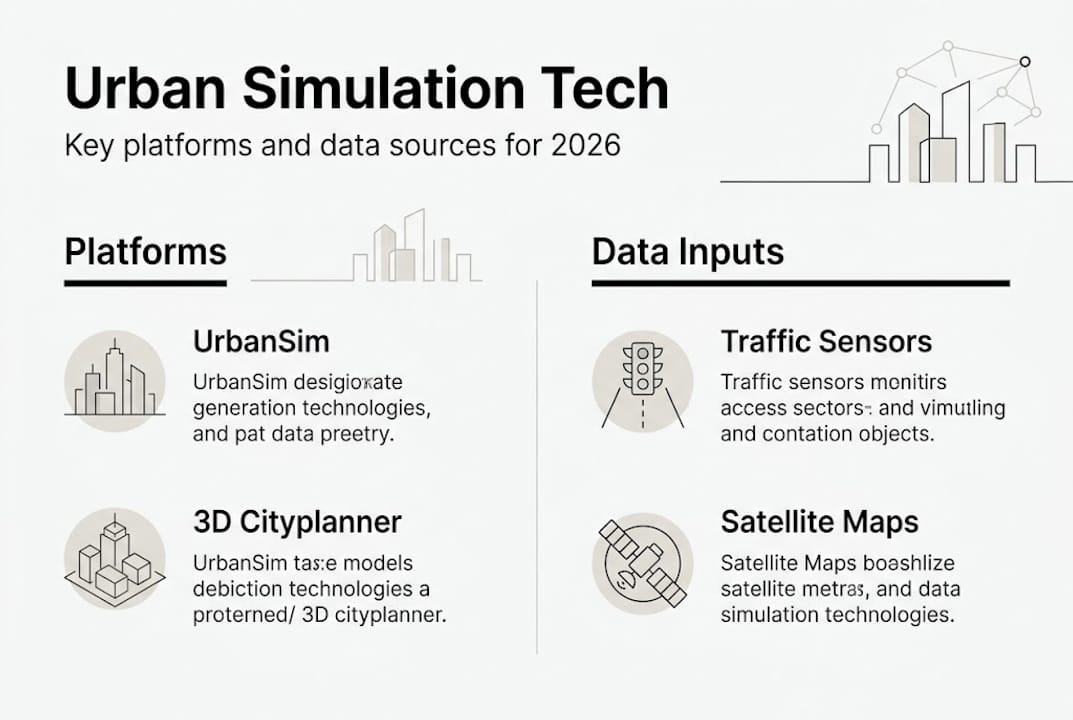
The UrbanSim platform is one well-documented example of how these technologies have been combined for city-wide land use and transportation modelling. For real estate developers, urban digital twins built on these foundations offer a credible basis for investment appraisal and site feasibility analysis.
| Technology | Primary use | Real-time capable |
|---|---|---|
| Agent-based modelling | Pedestrian and vehicle flow | Yes |
| Computational fluid dynamics | Microclimate, wind, pollution | Partial |
| 4D BIM | Construction phasing | Yes |
| GPU acceleration | Large-scale processing | Yes |
| Data fusion | Multi-source integration | Yes |
Pro Tip: Before selecting a simulation platform, audit your existing data infrastructure. The quality of your inputs, sensor coverage, data refresh rates, and API connectivity, directly determines the reliability of your simulation outputs.
Major benefits for urban planners and developers
Understanding the technology is one thing. Seeing what it delivers in practice is where decisions get made. The empirical evidence for real-time urban simulation benefits is now substantial enough to inform procurement decisions with confidence.
Benchmarked outcomes include 34% improvements in space utilisation efficiency, 28.7% gains in pedestrian flow, and traffic prediction errors of less than 8%. CO2 reductions and infrastructure cost savings follow from better-optimised designs. These are not theoretical projections. They represent performance levels measured across active urban simulation deployments.
For real estate developers, the implications are direct. Faster, more accurate site feasibility studies reduce pre-application risk. Scenario testing for density, massing, and access removes uncertainty from major investment decisions. The measured impacts of simulation-informed planning are visible in approval timelines and design iteration costs alike.
Simulations also enable scenario testing for resilient cities and help shift planning from reactive to predictive. This is particularly relevant when modelling climate adaptation strategies, transport demand changes, or population growth projections. Key areas where planners see the most value include:
- Traffic forecasting: Quantifying the impact of new developments on corridor performance before planning applications are submitted.
- Microclimate management: Reducing urban heat island effects through informed placement of green infrastructure and building materials.
- Pedestrian safety: Identifying dangerous conflict points in public space layouts before they are built.
- Energy efficiency: Modelling solar access, wind exposure, and building orientation to optimise energy performance at the masterplan stage.
The ways digital twins transform planning are expanding rapidly. Planners who adopt these tools now position themselves to meet rising regulatory and community expectations around evidence-based design. Those who wait risk working with less credible data than their counterparts and competitors.
Challenges, expert nuances, and advancing applications
Real-time simulation is not a plug-and-play solution. Planners and developers who approach it with realistic expectations will extract far more value than those who expect instant clarity.
Computational bottlenecks, data fusion heterogeneity, and uncertainty in non-linear urban dynamics are genuine obstacles. As city models grow more detailed, the processing demands increase significantly. A simulation that runs smoothly at neighbourhood scale may require substantial infrastructure upgrades to function across a whole metropolitan area.
“Cognitive AI agents improve the simulation of complex urban behaviours compared with logic-based models, better capturing the adaptive and unpredictable nature of human decision-making in cities.”
Model validation is a discipline in itself. Simulations are only as trustworthy as the assumptions and data inputs behind them. Without systematic calibration against observed real-world data, even sophisticated models can produce misleading outputs. Multi-agent twins research confirms that adaptive AI architectures significantly improve reliability, but they also introduce new demands on governance and oversight.
Here is a practical framework for navigating the implementation challenge:
- Start with a bounded use case. Pilot simulation at a single district or project site before attempting city-wide deployment. This limits risk and builds team confidence.
- Invest in data quality before model complexity. A simpler model fed with accurate, high-frequency data outperforms a complex model built on patchy inputs.
- Establish validation protocols early. Define how you will measure the simulation’s accuracy against observed conditions, and schedule regular calibration cycles.
- Plan for iteration. Urban models must evolve as cities change. Build update workflows into your project governance from day one.
Planners using 4D simulation are finding that phased implementation aligned with project milestones reduces both technical and organisational risk. The guide to digital twin cities offers a useful reference for teams building their first simulation capability.
Pro Tip: Treat your simulation model as a shared governance document, not just a technical artefact. Regular reviews with planning, engineering, and community stakeholders sharpen both model quality and organisational buy-in.
What most guides miss about urban real-time simulation
Most discussions of real-time simulation focus heavily on data speed and processing power. These matter, but they are rarely the primary reason implementations fall short. In practice, the limiting factors are organisational: teams that are not structured to act on simulation outputs, governance frameworks that cannot incorporate probabilistic findings, and planning cultures that treat models as a final answer rather than a decision-support tool.
A digital twin city is only as valuable as the decisions it informs. When planners treat simulation outputs as certainties, they misuse the technology. When they treat them as structured prompts for expert judgement, they unlock genuine value. The most effective teams we observe are those who couple strong technical infrastructure with adaptive governance and continuous model validation.
Bridging expert technology and local community realities is equally undervalued. Simulations built without local contextual knowledge, informal transport patterns, social use of public space, cultural preferences around density, tend to optimise the wrong outcomes. The next frontier for urban simulation is not faster processors. It is better integration of qualitative human insight alongside quantitative data.
Transform your city planning with advanced simulation tools
If the principles covered in this article align with the challenges you are working through, the next practical step is to explore platforms purpose-built for urban professionals.
The 3D Cityplanner platform brings together real-time 3D city modelling, 4D project planning, line-of-sight analysis, sound simulation, and automatic building generation in a single environment designed for planners and developers. It supports the kind of iterative, evidence-based decision-making that this article describes. You can explore real-time city modelling through a trial period without prior payment commitment, making it straightforward to test its capabilities against your own project demands before committing further.
Frequently asked questions
How does urban real-time simulation differ from traditional city modelling?
Urban real-time simulation continuously updates with live data, delivering immediate feedback and predictive insights, whereas static models remain fixed until a planner manually revises them. The gap in decision-making speed and accuracy is significant.
What are the main challenges when implementing real-time simulations?
Key challenges include managing large data volumes, ensuring compatibility between systems, and overcoming computational bottlenecks that emerge as city models increase in complexity and geographic scope.
How accurate are urban real-time simulation models?
Benchmarks show traffic prediction errors below 8% and trajectory errors below 0.23 metres, though real-world validation against observed data remains essential for reliable outputs.
Which technologies are essential for real-time urban simulation?
Core technologies include agent-based modelling, CFD, digital twins, GPU acceleration, and integrated real-time data pipelines from sensors and IoT networks.
Recommended
- Urban Environment Simulation: Enhancing City Planning – 3D Urban Development
- Why urban planners use 4D simulation in 2026 – 3D Urban Development
- 6 Best City Planning Best Practices for Urban Modelling – 3D Urban Development
- Why simulation matters in urban planning: smarter cities – 3D Urban Development


