Urban optimisation: How 3D technology transforms city planning

Even the most technologically advanced cities struggle to simultaneously achieve livability, sustainability, and economic growth. These goals often pull in opposite directions, and the planning decisions made today will shape urban environments for decades. Optimising urban spaces is now recognised as a data-driven process that uses advanced 3D technologies, digital twins, and multi-objective algorithms to balance these competing priorities. This guide explains what urban optimisation truly means, which technologies underpin it, how to navigate difficult trade-offs, and how to address the real-world barriers that prevent many projects from realising their full potential.
Key Takeaways
| Point | Details |
|---|---|
| Urban optimisation defined | It combines 3D technology, data, and algorithms to enhance city planning for better results. |
| Technology enables impact | Digital twins and advanced modelling streamline collaboration and optimise urban development. |
| Trade-offs are key | Balancing sustainability, livability, and density requires nuanced tools and data-driven insight. |
| Collaboration matters | Successful urban optimisation depends on multidisciplinary teamwork, not just advanced tech. |
What is urban optimisation?
Urban optimisation is a term that gets used loosely, but it has a precise meaning for professionals working in city planning and real estate development. At its core, it refers to the disciplined use of data, algorithms, and spatial technology to improve how cities function across multiple dimensions at once.
“Urban optimisation is the data-driven process of enhancing urban spaces using advanced 3D technologies, digital twins, and multi-objective algorithms to balance sustainability, efficiency, livability, and economic viability in city planning and development.”
The key word here is balance. Urban optimisation is not about maximising a single metric, such as building density or green space coverage. It is about finding configurations that perform well across all the dimensions that matter to a city and its residents. This is what separates urban optimisation from conventional urban planning, which often relies on static drawings and sequential approvals rather than iterative, data-led testing.
The process typically involves three interconnected components:
- Data integration: Pulling together GIS data, sensor feeds, demographic information, and infrastructure records into a unified spatial model
- 3D modelling and simulation: Building detailed representations of the urban environment that can be tested under different scenarios, including traffic flows, shadow analysis, noise propagation, and energy use
- Algorithm-driven decision support: Using multi-objective optimisation algorithms to search across thousands of possible design configurations and identify those that best satisfy the planner’s priorities
Digital twins in city planning sit at the intersection of all three components, acting as living simulation environments where proposals can be tested before a single spade breaks ground. Understanding this integrated approach is essential before exploring the specific tools that make it possible.
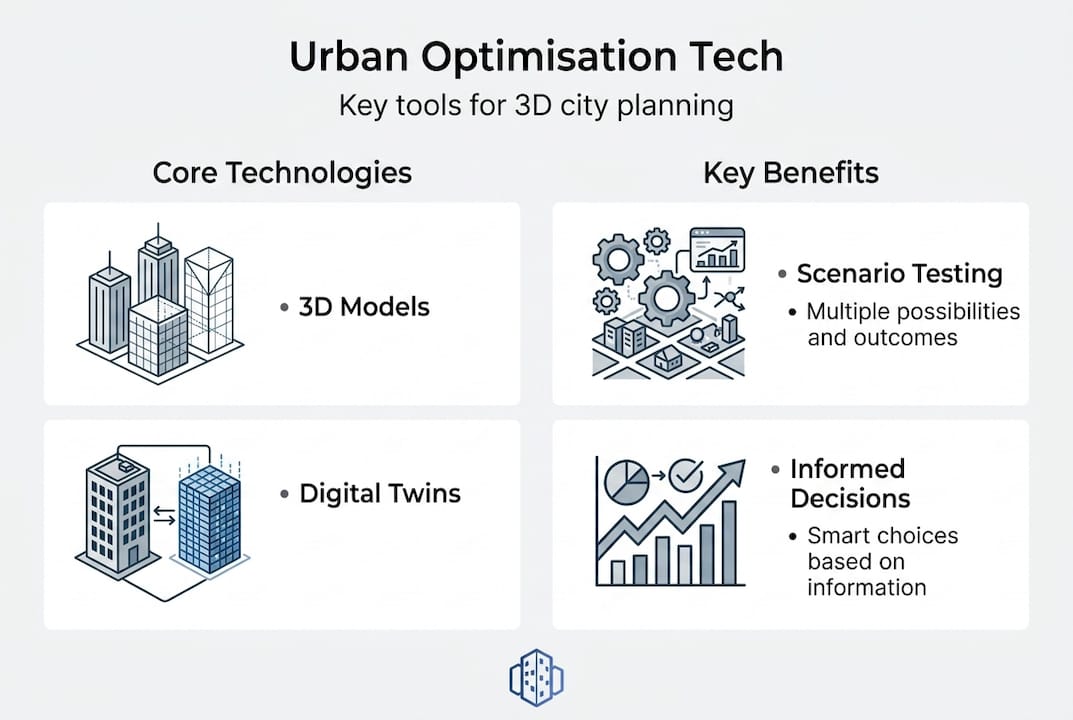
Key technologies enabling urban optimisation
Understanding the technologies that make urban optimisation possible helps reveal its full potential. Three categories of tool are central to any serious urban optimisation effort: digital twins, 3D city models, and multi-objective optimisation algorithms. Each plays a distinct role, and their combined effect is greater than the sum of their parts.
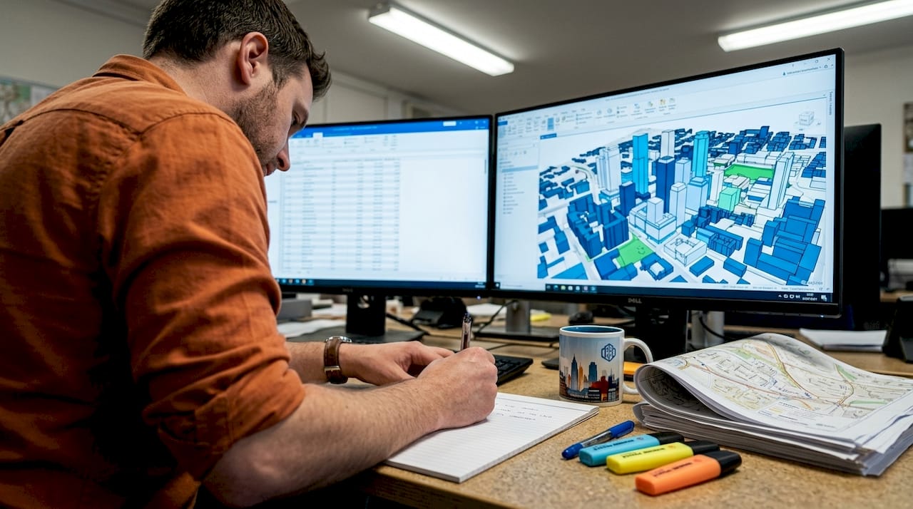
How digital twins support urban optimisation is a subject gaining significant attention across the profession. A digital twin is a continuously updated virtual replica of a physical urban environment. It links real-world sensor data, building information, and infrastructure records to a 3D spatial model, allowing planners to simulate proposed changes and observe likely outcomes in real time. Unlike a static CAD model, a digital twin evolves as the city evolves.
3D city models provide the geometric and semantic foundation on which digital twins are built. The benefits of 3D city models extend well beyond visualisation. They support line-of-sight analysis, solar access calculations, acoustic modelling, and flood risk assessment, all within a single coherent spatial framework. When a developer wants to test whether a proposed tower will cast unacceptable shadows on a neighbouring park, a 3D city model delivers that answer in minutes rather than weeks.
Multi-objective optimisation algorithms are the analytical engine beneath the surface. These algorithms simultaneously evaluate hundreds or thousands of design variables against multiple performance criteria, identifying a set of optimal solutions rather than a single “best” answer. This is important because real urban projects never have just one goal.
The table below summarises the core features, key benefits, and typical use cases for each technology:
| Technology | Core features | Key benefits | Typical use cases |
|---|---|---|---|
| Digital twin | Real-time data integration, dynamic simulation | Live scenario testing, continuous monitoring | Transport planning, infrastructure management |
| 3D city model | Geometric and semantic spatial data | Visual communication, multi-criteria analysis | Shadow studies, noise modelling, zoning review |
| Multi-objective optimisation | Algorithm-driven scenario generation | Identifies trade-off frontiers across goals | Site layout, energy efficiency, density planning |
Pro Tip: When selecting platforms, prioritise tools that allow all three technologies to operate within a shared data environment. Switching between disconnected systems introduces errors and slows collaboration significantly.
Together, these tools streamline communication across disciplines. An architect, a transport engineer, and an environmental consultant can all work from the same 3D model, reducing the misalignments that typically arise when each team operates from separate documents.
Balancing trade-offs: Sustainability, density, and livability
Once you see the technologies, it is crucial to recognise that urban optimisation is not just a technical exercise. It is fundamentally about making difficult choices. Cities cannot have unlimited density and abundant green space and low carbon emissions and affordable housing all at once. Every project involves trade-offs, and the real value of urban optimisation tools is that they make those trade-offs visible and manageable.
Digital twin urban planning platforms allow planners to generate multiple scenarios and compare them side by side. One scenario might prioritise housing density, accepting a reduction in open space. Another might maximise green infrastructure, accepting a lower floor area ratio. A third might seek a middle path that performs adequately across all criteria. None of these is automatically “correct.” The right choice depends on the specific context, community priorities, and economic constraints of the project.
Research consistently shows that hybrid building typologies balance density and livability better than purely compact or purely open urban forms, and that trade-offs are inevitable but can be visualised using Pareto frontiers. A Pareto frontier is a graph that plots all the configurations where improving one objective necessarily worsens another. It gives planners a clear picture of what is achievable and helps stakeholders make genuinely informed decisions.
Consider the following scenario outcomes when different objectives are prioritised:
| Primary objective | Density outcome | Green space outcome | Energy performance | Livability score |
|---|---|---|---|---|
| Maximise density | Very high | Low | Moderate | Below average |
| Maximise green space | Low | Very high | High | Above average |
| Hybrid balance | High | Moderate | High | Above average |
| Minimise carbon | Moderate | High | Very high | Average |
The hybrid balance scenario consistently delivers strong results across multiple criteria simultaneously. This does not mean it is always the right choice, but it demonstrates why hybrid building forms have become a focal point in urban optimisation research and practice.
Practical considerations when navigating trade-offs include:
- Engage stakeholders early: Pareto frontier visualisations are most powerful when shared with community groups, elected officials, and developers before decisions are locked in
- Establish weighted priorities: Work with your team to assign explicit weights to different objectives at the project outset, so the algorithm knows what “optimal” means in your specific context
- Run sensitivity analyses: Test how outcomes change when priorities shift slightly, identifying which decisions are robust across different value judgements and which are fragile
- Document assumptions transparently: Every simulation relies on assumptions about future conditions. Make these visible so that stakeholders can challenge them constructively
The discipline of working through trade-offs explicitly is one of the most valuable habits that urban optimisation tools can instil in a planning team.
Overcoming challenges in urban optimisation projects
With the potential understood, it is important to be proactive in tackling the real-world barriers that prevent many projects from delivering on their promise. Data silos, high compute costs, scalability for real-time fidelity, integration of human behaviour, and resource-limited contexts all require deliberate mitigation strategies.
The most common challenges fall into five categories. Here is a structured approach to addressing each one:
- Data silos: Urban data is frequently held in separate systems managed by different agencies or departments. Transport data sits with one authority, utility data with another, and property records with a third. Resolving this requires establishing data-sharing agreements early and using open standards such as CityGML or IFC to ensure interoperability between platforms. Creating 3D city models from federated data sources is now well understood, but it demands upfront investment in data governance.
- High computational demands: Running high-fidelity simulations across large urban areas requires significant processing power. Cloud-based platforms with scalable compute resources are the most practical solution for most organisations. Rather than attempting to model an entire metropolitan area at once, start with a precisely defined project boundary and expand as your team builds confidence and infrastructure.
- Real-time scalability: Achieving true real-time responsiveness in large-scale digital twins remains technically challenging. A practical mitigation is to use tiered modelling, where areas of primary interest are modelled at high fidelity while surrounding zones use simplified representations. This preserves computational efficiency without sacrificing accuracy where it matters most.
- Integrating human behaviour: Algorithms are excellent at optimising physical parameters but struggle with the complexity of how people actually use urban spaces. Supplement your quantitative models with qualitative data from user surveys, pedestrian movement studies, and community engagement sessions. Using 3D modelling for results is most effective when the models are validated against observed human behaviour, not just theoretical assumptions.
- Resource-limited contexts: Not every organisation has access to enterprise-level software and large data science teams. In these situations, phased pilot projects deliver the best return. Begin with a single district or development site, demonstrate measurable outcomes, and use that evidence to secure resources for broader implementation.
Pro Tip: Adopt a modular software architecture from the start. Using tools and data formats that integrate with other platforms means you are not locked into a single vendor’s ecosystem, and your models remain useful as technology evolves.
Interdisciplinary teams are consistently the most effective at navigating these challenges. When urban designers, data scientists, community planners, and infrastructure engineers collaborate from project inception, problems are identified earlier and solutions are more robust.
Why the true value of urban optimisation is collaboration, not just technology
After working through the technical landscape of urban optimisation, it is worth pausing to consider a perspective that most technology-focused discussions miss entirely. The most sophisticated digital twin in the world will not improve a city if the organisations responsible for planning it cannot agree on shared goals.
Technology is an enabler. It creates the conditions for better decisions by making information clearer and trade-offs more visible. But the actual quality of decisions still depends on the people in the room and the quality of the conversations they have. Urban digital twins that enhance planning through virtual city environments do not replace human judgement. They sharpen it.
The teams that achieve the most from urban optimisation tools are those that treat 3D platforms as shared conversational infrastructure rather than technical deliverables. They bring ecologists, social workers, transport planners, and real estate economists into the same model review sessions. They use visualisations not just to communicate decisions, but to interrogate assumptions and surface disagreements before they become costly disputes.
There is also a risk that powerful optimisation tools create false certainty. A Pareto frontier looks authoritative. A beautifully rendered digital twin feels definitive. But every model is built on assumptions, and assumptions reflect the values and blind spots of the people who made them. The most responsible use of urban optimisation technology involves actively questioning what the model does not capture, not just celebrating what it does.
The cities that will thrive in the coming decades are not necessarily those with the most advanced technology. They are the ones where planners, developers, and communities use technology as a platform for richer, more honest collaboration. Urban optimisation, at its best, is not a substitute for that conversation. It is what makes that conversation productive.
Ready to optimise your next urban project?
Translating these principles into practice requires tools that are purpose-built for urban planning professionals and real estate developers.
3D Cityplanner brings together digital twin capabilities, automated 3D building generation, line-of-sight visualisations, noise simulation, and 4D timeline planning within a single, intuitive platform. Whether you are evaluating a new mixed-use development, reviewing the impact of infrastructure changes, or coordinating across a multidisciplinary project team, the platform is designed to support every stage of the optimisation process. You can begin with a free trial and explore the full feature set without any upfront commitment, making it straightforward to assess how these tools fit your specific workflow and project requirements.
Frequently asked questions
What is the main benefit of urban optimisation for city planners?
Urban optimisation helps planners make evidence-based decisions that balance sustainability, efficiency, and livability, reducing the guesswork that has traditionally defined spatial planning at scale.
How do digital twins fit into urban optimisation?
Digital twins act as interactive virtual models linking real-world urban data with simulation tools, enabling planners to test design scenarios and evaluate outcomes before committing to physical changes. Urban optimisation uses digital twins as its central analytical environment.
What are common challenges in urban optimisation projects?
Key challenges include overcoming data silos, managing compute costs, and accurately modelling human behaviour. These challenges require mitigation through modular software architectures, phased pilots, and strong interdisciplinary team structures.
Can urban optimisation improve project collaboration?
Yes. 3D platforms designed for urban optimisation create a single source of truth that all stakeholders, including planners, developers, engineers, and community representatives, can interrogate together, significantly reducing miscommunication and rework.
What makes hybrid building typologies valuable in urban optimisation?
Hybrid building typologies balance density and livability more effectively than either purely compact or purely open urban forms, making them a consistently strong option when multiple performance criteria must be satisfied simultaneously.
Recommended
- Why optimise city planning: 3D tools for better design – 3D Urban Development
- Urban visualisation: a guide to 3D city planning – 3D Urban Development
- Urban project optimisation with advanced 3D tools in 2026 – 3D Urban Development
- Optimise city development with advanced 3D strategies – 3D Urban Development


