Why visualise urban projects: maximise impact with 3D

Many urban planning teams still rely on flat drawings and static renders to communicate complex projects, assuming these tools are sufficient. They are not. Research confirms that 3D outperforms 2D in stakeholder perception accuracy, meaning decisions made from traditional plans carry a measurable risk of misunderstanding. For city officials, developers, and architects, that gap between what a plan shows and what stakeholders actually perceive can derail approvals, inflate costs, and erode public trust. This guide examines the evidence for visualising urban projects in 3D, explores who benefits most, and outlines where the field is heading next.
Table of Contents
- The limitations of traditional urban project visualisation
- How 3D visualisation transforms urban planning
- Who benefits from visualising urban projects and why
- Hybrid and data-driven approaches: the future of urban project visualisation
- What most experts miss about urban project visualisation
- See the difference with innovative 3D visualisation tools
- Frequently asked questions
Key Takeaways
| Point | Details |
|---|---|
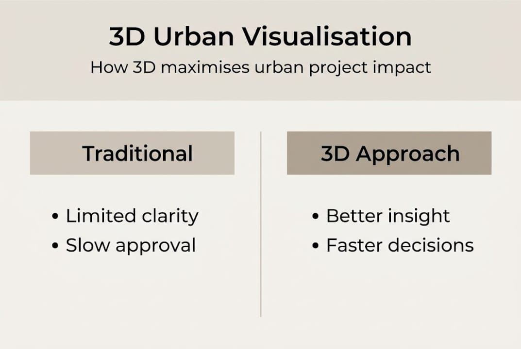
| 3D brings clarity | Switching from 2D to 3D models makes urban projects easier for all to understand and evaluate. |
| Audience matters | Different groups benefit from tailored visualisations—public prefers photorealistic, experts symbolic. |
| Hybrid is the future | Combining visual and data-driven approaches yields the best analysis for urban planning. |
| Efficiency gains | Visualising projects in 3D cuts time and cost across all phases of the urban development process. |
The limitations of traditional urban project visualisation
To understand the benefits of visualising urban projects, it helps to first examine where traditional methods fall short.
Conventional 2D drawings, floor plans, and static elevation renders have served the industry for decades. Yet they carry a fundamental flaw: they require the viewer to mentally reconstruct three-dimensional space from flat information. For trained professionals, this is second nature. For councillors, community members, or investors without technical backgrounds, it is genuinely difficult. The result is a persistent gap between what a plan communicates and what a stakeholder actually understands.
This gap creates real problems in practice. Consider what typically goes wrong:
- Missed context: A 2D plan rarely conveys how a new building will feel at street level, how it relates to neighbouring structures, or how it changes sightlines across a public square.
- Misinterpretation of scale: Stakeholders routinely underestimate or overestimate the physical impact of a proposed development when working from flat drawings alone.
- Exclusion of non-experts: Community consultation becomes superficial when residents cannot meaningfully engage with technical plans, reducing the quality of feedback and risking equity risks in immersive tech adoption.
- Slower consensus: When stakeholders cannot visualise the same outcome, disagreements multiply and approvals stall, pushing back timelines and increasing costs.
“Photorealistic 3D is preferred for aesthetics and spatial understanding by laypeople, while symbolised representations suit expert accuracy needs. Crucially, 3D outperforms 2D in perception prediction across both groups.”
The evidence is clear. Yet many teams continue to default to traditional formats, often because switching feels complex or costly. In reality, the cost of not switching is higher. Projects that invest in better visualisation tools consistently achieve faster planning outcomes, with fewer revision cycles and stronger stakeholder alignment from the outset. The limitations of traditional methods are not merely inconvenient; they are a structural barrier to effective urban development.
How 3D visualisation transforms urban planning
Recognising the limits of old approaches, it is vital to see the concrete ways 3D visualisation can reframe urban project outcomes.
The shift from 2D to 3D is not simply aesthetic. It changes how teams work, how decisions are made, and how quickly projects move forward. There are three core improvements that practitioners consistently report:
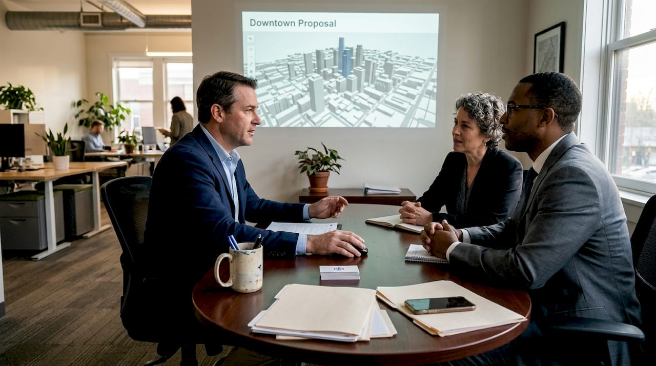
- Spatial clarity: Stakeholders can immediately grasp scale, massing, and context. A photorealistic model of a proposed mixed-use development communicates in seconds what a technical drawing takes minutes to decode, and often still leaves room for doubt.
- Rapid iteration: Design teams can test and adjust massing, height, or material choices in real time, reducing the back-and-forth that inflates project timelines. 3D urban visualisation benefits extend well beyond aesthetics into genuine workflow efficiency.
- Increased engagement: Interactive 3D environments invite stakeholders to explore a project rather than simply observe it, which measurably improves buy-in and the quality of feedback received.
Empirical benchmarks show consistent gains in efficiency and cost performance when 3D visualisation is adopted, though it is worth noting that equity concerns around immersive technology access remain a live issue for some communities.
| Method | Revision cycles | Stakeholder clarity | Engagement level |
|---|---|---|---|
| 2D drawings | High | Low | Passive |
| Static 3D renders | Medium | Medium | Passive |
| Interactive 3D models | Low | High | Active |
The data makes a compelling case. Teams using interactive 3D models report fewer misunderstandings, shorter approval timelines, and stronger community support. For those interested in using 3D modelling in design, the practical gains are well documented.
Pro Tip: Overlay semantic data layers, such as noise contours, shadow analysis, or traffic flow, onto your 3D model during stakeholder presentations. This transforms a visual into a decision-making tool and significantly raises the quality of discussion.
Who benefits from visualising urban projects and why
Having explained the advantages, let us pinpoint exactly who gains most from these new capabilities.
Different stakeholders engage with urban projects for different reasons, and the type of visualisation that works best varies accordingly. Understanding this distinction is what separates teams that use 3D effectively from those that simply produce impressive renders.
City officials and planning authorities need tools that build consensus quickly. They work across technical and non-technical audiences simultaneously, often in public meetings where clarity is critical. Interactive 3D models reduce the risk of misaligned expectations and support reasons to use 3D city models for governance and accountability.
Real estate developers use 3D visualisation for two distinct purposes: internal planning and external pitching. During design, accurate massing models help teams assess viability. During investor or planning presentations, photorealistic renders and interactive walkthroughs are far more persuasive than technical drawings.
Architects tend to favour a blend. Early-stage design benefits from flexible, symbolised models that allow rapid iteration. Later stages call for photorealistic outputs that communicate intent to clients and planning committees. City visualisation examples illustrate how this progression works in practice.
The public responds most strongly to photorealistic models. Research confirms that photorealistic 3D aids spatial understanding for laypeople, while symbolised representations are better suited to expert analysis. Presenting a community with a technically accurate but abstract model is a missed opportunity.
- City officials: prioritise interactive, data-rich models for consensus building
- Developers: use photorealistic renders for pitching, massing models for planning
- Architects: blend symbolised and photorealistic outputs across project phases
- Public: photorealistic walkthroughs drive genuine engagement and informed feedback
Pro Tip: Tailor your visualisation format to the audience in the room. Presenting a symbolised technical model to a community group is as ineffective as showing a photorealistic render to an engineering panel expecting precise data.
Hybrid and data-driven approaches: the future of urban project visualisation
With each audience benefiting in unique ways, it is crucial to note where visualisation techniques are headed next.
The most forward-thinking urban planning teams are moving beyond the binary choice between photorealistic and symbolised 3D. Instead, they are adopting hybrid approaches that combine the communicative power of photorealism with the analytical rigour of data-driven layers. This is where the field is genuinely advancing.
Here is how a hybrid approach typically works in practice:
- Base model construction: A geometrically accurate 3D model is built from GIS data and building information, providing the structural foundation for all subsequent analysis.
- Semantic data integration: Attributes such as land use, building age, energy performance, or noise levels are attached to model elements, enabling targeted analysis rather than purely visual assessment.
- Layer-based presentation: Teams switch between photorealistic views for public engagement and data-driven overlays for technical review, using the same underlying model for both purposes.
- Real-time adjustment: Real-time data visualisation platforms allow planners to update parameters and immediately see the impact on metrics such as shadow coverage or pedestrian flow.
The statistical case for this approach is strong. Studies report R² values above 0.85 when 3D metrics predict real-world perception outcomes, a level of accuracy that flat plans simply cannot match. Research on hybrid approaches further supports the view that edge cases favour combined photorealistic and symbolised methods, with semantic data taking priority over pure visuals for analytical purposes.
The practical implication is significant. A visualisation platform that supports both photorealistic rendering and semantic data integration is not a luxury; it is the baseline for serious urban planning work in 2026.
What most experts miss about urban project visualisation
The evidence for visualising urban projects is compelling, yet few practitioners discuss the most critical factor: matching the visualisation type to the audience and purpose.
Many teams treat 3D as a box to tick. They produce a photorealistic render, present it at a public meeting, and consider the visualisation requirement fulfilled. This approach misses the point entirely. The research is unambiguous that the type of 3D representation matters as much as the decision to use 3D at all. A symbolised model shown to a community group achieves little. A photorealistic walkthrough presented to a technical panel wastes everyone’s time.
The real differentiator is a deliberate, blended strategy that aligns visualisation choices with stakeholder needs and measurable outcomes. This means asking, before every presentation, what the audience needs to understand and what decision they need to make. It means building workflows that can shift between representation modes without rebuilding the model from scratch.
We believe that 3D is a genuine game-changer for urban planning, but only when it is deployed thoughtfully. Teams that invest in understanding their audiences, and in platforms that support flexible, data-rich visualisation, are the ones achieving consistently better project outcomes. The technology is ready. The question is whether your strategy is.
See the difference with innovative 3D visualisation tools
If you are ready to move beyond static plans and put the insights above into practice, purpose-built platforms make the transition far more straightforward than most teams expect.
3D Cityplanner brings together photorealistic rendering, semantic data integration, real-time analysis, and 4D timeline planning in a single environment. Whether you are a city official preparing a public consultation, a developer building an investor pitch, or an architect iterating on a complex massing study, the platform supports every stage of the process. Explore the full range of planning tool capabilities and start a trial without any upfront commitment. Better decisions begin with better visualisation.
Frequently asked questions
What is the main advantage of visualising urban projects in 3D?
The main advantage is improved spatial understanding. 3D outperforms 2D in stakeholder perception accuracy, enabling all parties to engage with a project more meaningfully than flat plans allow.
How does 3D visualisation speed up urban planning processes?
Interactive 3D models reduce miscommunication and revision cycles by giving all stakeholders a shared, accurate view of the project. Empirical benchmarks confirm consistent efficiency and cost gains compared to traditional methods.
Are there cases where photorealistic or symbolised 3D is better?
Yes. Photorealistic 3D suits public engagement and aesthetic review, while symbolised representations are preferred by technical experts who need precision and analytical accuracy.
What risks exist with immersive 3D technologies for urban planning?
Equity is a genuine concern. Immersive tech adoption can disadvantage communities with limited digital access, so inclusive design and accessible formats should always be part of any engagement strategy.


