Why adopt smart city strategies: a guide for planners
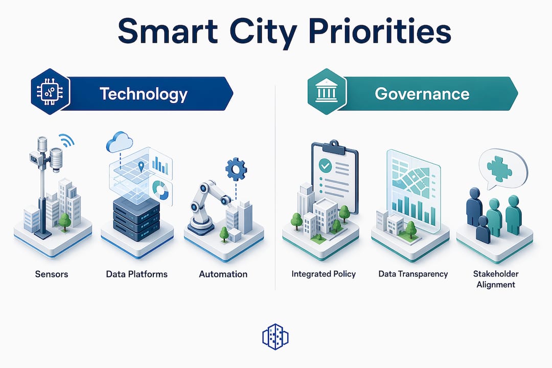
Smart city strategies are defined as coordinated frameworks that integrate data, digital infrastructure, and governance to improve how urban systems function across transport, energy, water, public space, and housing. With over 68% of the global population projected to live in urban areas by 2050, the pressure on city officials and planners to manage resources more intelligently is not a future concern. It is already here. The global smart cities market is expected to grow from $877.6 billion in 2024 to over $1.91 trillion by 2030, a figure that reflects genuine municipal investment rather than speculative hype. Understanding why adopt smart city strategies matters is the starting point for any planner or policymaker who wants to make decisions that hold up over the next decade.
Why adopt smart city strategies for cost and efficiency gains
The economic case for smart city adoption is grounded in measurable outcomes, not projections. McKinsey estimates that smart technologies can reduce per-capita urban costs by 10 to 15%, primarily through more efficient management of energy, water, and transport. That figure represents real budget relief for municipalities operating under fiscal pressure.
The efficiency gains break down across several urban systems:
- Energy: Smart street lighting using adaptive controls cuts energy consumption by 50 to 70% compared to conventional fixed-schedule systems. For a mid-sized city with thousands of street lamps, that reduction translates directly into capital that can be redirected to public space or housing.
- Water: IoT-enabled leak detection reduces non-revenue water losses by 20 to 40%, addressing one of the most persistent and invisible drains on municipal budgets.
- Mobility: Cities adopting integrated smart mobility strategies report up to 30% reductions in traffic congestion and associated emissions. Real-time traffic data allows planners to shift from reactive incident management to predictive network optimisation.
These are not isolated wins. When energy, water, and transport systems share a common data layer, the benefits compound. A city that has already deployed IoT water monitoring can extend the same network architecture to air quality sensors or flood detection, spreading the infrastructure cost across multiple use cases. Explore how real-time data in urban planning translates these efficiency gains into practical planning decisions.
Pro Tip: Prioritise open, interoperable data standards from the outset. Proprietary sensor ecosystems lock you into single vendors and make it expensive to integrate new systems later. Open standards allow different departments and future technologies to connect without costly re-engineering.

Does governance matter more than technology in smart cities?
Technology alone does not guarantee that a smart city strategy will succeed. Integrated governance that aligns technology deployment with social equity, civic participation, and ethical data standards is what separates functional smart cities from expensive pilot projects that stall after the ribbon-cutting.
The most common failure mode is treating smart city projects as hardware procurement exercises. Officials select sensors, platforms, and dashboards before they have diagnosed what specific urban problems they are trying to solve. The result is fragmented infrastructure that generates data nobody acts on, and communities that feel surveilled rather than served.
Effective governance for smart city adoption rests on four foundations:
- Problem diagnosis first: Map the friction points in your city’s operations before selecting any technology. Is the core issue peak-hour congestion, ageing water infrastructure, or inequitable access to green space? The answer determines the tools, not the other way around.
- Inclusive participation: Residents, community organisations, and local businesses must have a genuine voice in how data is collected and used. Participatory planning processes build the social licence that technology projects require to scale.
- Ethical data standards: Define what data is collected, how long it is retained, who can access it, and under what conditions it can be shared. Cities that have published clear data governance charters report higher public trust and fewer legal challenges.
- Local adaptation: One-size-fits-all tech solutions imported from other contexts routinely fail because they do not account for local regulatory frameworks, existing infrastructure, or community priorities.
“Smart city initiatives must remain people-centred, prioritising human rights, social equity, and inclusion to improve daily life.” — UN News, 2026
Pro Tip: Publish a data transparency report annually. It does not need to be lengthy. A clear summary of what data your city collects, how it is used, and what safeguards are in place does more to maintain public trust than any communications campaign.
Balancing digital tools with traditional spatial planning
Smart city strategies work best when they reinforce good spatial planning rather than substitute for it. Embedding local knowledge alongside data-driven layers produces more resilient outcomes than either approach achieves alone. This is where the importance of smart city planning becomes tangible for urban designers and planners working at the neighbourhood scale.
Consider four practical combinations that illustrate this balance:
- Converting underused road space: Several European cities have reclaimed lanes from private vehicles and reallocated them to cycling infrastructure and pedestrian zones. Digital mobility data identifies which corridors carry the lowest vehicle throughput, giving planners an objective basis for decisions that would otherwise face political resistance.
- Green infrastructure with sensor monitoring: Urban tree canopies and bioswales reduce surface temperatures and manage stormwater. Pairing these with soil moisture sensors and microclimate monitoring allows maintenance teams to respond to stress before vegetation fails, protecting the capital investment in green infrastructure.
- 3D scenario modelling for development capacity: Digital twins and 3D city models allow planners to test building massing, sunlight access, visibility corridors, and parking demand across multiple development scenarios before a single planning application is submitted. This reduces the iteration time between concept and consent significantly.
- Climate adaptation overlays: Flood risk mapping, heat island analysis, and wind modelling can be layered onto existing GIS data to identify which neighbourhoods are most exposed. Planners can then prioritise infrastructure upgrades and zoning adjustments in the areas of highest need.
The table below summarises how traditional planning methods and digital tools complement each other in practice:
| Planning challenge | Traditional approach | Digital enhancement |
|---|---|---|
| Development capacity assessment | Manual floor area ratio calculations | 3D massing models with automated GFA output |
| Traffic impact analysis | Manual counts and static models | Real-time IoT data and predictive simulation |
| Green space equity | Desktop mapping and site visits | GIS layers with population density and access radii |
| Climate resilience | Engineering standards and flood maps | Dynamic scenario modelling with climate projections |
Platforms like 3D Cityplanner support this integration directly, combining GIS data, 3D city models, and scenario planning tools in a browser-based environment that planners and stakeholders can access without specialist software. For a broader view of how infrastructure planning strategies connect to urban resilience, the principles translate directly into smart city contexts.
How to implement smart city strategies effectively
A practical implementation roadmap prevents the governance gaps and siloed deployments that undermine so many smart city programmes. The following steps reflect best practice drawn from cities that have moved beyond pilot projects to city-wide adoption.
- Diagnose before you deploy. Conduct a structured audit of your city’s operational friction points. Identify where data is already being collected, where decisions are made on incomplete information, and where residents report the most persistent service failures. This audit becomes the brief for your technology procurement.
- Define interoperability and data governance upfront. Siloed IoT implementations without unified governance frameworks impair scalability and make systems unmanageable within three to five years. Establish data standards, API requirements, and access protocols before issuing any procurement tender.
- Build internal capacity alongside vendor partnerships. External vendors deliver platforms; your internal team must be able to interpret outputs, maintain systems, and adapt configurations as needs change. Invest in training and in hiring staff with GIS, data analysis, and urban informatics skills.
- Coordinate across departments. Transport, utilities, planning, and housing departments frequently operate separate data systems. A cross-departmental data working group with a shared platform reduces duplication and surfaces insights that siloed teams would miss entirely.
- Adopt incrementally. Start with one or two high-impact use cases where data is already available and outcomes are measurable. Demonstrate value, build institutional confidence, and then extend the framework to additional systems. Wholesale technology adoption without this foundation produces expensive failures.
Pro Tip: Use 3D Cityplanner for scenario comparison and stakeholder communication during the early stages of smart city planning. Visualising development options, infrastructure layouts, and public space configurations in 3D makes abstract data legible to elected officials and community groups, which accelerates decision-making and reduces the risk of late-stage objections.
For a structured overview of smart city planning tips that address governance and construction planning intersections, the principles above translate directly into project-level practice.
Key takeaways
Smart city strategies succeed when governance, data standards, and spatial planning are treated as equally important as the technology itself.
| Point | Details |
|---|---|
| Cost reduction is measurable | Smart technologies reduce per-capita urban costs by 10 to 15% across energy, water, and transport. |
| Governance precedes technology | Diagnose urban problems and define data governance frameworks before selecting or deploying any platform. |
| Interoperability prevents lock-in | Open data standards and unified governance frameworks are prerequisites for scalable IoT deployment. |
| Digital and traditional planning complement each other | 3D scenario modelling and GIS layers enhance spatial planning without replacing local knowledge or community input. |
| Incremental adoption reduces risk | Starting with measurable, high-impact use cases builds institutional confidence before city-wide rollout. |
Why I remain cautious about tech-first smart city projects
I have reviewed enough smart city programmes to recognise a pattern that repeats itself with frustrating regularity. A city announces an ambitious digital transformation. Sensors are procured, dashboards are built, and a press release goes out. Two years later, the dashboards are underused, the data is siloed, and the original urban problems remain unsolved. The technology worked. The governance did not.
The projects that actually improve how cities function share one characteristic: they started with a clear problem statement, not a technology catalogue. A city that knows it is losing 35% of treated water to undetected pipe leaks has a specific, measurable problem. That specificity drives procurement, defines success metrics, and keeps the project accountable. A city that decides to become a “smart city” without that specificity is buying infrastructure in search of a purpose.
What I find most encouraging about the current generation of planning tools is that they make the governance conversation easier to have. When you can show a councillor or a community group a 3D model of two development scenarios side by side, with sunlight analysis, parking demand, and green space coverage all visible at once, the discussion shifts from abstract policy to concrete trade-offs. That is where good decisions get made. Digital twins and 3D urban modelling do not replace judgement. They give judgement better material to work with.
The cities that will manage urbanisation well over the next two decades are not necessarily the ones with the most sensors. They are the ones that have built the governance capacity to act on what their data tells them.
— Anne Dullemond
Plan smarter with 3D Cityplanner
3D Cityplanner is a browser-based digital twin platform built for municipalities, urban planners, and planning consultants who need to design, analyse, and compare spatial development scenarios in 3D. The platform combines GIS data, 3D city models, automated area generation, and scenario planning tools to support data-driven decisions at every stage of urban development. Whether you are evaluating development capacity, modelling infrastructure options, or communicating planning proposals to stakeholders, 3D Cityplanner gives you a single environment to test assumptions and present findings clearly. Explore the urban design platform to see how it supports smart city strategy work from feasibility through to masterplanning.
FAQ
What are smart city strategies?
Smart city strategies are coordinated frameworks that use data, IoT infrastructure, and digital tools to improve how urban systems such as transport, energy, water, and public space are managed and delivered. They combine technology deployment with governance structures to produce measurable improvements in service quality and resource efficiency.
What are the main benefits of smart cities?
The primary benefits include reduced per-capita urban costs of 10 to 15%, energy savings of 50 to 70% from smart street lighting, and reductions in traffic congestion of up to 30%. These gains depend on integrated governance and interoperable data systems, not technology alone.
Why do some smart city projects fail?
Most failures stem from tech-first approaches that deploy sensors and platforms before diagnosing specific urban problems. Without a clear problem statement and a governance framework for acting on data, technology investments produce dashboards that go unused.
How do digital twins support smart city planning?
Digital twins create live or scenario-based 3D models of urban areas, allowing planners to test development options, infrastructure layouts, and climate adaptation measures before committing to physical changes. They make complex spatial data legible to decision-makers and community stakeholders alike.
Where should a city start with smart city adoption?
Start with a structured audit of operational friction points to identify where data is missing or decisions are poorly informed. Define interoperability standards and data governance protocols before procuring any technology, and pilot one or two high-impact use cases before scaling city-wide.