What is zoning analysis? a guide for developers

Zoning analysis is defined as the systematic review of a property’s municipal zoning regulations to determine what land uses, building configurations, and development densities are legally permitted on that site. For urban planners, architects, and real estate developers, this process is the foundation of any credible feasibility study. Failing to conduct zoning analysis early leads to costly redesigns or outright project abandonment when designs conflict with zoning rules. A thorough zoning analysis covers permitted and prohibited uses, floor-area ratios (FAR), building heights, setbacks, parking requirements, and overlay district restrictions. Tools such as GIS mapping systems, municipal zoning codes, and platforms like 3D Cityplanner are central to conducting this work accurately and efficiently.
What is zoning analysis and what does it assess?
Zoning analysis, sometimes called a zoning report or land use assessment, is the structured process of interpreting the regulatory framework governing a specific parcel of land. A zoning report typically covers classification, permitted uses, dimensional standards, non-conformities, code violations, variances, and pending zoning changes. That scope makes it far more than a simple classification lookup. It is a decision-making instrument that shapes whether a project proceeds, stalls, or requires a fundamentally different approach.
The analysis draws on municipal zoning ordinances, GIS records, overlay district maps, and planning authority databases. Each of these sources contributes a different layer of regulatory information. Together, they define the outer limits of what can be built, how large it can be, and under what conditions it may operate.

Understanding the urban zoning analysis process is not optional for developers or planners working on any site with development potential. Zoning regulations are legally binding. Misreading them at the outset creates compounding problems throughout design, financing, and construction.
Which zoning components does an analysis cover?
Zoning analysis identifies permitted, conditional, and prohibited uses, building height, setbacks, floor-area ratios, parking, and overlay restrictions specific to the site. Each component directly shapes the development envelope available to a project team.
The key components assessed in a thorough zoning analysis include:
- Land use categories: Permitted uses are those allowed by right. Conditional uses require additional approval, such as a planning committee hearing. Prohibited uses are simply off the table without rezoning.
- Dimensional standards: FAR defines the total floor area allowed relative to the plot size. A FAR of 2.0 on a 1,000 sq m site permits 2,000 sq m of gross floor area. Height limits and setbacks further constrain the building envelope from all sides.
- Lot coverage and open space: Many codes cap the percentage of a plot that buildings may occupy, preserving space for landscaping, drainage, or public realm.
- Parking minimums and accessibility: Residential, commercial, and mixed-use zones each carry different parking ratios. These requirements directly affect site layout and underground structure costs.
- Environmental and utility constraints: Flood zones, heritage overlays, and utility easements can reduce the developable area significantly, even on sites with generous zoning classifications.
- Non-conforming uses and zoning overlays: A building that predates current zoning may have grandfathered rights that complicate redevelopment. Overlays add another regulatory layer on top of base zoning, often for conservation, design, or density bonus purposes.
Pro Tip: Always check for active overlay districts before interpreting base zoning. A site zoned for high-density residential may sit within a heritage conservation overlay that restricts demolition and limits facade changes, effectively overriding the base classification.
These components collectively define the development scope. Skipping any one of them introduces risk that surfaces later at a far higher cost.
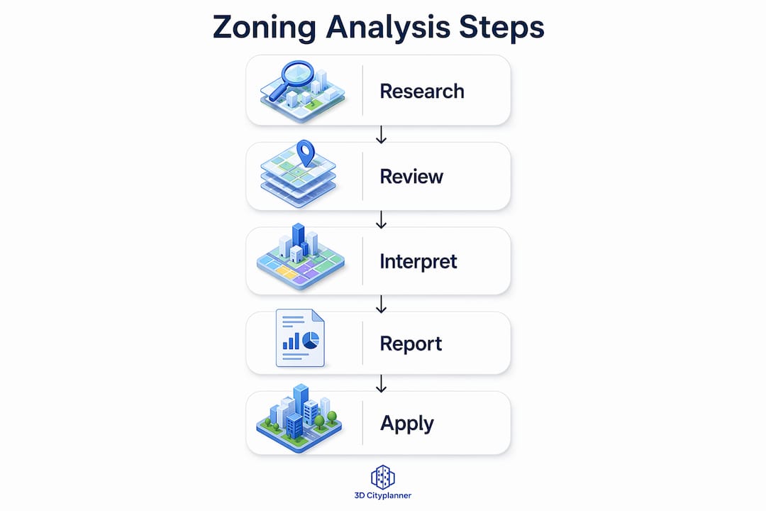
How to conduct a zoning analysis: process and steps
A structured zoning analysis process follows a clear sequence. Deviating from it, or compressing steps to save time, is where most errors originate. A standard 14-day due diligence timeline splits initial screening, code deep-dives, and official verification across a defined schedule. Missing that schedule can delay financing and the overall project.
Follow these steps for a thorough zoning analysis:
- Initial parcel screening: Use municipal GIS portals and online zoning maps to confirm the parcel’s base zoning classification, lot dimensions, and any flagged overlays. This takes hours, not days, and immediately filters out non-viable sites.
- Ordinance review: Download and read the relevant sections of the local zoning ordinance. Focus on the use table, dimensional standards table, and any special provisions for the identified zone.
- Overlay and special district identification: Cross-reference the parcel against flood zone maps, heritage registers, design control areas, and infrastructure easements. Each overlay carries its own set of rules.
- Building envelope calculation: Apply FAR, height limits, setbacks, and lot coverage rules to calculate the maximum permissible building volume. This is where platforms like 3D Cityplanner add measurable value, translating regulatory numbers into a visible 3D massing model.
- Special permit and variance identification: Determine whether the intended use or scale requires a conditional use permit, variance, or rezoning application. Variance and rezoning timelines range from 4 to 12 months, with professional fees from £12,000 to over £80,000. These figures must enter the project’s financial model immediately.
- Verification with planning authorities: Confirm interpretations directly with the local planning department. Written confirmation protects the project if disputes arise later.
- Documentation and reporting: Compile findings into a structured zoning report that covers all components, flags risks, and outlines the path forward for design and approvals.
Pro Tip: Investigate the property’s zoning history, including past variances and grandfathered uses, before finalising your analysis. Zoning history and legacy entitlements are often absent from digital databases but can significantly affect development rights and legal exposure.
Manual zoning analysis vs. ai-powered digital methods
The gap between traditional and digital zoning analysis is now substantial enough to affect competitive positioning in real estate development.
| Factor | Manual Analysis | AI-Powered / Digital Analysis |
|---|---|---|
| Time per parcel | 3–5 business days | Minutes to hours |
| Cost per parcel | £1,200–£4,000 | Significantly lower |
| Jurisdictions covered | Limited by expertise | Thousands simultaneously |
| Error risk | Higher, human-dependent | Reduced, code-driven |
| 3D visualisation | Rarely included | Integrated in platforms like 3D Cityplanner |
| Scalability | Low for portfolios | High for pipeline screening |
Manual zoning analysis consumes 3 to 5 business days per parcel and costs between $1,500 and $5,000, creating bottlenecks in high-volume development pipelines. For a developer screening 50 sites simultaneously, that cost and delay is prohibitive.
AI platforms parse municipal zoning codes across thousands of jurisdictions using natural language processing to produce structured zoning summaries in seconds. This enables investors and planners to query permitted uses, dimensional requirements, and special conditions at a scale that was previously impossible.
That said, human expertise remains non-negotiable in several areas. Interpreting ambiguous ordinance language, negotiating with planning authorities, and modelling alternative development scenarios all require professional judgement. Digital tools accelerate and inform the process. They do not replace the planner or the architect.
For teams working across large portfolios, the practical benefits of digital methods include faster go or no-go decisions, reduced legal fees at the screening stage, and the ability to run zoning analysis tools across multiple sites in parallel before committing to detailed due diligence.
Zoning challenges and how analysis manages project risk
Zoning is rarely straightforward on sites with development potential. The most complex sites are often the most attractive, and complexity means risk.
Non-conforming uses may restrict rebuilding potential after damage and impose development limitations that increase project risk. A warehouse operating under a grandfathered industrial use in a zone now classified as residential may not be rebuilt to the same footprint if it is destroyed. That single fact can determine whether a lender finances the acquisition.
Common zoning risks that analysis surfaces include:
- Rebuilding restrictions on non-conforming structures: Lenders and insurers evaluate zoning reports to assess whether a damaged building can be reconstructed. Zoning restrictions can permanently reduce property value after damage if rebuilding is limited.
- Pending zoning changes: A site may be zoned for commercial use today but subject to a draft amendment that would reclassify it as open space. Zoning analysis flags these pending changes before contracts are signed.
- Highest and best use identification: Zoning analysis highlights highest and best use opportunities, enabling developers to uncover more profitable uses legally permitted beyond current property utilisation. A site used as a car park may carry zoning rights for a ten-storey mixed-use building.
- Financing and insurance underwriting: Lenders require zoning reports to confirm that a property’s current use is legally conforming. Non-conformities can trigger loan conditions or outright refusals.
“Zoning analysis is dynamic. If intended uses are prohibited or need variances, analysis should model alternative development scenarios or policy amendment paths to avoid deal failure.” — Situate Inc.
The practical response to these risks is to treat zoning analysis as a living document rather than a one-time checklist. As project scope evolves, the analysis should be revisited and updated to reflect any changes in regulatory status or planning policy.
Applying zoning analysis results to design and stakeholder communication
Zoning analysis outputs are most valuable when they feed directly into design decisions and planning conversations. The numbers and classifications in a zoning report translate into physical form through building massing, site layout, and density calculations.
Pro Tip: Use your zoning envelope calculations as the starting geometry in your 3D model. Building from the maximum permissible volume downward is far more efficient than designing freely and then discovering constraints late in the process.
Practical applications of zoning analysis results include:
- Building massing and envelope modelling: FAR, height limits, and setbacks define a three-dimensional zone of permissible construction. Platforms like 3D Cityplanner convert these parameters into interactive 3D models that design teams can test and iterate against in real time.
- Density and capacity calculations: Gross floor area calculations, unit count estimates, and commercial space ratios all derive from zoning data. These figures feed directly into financial models and planning applications.
- Stakeholder communication: Presenting zoning constraints visually, through 3D scenario models rather than tables of numbers, makes regulatory complexity accessible to clients, investors, and planning committees. A city planning workflow that integrates zoning data from the outset produces more coherent presentations and fewer surprises at committee stage.
- Scenario comparison: Where a site permits multiple development approaches, zoning analysis supports side-by-side comparison of options. A residential-only scheme versus a mixed-use scheme on the same plot may both comply with zoning but deliver very different returns and planning outcomes.
- Integration into broader due diligence: Zoning findings sit alongside geotechnical reports, infrastructure assessments, and market studies in a complete site due diligence package. Treating them in isolation misses the interactions between regulatory constraints and physical site conditions.
Key takeaways
Zoning analysis is the single most important regulatory step in early-stage development, because it defines what can legally be built before any design or financial commitment is made.
| Point | Details |
|---|---|
| Start with zoning analysis | Conduct zoning analysis before design begins to avoid costly redesigns and approval delays. |
| Cover all components | Assess permitted uses, FAR, height, setbacks, parking, overlays, and non-conformities without exception. |
| Factor in timelines and costs | Variance and rezoning processes can take 4–12 months and cost tens of thousands of pounds. |
| Use digital tools for accuracy | Platforms like 3D Cityplanner translate zoning data into 3D massing models for faster, clearer decision-making. |
| Treat analysis as dynamic | Revisit zoning findings as project scope evolves and monitor pending regulatory changes throughout. |
Why i think most teams underestimate zoning analysis
By Anne Dullemond
After working across urban development projects in multiple European jurisdictions, the pattern I see most consistently is this: zoning analysis gets treated as an administrative box to tick rather than a strategic instrument. Teams commission a basic zoning report, note the classification, and move straight into design. That approach works until it doesn’t, and when it fails, it fails expensively.
The most valuable zoning work I have seen happens before the design brief is written. When a team understands the full regulatory envelope first, including the history of variances on a site, the implications of overlay districts, and the realistic timeline for any permits required, the design process becomes far more focused. You are not designing freely and then cutting back. You are building within a known framework from day one.
The other misconception worth challenging is that zoning analysis is a static document. Regulations change. Planning policy evolves. A site that was non-conforming two years ago may now sit within a new regeneration zone with entirely different development rights. I have seen projects revived, and others derailed, purely because the team did or did not check for pending amendments before proceeding.
The arrival of 3D digital tools has genuinely changed what is possible here. Being able to model a zoning envelope in three dimensions, run multiple scenarios against the same regulatory parameters, and present those scenarios to a planning committee in a single session compresses what used to take weeks into days. That is not a marginal improvement. It changes the economics of early-stage feasibility work.
My advice to any planner or developer reading this: make zoning analysis the first line item in your project programme, not the second.
— Anne Dullemond
See your zoning constraints in 3d with 3d cityplanner
3D Cityplanner is a browser-based urban design platform built for urban planners, architects, and real estate developers who need to move from zoning data to spatial decisions quickly. The platform integrates GIS data and municipal zoning parameters directly into a 3D city model, allowing you to visualise building envelopes, test massing scenarios, and compare development options against regulatory constraints in real time.
For feasibility studies, masterplanning, and stakeholder presentations, 3D Cityplanner functions as a digital twin for urban planning, giving your team a shared, data-driven environment to evaluate zoning outcomes before committing to detailed design. Explore the platform and request a demo to see how zoning analysis becomes a live, visual process rather than a static report.
FAQ
What is the zoning analysis definition in simple terms?
Zoning analysis is the process of reviewing a property’s local zoning regulations to determine what uses, building sizes, and development configurations are legally permitted on that site. It covers permitted uses, dimensional standards, parking requirements, and any overlay restrictions.
How long does a zoning analysis take to complete?
A standard zoning analysis follows a 14-day due diligence timeline, covering initial screening, ordinance review, and official verification. If a variance or rezoning is required, the process extends to 4–12 months.
Why is zoning analysis important for real estate developers?
Zoning analysis defines the maximum development potential of a site and identifies risks such as non-conforming uses, pending regulatory changes, and permit requirements. Without it, developers risk designing projects that cannot receive planning approval or financing.
What is the difference between a permitted use and a conditional use?
A permitted use is allowed by right under the zoning classification and requires no additional approval. A conditional use is allowed only after a planning authority grants specific approval, typically through a hearing process with defined conditions attached.
Can AI tools replace a professional zoning analysis?
AI tools can parse zoning codes across thousands of jurisdictions rapidly and produce structured summaries, but they do not replace professional judgement for interpreting ambiguous ordinance language, negotiating with planning authorities, or modelling alternative development scenarios.