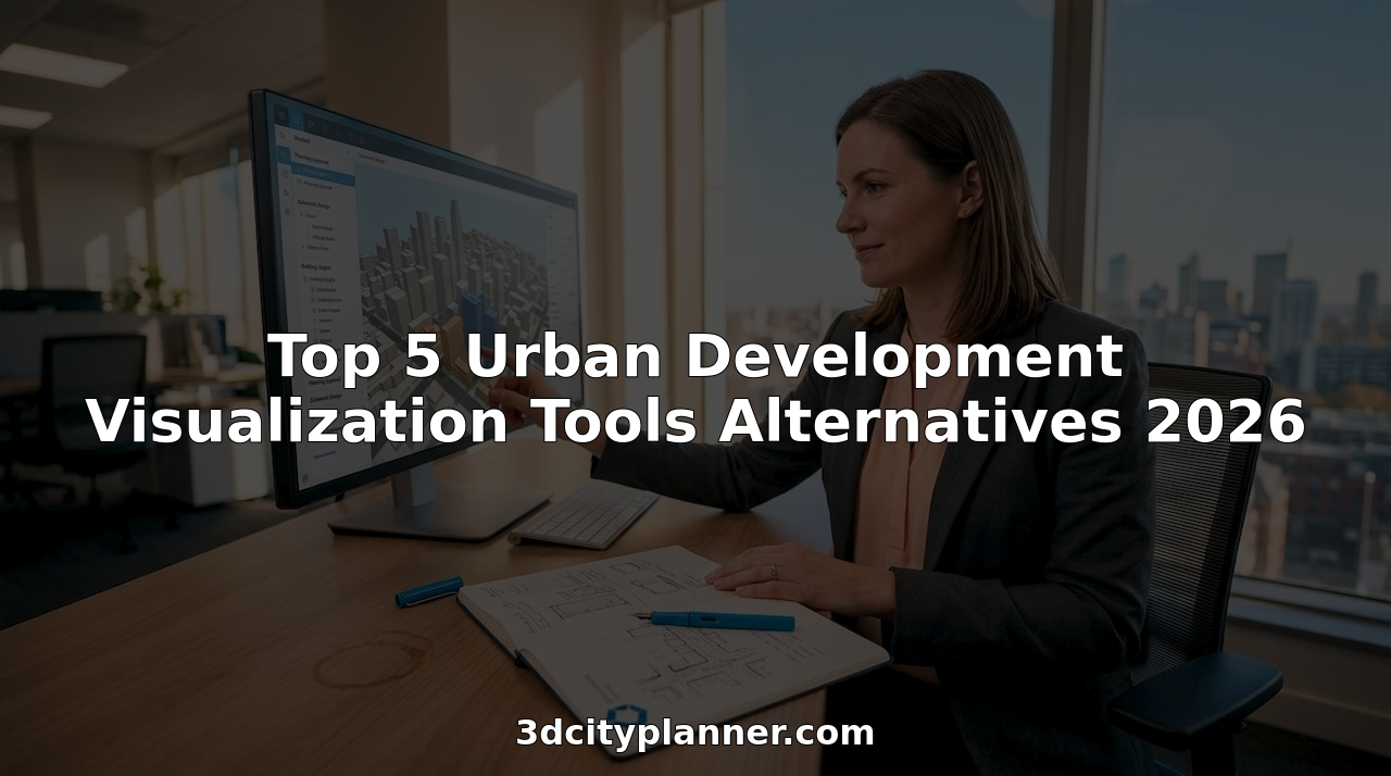
Urban infrastructure analysis: methods and tools explained

Urban infrastructure analysis is far more than a survey of roads, pipes, and utility assets. Many urban development professionals still treat it as a stock-taking exercise, cataloguing what exists rather than examining how systems interact, degrade, and recover under pressure. In reality, urban infrastructure analysis is the systematic study of the physical and operational systems that support a city, including transportation, energy, water, and waste networks, to understand performance, interdependencies, and where failures may occur. Getting this distinction right shapes every planning decision that follows.
Key Takeaways
| Point | Details |
|---|---|
| Systems-based analysis | Urban infrastructure analysis looks at how city systems interact, not just their standalone function. |
| Multiple methodologies | Approaches like asset management and resilience analysis serve different planning needs. |
| Essential role of data | GIS and data-driven tools make evaluations more accurate and insightful. |
| Consider technical and social | Best outcomes come from blending hard data with local, social input. |
Defining urban infrastructure analysis
Urban infrastructure analysis sits at the intersection of engineering, geography, and policy. It examines not just what assets exist, but how they function together as a system, how they serve communities, and how they behave when conditions change. This framing matters enormously for professionals tasked with making long-term investment and planning decisions.
At its core, the field studies six broad categories of urban systems:
- Transportation networks: Roads, rail, cycling infrastructure, and pedestrian routes, plus the connections between them
- Energy systems: Power generation, transmission grids, and distribution networks serving residential, commercial, and industrial users
- Water and sanitation: Potable water supply, stormwater drainage, and wastewater treatment facilities
- Waste management: Collection routes, processing facilities, and disposal or recycling infrastructure
- Digital and telecommunications: Fibre networks, mobile coverage, and smart city sensor arrays
- Green infrastructure: Parks, urban forests, wetlands, and green corridors that regulate temperature, flooding, and biodiversity
“Urban infrastructure analysis is the systematic study of the physical and operational systems that support a city to understand performance, interdependencies, and where failures may occur.” This definition, simple as it reads, signals that no single network can be assessed in isolation.
The systems-based perspective is what separates rigorous analysis from basic auditing. A water main failure does not just affect water supply; it disrupts road access for repair crews, affects business operations, and may trigger cascading energy or telecommunications interruptions. Understanding these interdependencies is the foundation of effective urban infrastructure modelling, and it is where analytical frameworks begin to earn their value. For urban development professionals, adopting this systemic view transforms how projects are scoped, evaluated, and delivered.
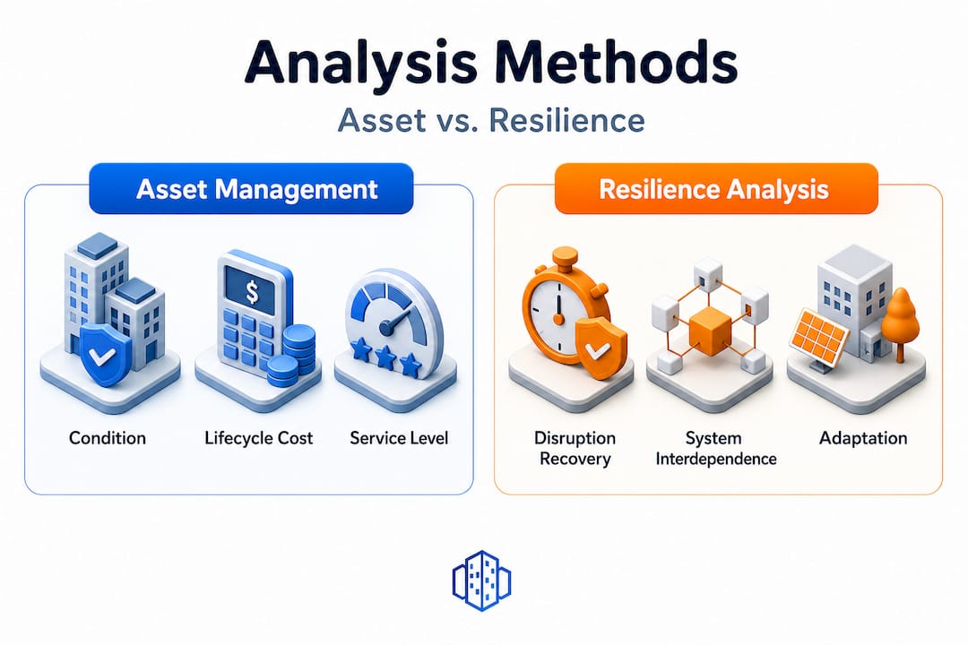
Key approaches: from asset management to resilience analysis
With the definition established, the next step is selecting the right analytical framework for your project. Two major clusters of methodology dominate the field, and understanding their differences helps you match your approach to your planning objective.
Infrastructure asset management (IAM) focuses on the physical condition and financial performance of assets over their lifecycle. According to IAM methodologies, this framework informs planning and budgeting through assessments of asset condition, performance against service level targets, risk exposure, and lifecycle cost. It is particularly valuable when a city or authority needs to prioritise maintenance spending or justify capital investment to elected bodies.
Resilience analysis, by contrast, evaluates how well systems withstand and recover from disruption. Resilience assessment approaches typically combine indicator frameworks with weighting systems and spatial or network analysis to evaluate system robustness under stress scenarios such as flooding, extreme heat, or supply chain disruption.
| Criterion | Asset management (IAM) | Resilience analysis |
|---|---|---|
| Primary focus | Asset condition and lifecycle cost | System performance under disruption |
| Typical output | Maintenance schedules, budgets | Vulnerability maps, recovery curves |
| Data inputs | Inspection records, service histories | Network topology, hazard scenarios |
| Planning horizon | Medium to long term | Short to long term |
| Key users | Asset owners, finance teams | Planners, emergency managers |
| Governance link | Budget cycles, regulatory compliance | Climate adaptation, risk frameworks |
A practical sequence for applying these frameworks in a project context might look like this:
- Baseline audit: Catalogue existing assets, their age, condition, and service performance using IAM principles.
- Interdependency mapping: Identify how systems connect and where cascading failures are most likely to occur.
- Scenario definition: Specify realistic disruption scenarios (flood, heat event, cyber attack) relevant to your geographic and climatic context.
- Resilience scoring: Apply indicator frameworks and network analysis to evaluate system robustness against each scenario.
- Prioritisation: Use combined IAM and resilience outputs to rank interventions by impact, cost, and urgency.
- Review against objectives: Cross-check findings against your optimisation planning guide to align analysis with broader project goals.
Pro Tip: Match your framework to your project phase. IAM suits early scoping and budget justification, while resilience analysis becomes essential once you move into design development and risk assessment. Using both in sequence gives you a fuller picture than either approach alone.
Data-driven tools and GIS-based methods
Frameworks are only as good as the data and tools that feed them. Modern urban infrastructure analysis relies heavily on geospatial technologies, network science, and integrated data platforms to turn raw information into actionable insight.
Geographic Information Systems (GIS) are the backbone of spatial infrastructure analysis. GIS-based methods are widely used for infrastructure-related questions, covering data preprocessing, standardisation, multi-criteria evaluation, and mapping. In practical terms, this means a planning team can layer multiple data sources, such as asset locations, flood risk zones, population density, and land use classifications, onto a single spatial canvas and evaluate trade-offs visually and quantitatively.
The essential data tools that support infrastructure analysis include:
- GIS and spatial analysis platforms: For mapping, overlay analysis, and multi-criteria evaluation across urban systems
- Network analysis tools: For modelling connectivity, flow capacity, and vulnerability in transport, water, or energy grids
- Lifecycle costing models: For projecting the long-term financial implications of maintenance versus replacement decisions
- Scenario simulation engines: For stress-testing systems against defined disruption events and visualising recovery paths
- Remote sensing and LiDAR data: For capturing current asset conditions, particularly in dense or rapidly changing urban environments
- Open data repositories: For supplementing proprietary datasets with publicly available land use, demographic, and environmental information
Data-driven urban analysis now routinely incorporates connectivity and network science, lifecycle costing, and scenario evaluation, often expressed as performance curves or reliability metrics. These outputs are far more useful to decision-makers than static condition reports because they show how performance evolves over time and under changing conditions.
For infrastructure mapping, technologies such as 3D and 4D modelling have become increasingly relevant. Exploring infrastructure mapping tech shows how three-dimensional representations allow planners to model not just horizontal spread but vertical complexity, essential in dense urban cores where underground utilities, elevated structures, and surface networks all interact. Pairing GIS data with a robust GIS planning software environment enables teams to move seamlessly from raw data to polished visualisations and quantified assessments.
When combined with city planning strategies with 3D tools, GIS-based analysis supports not only current-state assessment but also forward-looking scenario modelling, allowing teams to test how proposed developments or infrastructure upgrades will affect system performance before a single shovel breaks ground.
Pro Tip: Integrate at least three distinct data sources when building your analysis baseline. Combining asset condition records, spatial hazard datasets, and socio-economic data gives a richer, more defensible picture than any single source can provide. Document your data sources and preprocessing steps thoroughly to support peer review and stakeholder scrutiny.
Advanced considerations: integration, disruption, and governance
Mastering the core tools and frameworks is a strong foundation. But the most rigorous and useful analyses also grapple with a set of harder, messier questions that sit at the boundaries of technical and social systems.
Defining disruption precisely is the first challenge. Many resilience analyses fail not because of poor data but because the disruption scenario is defined too loosely. Evaluating infrastructure networks under disruption requires explicitly defining both the disruption event and the recovery process, then selecting metrics that reflect system dynamics over time rather than just static capability at a single moment. For example, a transport network may have high capacity in normal conditions but degrade catastrophically under a 48-hour flooding event if critical nodes are located in flood zones.
Choosing between dynamic and static metrics shapes the quality of your analysis. Static metrics, such as total asset value or percentage of assets in good condition, give a snapshot. Dynamic metrics, such as recovery time, service continuity during disruption, or network redundancy under failure, tell a more honest story about how a system actually performs when it matters most.
Advanced infrastructure analysis also integrates a broader set of considerations beyond the purely technical:
- Social and community factors: How do infrastructure decisions affect access, equity, and daily life for different resident groups?
- Political and governance realities: Who has authority over each system? What procurement constraints or regulatory requirements shape what is feasible?
- Environmental and climate context: How do long-term climate trajectories affect asset lifespans and hazard exposure?
- Cross-jurisdictional complexity: Many urban infrastructure systems cross administrative boundaries, requiring collaborative governance arrangements.
As research into infrastructure readings makes clear, productive analysis should integrate both technical and social or political readings to better understand how infrastructure is governed and experienced in practice. An analysis that ignores governance realities may identify technically optimal solutions that are practically undeliverable.
“Some analyses distinguish ‘technical’ infrastructure readings from ‘social/political’ readings, arguing that productive approaches should integrate both to better address how infrastructure is governed and experienced in place.”
Using GIS integration tools that allow you to layer socio-economic and governance data alongside technical infrastructure records makes this integration substantially easier. The goal is an analysis that is both technically sound and politically and socially credible.
Why the best infrastructure analysis blends hard data with local context
There is a persistent temptation in infrastructure analysis to let the data do all the talking. Advanced modelling platforms, rich datasets, and sophisticated network analysis tools can produce outputs of impressive complexity. The risk is that teams become so focused on what the model shows that they undervalue what local communities and governance actors know from experience.
We have observed, consistently, that technically robust analyses which fail to account for local governance realities or community needs tend to produce recommendations that stall at implementation. A flood-resilience plan that identifies optimal drainage upgrades but ignores the fact that affected areas sit across two competing municipal jurisdictions will not deliver results, regardless of how precise the modelling was.
The productive integration of technical and social readings is not a theoretical nicety. It is a practical necessity. The most effective analyses build local partnerships early, running community engagement in parallel with technical data collection rather than bolting it on at the end. This surfaces tacit knowledge, such as informal drainage paths, seasonal usage patterns, and politically sensitive locations, that rarely appears in any dataset.
Common pitfalls arise when one perspective dominates. A purely technical analysis may miss distributional inequities entirely: optimising average system performance can mask sharp disparities in service quality across neighbourhoods. A purely political analysis, on the other hand, may resist necessary but unpopular infrastructure changes, leaving systems vulnerable. Balance is not a compromise; it is the method.
Our practical advice: build your analysis team to include both technical specialists and people with strong local governance or community engagement expertise. Use 3D optimisation case studies to show stakeholders what improved outcomes look like in spatial terms, making abstract analysis tangible and discussable. The goal is an analysis that communities and decision-makers can understand, trust, and act on.
Take your urban infrastructure analysis further
Understanding the principles and methods of urban infrastructure analysis is the critical first step. Applying them effectively requires tools that can handle complex spatial data, simulate scenarios, and present results clearly to diverse stakeholders.
The 3D Cityplanner platform is designed precisely for urban development professionals who need to move from analysis to action. It integrates GIS data, 3D modelling, line-of-sight analysis, sound simulation, and 4D project timelines into a single environment, so your infrastructure analysis does not remain a static report but becomes a living, interactive planning tool. Paired with advanced GIS software capabilities, the platform supports everything from asset condition mapping to resilience scenario modelling. Explore what it can do for your next project with a free trial, no upfront payment required.
Frequently asked questions
What are the main objectives of urban infrastructure analysis?
The main goals are to assess system performance, understand interdependencies, and anticipate points of failure or improvement across urban systems such as transport, energy, water, and waste. As the field defines it, the aim is to understand how these systems support city functioning and where vulnerabilities lie.
How do GIS tools support urban infrastructure analysis?
GIS enables planners to integrate, map, and evaluate spatial data across multiple infrastructure systems simultaneously. GIS-based methods support data preprocessing, standardisation, multi-criteria evaluation, and visual mapping, making them indispensable for identifying spatial patterns and planning priorities.
What is the difference between asset management and resilience analysis?
Asset management focuses on asset condition, service levels, risk, and lifecycle cost considerations, supporting budget planning and maintenance prioritisation. Resilience analysis, by contrast, stress-tests systems against disruption scenarios and evaluates system robustness and recovery, making it essential for climate adaptation and emergency planning.
Why consider social and political factors in infrastructure analysis?
Integrating social and governance perspectives ensures that technically sound recommendations are also feasible, equitable, and acceptable to the communities and institutions responsible for implementation. Without this integration, even well-modelled solutions risk stalling at the governance or community acceptance stage.
Recommended
- Urban infrastructure modelling: techniques, tools, and impact – 3D Urban Development
- Master urban infrastructure mapping with 3D and 4D tech – 3D Urban Development
- Urban infrastructure planning guide for advanced 3D optimisation – 3D Urban Development
- Urban Development Workflow for Efficient 3D Planning – 3D Urban Development