Top city planning strategies using advanced 3D technology
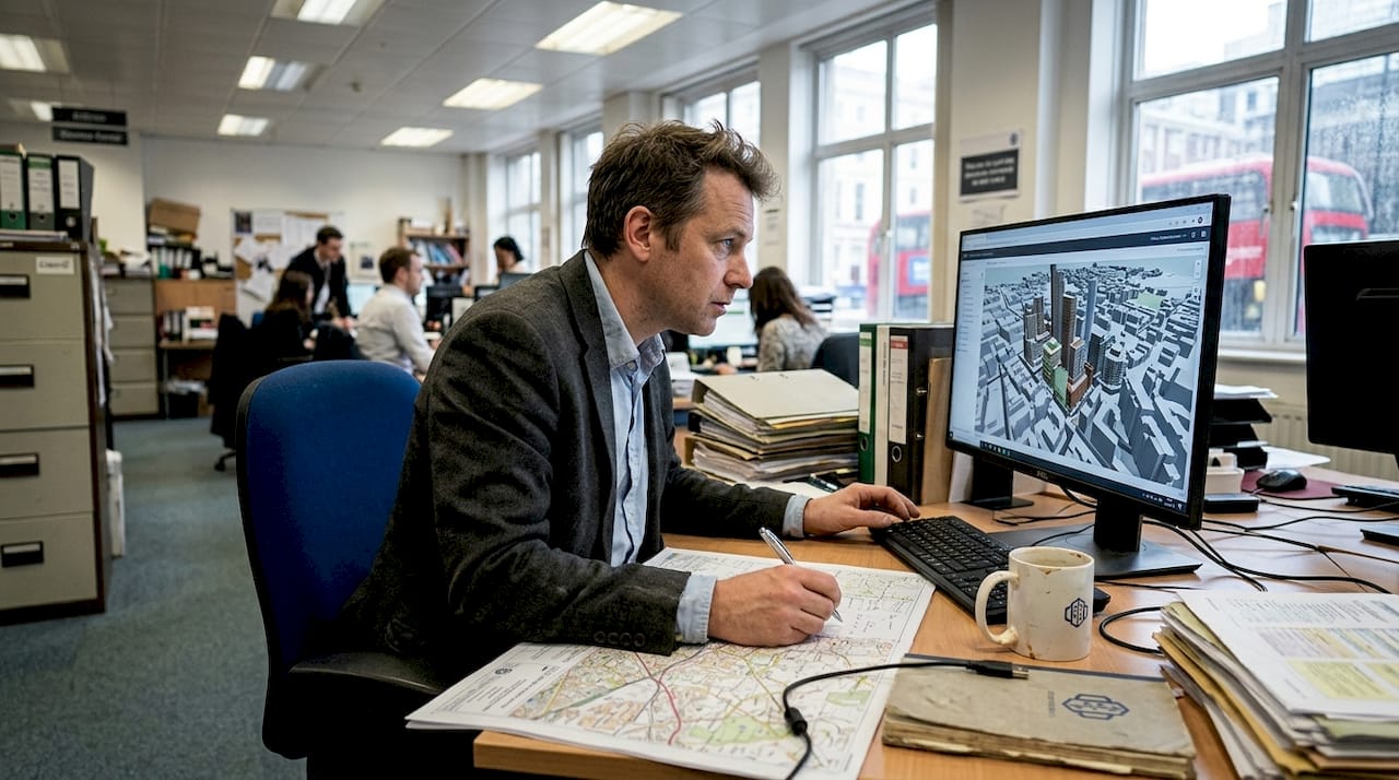
Selecting the right city planning strategies in an era of advanced 3D technology presents both opportunity and complexity for urban professionals. Digital tools now enable simulation, semantic modelling, and optimisation at unprecedented scales, yet navigating the landscape of GIS-BIM integration, urban digital twins, CityGML standards, generative design, and procedural modelling requires clear criteria and evidence. This article guides you through essential evaluation frameworks, reviews top strategies with real-world outcomes, and provides actionable recommendations for implementing innovative, data-driven urban development solutions that enhance resilience, sustainability, and stakeholder engagement.
Table of Contents
- Key takeaways
- Criteria for selecting top city planning strategies
- GIS-BIM integration for holistic urban resilience
- Urban digital twins for human-centred simulation and engagement
- CityGML 3D city models for semantic enrichment and standardisation
- Generative design and multi-objective optimisation for sustainable urban form
- Procedural 3D modelling for large-scale city generation and simulation
- Discover 3D Cityplanner solutions for advanced urban development
- Frequently asked questions
Key Takeaways
| Point | Details |
|---|---|
| Flood risk reduction | GIS BIM integration reduces flood risk by 30 per cent and enables scenario testing across transport networks, utilities and emergency routes. |
| Scenario simulation with twins | Urban digital twins enable scenario simulations and broaden stakeholder engagement across planning stages. |
| CityGML standardisation | CityGML standardisation enables standardised urban data for easier access and more effective energy analysis. |
| Generative retrofit optimisation | Generative design optimises carbon neutral retrofits and informs urban morphology decisions. |
| Procedural modelling | Procedural modelling supports large scale simulations by generating complex city geometries efficiently. |
Criteria for selecting top city planning strategies
Choosing effective city planning strategies that integrate 3D technologies demands careful evaluation against multiple criteria. Data interoperability and semantic richness form the foundation, ensuring that diverse datasets from GIS, BIM, and sensor networks communicate seamlessly. Process workflows must support bi-directional conversions between formats like IFC and CityGML, preserving both geometric precision and attribute metadata throughout the planning lifecycle.
Key challenges include reducing geometric complexity without losing critical detail, aligning coordinate systems across regional and building scales, and reconciling standards discrepancies between IFC and CityGML that affect integration quality. These technical hurdles directly impact analysis accuracy and collaboration efficiency.
Scalability and adaptability to diverse urban contexts are vital. Strategies must handle datasets ranging from single districts to entire metropolitan regions whilst accommodating varying data availability, regulatory frameworks, and climate conditions. Evaluate whether a strategy supports incremental implementation, allowing pilot projects before city-wide rollout.
Pro Tip: Prioritise strategies that align with existing data infrastructure and staff expertise. A technically superior approach that requires complete workflow overhaul may deliver less value than an incremental enhancement to current systems.
Consider these essential criteria when assessing options:
- Semantic depth and attribute preservation across conversions
- Computational performance at city scale
- Compatibility with existing software ecosystems
- Support for real-time updates and scenario testing
- Accessibility for non-technical stakeholders
These criteria provide the framework for evaluating specific strategies, beginning with GIS-BIM integration.
GIS-BIM integration for holistic urban resilience
Integrating Geographic Information Systems with Building Information Modelling creates more resilient, optimised urban environments by combining spatial analysis with detailed building models. This approach improves land use planning, infrastructure coordination, and flood mitigation through unified data layers that span from regional geography to individual building components.

GIS-BIM integration reduces flooding risk by 30% whilst enabling scenario simulations for traffic patterns, utility networks, and emergency response routes. By coordinating spatial and building data, planners identify conflicts earlier, test alternatives faster, and communicate proposals more effectively to stakeholders.
The integration supports urban resilience by facilitating multi-hazard assessments that consider building vulnerability alongside geographic exposure. Planners model how proposed developments affect drainage capacity, visualise evacuation routes through 3D building interiors, and analyse infrastructure interdependencies that traditional 2D GIS cannot reveal.
Pro Tip: Implement GIS-BIM integration during early project phases rather than as a post-design validation tool. Early integration maximises opportunities for infrastructure optimisation and cost reduction.
Key benefits include:
- Unified visualisation of geographic and building data
- Enhanced infrastructure conflict detection
- Improved flood risk assessment and mitigation
- Streamlined coordination between planning and engineering teams
“GIS-BIM integration transforms urban planning from siloed disciplines into a coordinated, evidence-based process that enhances resilience and sustainability.”
Successful implementation requires establishing data exchange protocols, training staff in both GIS and BIM workflows, and selecting platforms that support native interoperability. The investment delivers measurable improvements in planning accuracy and infrastructure performance.
Urban digital twins for human-centred simulation and engagement
Urban digital twins provide detailed human-centred simulations that enhance planning precision and public interaction through virtual representations of cities updated with real-time data. These dynamic models support scenario prediction for traffic flows, energy consumption, and pedestrian movement, enabling planners to test interventions before physical implementation.
The Nihonbashi urban digital twin reduced energy use intensity by 99 kWh/m²/year through solar photovoltaic potential estimation and optimised building orientation. Digital twins increase transparency by allowing stakeholders to explore proposed developments through immersive VR and AR experiences, facilitating meaningful feedback that improves design quality.
Pro Tip: Incorporate stakeholder feedback in iterative urban digital twin updates rather than treating public engagement as a final validation step. Early input identifies concerns that are cheaper to address and builds community support.
Implementing urban digital twins involves these essential steps:
- Acquire baseline data from surveys, sensors, and existing 3D models
- Create the initial digital twin using integration platforms
- Validate model accuracy against real-world measurements
- Connect real-time data streams for dynamic updates
- Deploy visualisation tools for stakeholder engagement
- Establish maintenance protocols for ongoing accuracy
Key applications include:
- Traffic flow optimisation through simulation testing
- Energy efficiency analysis for district heating networks
- Pedestrian comfort assessment using microclimate modelling
- Emergency response planning with real-time incident data
Digital twins transform planning from static snapshots into dynamic, evidence-based processes that adapt to changing urban conditions and stakeholder needs.
CityGML 3D city models for semantic enrichment and standardisation
CityGML-based models with Application Domain Extensions promote interoperable, enriched urban datasets vital for planning accessibility and energy strategies. This open standard for 3D city models combines geometric representation with semantic meanings, enabling analyses that require understanding building functions, material properties, and spatial relationships.
The Japan PLATEAU project created over 200 standardised city models used for accessibility analysis, urban morphology studies, and disaster risk assessment. Application Domain Extensions extend CityGML’s core schema for specialised applications like energy modelling, noise propagation, and historical preservation, maintaining interoperability whilst adding domain-specific attributes.
The 3D City Index enables benchmarking urban datasets across different cities and time periods, supporting comparative studies of urban form, density patterns, and infrastructure coverage. This standardisation facilitates knowledge transfer between projects and cities.
| ADE type | Primary application | Key attributes |
|---|---|---|
| Energy ADE | Building energy performance | Thermal properties, HVAC systems |
| Utility Network ADE | Infrastructure planning | Pipe networks, cable routes |
| Transportation ADE | Mobility analysis | Road hierarchies, transit stops |
| Accessibility ADE | Universal design | Barrier locations, ramp gradients |
CityGML’s semantic richness supports sophisticated analyses that simple geometric models cannot deliver. Energy simulations require material thermal properties, accessibility assessments need detailed terrain gradients, and morphology studies depend on accurate building typologies.
Implementing CityGML requires selecting appropriate Level of Detail for your analysis needs, extending schemas with relevant ADEs, and establishing data maintenance workflows that preserve semantic attributes during updates. The investment in standardisation pays dividends through improved analysis quality and dataset reusability.
Generative design and multi-objective optimisation for sustainable urban form
Generative design and multi-objective optimisation applied to 3D urban data improve carbon-neutral retrofits and balance resilience, energy efficiency, and financial goals. Algorithms explore thousands of design solutions, identifying configurations that satisfy competing objectives better than manual iteration.
A Tokyo optimisation balanced resilience, energy, and finance across 154 buildings using multi-objective methods that evaluated trade-offs between seismic upgrades, insulation improvements, and photovoltaic installations. This approach reduces carbon emissions through energy-efficient retrofits whilst maintaining economic viability.
Morphology bi-directional mapping enables refinement of urban form by linking generative design outputs back to 3D city models, supporting iterative improvement of district layouts, building massing, and open space distribution.
Pro Tip: Prioritise optimisation goals aligned with local policy targets and climate commitments. Generic objectives produce generic solutions, whilst context-specific goals deliver actionable recommendations.
| Aspect | Generative design | Procedural modelling |
|---|---|---|
| Primary strength | Explores optimal solutions | Rapid large-scale generation |
| Computational demand | High for complex optimisations | Moderate for rule-based generation |
| Customisation | Highly flexible objectives | Rule-defined parameters |
| Best application | Retrofit and district planning | City-wide scenario testing |
Generative design excels when balancing multiple competing objectives like minimising carbon emissions, maximising daylight access, and controlling construction costs. The approach provides quantified trade-offs that support evidence-based decision making.
Successful implementation requires defining clear objectives with measurable metrics, establishing constraints that reflect regulatory and site conditions, and allocating computational resources for iterative optimisation runs. The results identify solutions that human designers might overlook.
Procedural 3D modelling for large-scale city generation and simulation
Procedural modelling techniques rapidly generate detailed city models enabling large-scale traffic and energy simulations with high precision and performance. Rule-based generation using grammars like CGA creates buildings, streets, and infrastructure from compact rule sets, efficiently handling complex urban datasets.
Procedural modelling achieves 60 frames per second simulation of 1,500 vehicles with positioning errors below 0.15 metres, supporting real-time traffic analysis and autonomous vehicle testing. This performance enables planners to test multiple scenarios rapidly, comparing impacts of different street layouts, building densities, and transit networks.
Key capabilities include:
- Hyper-precision artificial intelligence integration for detailed feature generation
- Edge computing support for distributed simulation processing
- Traffic and energy usage simulations at metropolitan scale
- Rapid scenario generation for comparative analysis
Procedural modelling optimises visualisation performance through level-of-detail management, displaying simplified geometry for distant objects whilst maintaining detail for close-up views. This efficiency makes interactive exploration of city-scale models practical on standard hardware.
The approach supports parametric variation, allowing planners to adjust building heights, street widths, or land use mixes through parameter changes rather than manual remodelling. This flexibility accelerates design iteration and sensitivity analysis.
Implementing procedural modelling requires developing or adapting rule sets that reflect local building typologies, street patterns, and urban design guidelines. Initial rule development demands time investment, but subsequent scenario generation becomes remarkably efficient.
Discover 3D Cityplanner solutions for advanced urban development
Ready to implement these strategies in your projects? 3D Cityplanner offers a comprehensive suite of tools supporting GIS-BIM integration, urban digital twins, and semantic 3D city models that transform how you plan and develop urban environments. Our platform facilitates creating enriched models with CityGML compatibility, enables procedural modelling workflows, and supports generative design processes that optimise sustainability and resilience.
Experience these capabilities firsthand through our interactive demo, which showcases automatic building generation, line-of-sight visualisation, noise simulation, and 4D timeline planning. Explore our digital twin solutions for real-time scenario testing and stakeholder engagement, or discover our structure planning tools that streamline infrastructure coordination and conflict detection.
“Empowering urban planners with cutting-edge 3D technology for sustainable, resilient cities.”
Our platform integrates extensive global building and infrastructure databases, supports diverse 3D model imports, and provides training resources that accelerate your team’s proficiency. Start your trial period without upfront payment and discover how advanced 3D technology enhances your planning outcomes.
Frequently asked questions
What are the primary benefits of GIS-BIM integration in city planning?
GIS-BIM integration enhances coordination between spatial and building data, improving infrastructure planning and urban resilience. This approach reduces flooding risks by 30% and enables detailed scenario modelling for utilities and transportation networks. The unified data environment facilitates earlier conflict detection and more effective stakeholder communication.
How do urban digital twins improve public engagement in planning?
Urban digital twins use immersive VR and AR simulations that allow stakeholders to explore proposed developments interactively, facilitating meaningful feedback and participatory design. This transparency builds community trust and identifies concerns early when they are cheaper to address. Real-time scenario visualisation helps non-technical audiences understand complex planning decisions.
What challenges exist when standardising 3D city models with CityGML?
Standardising diverse urban data requires managing geometric complexity and coordinate system mismatches between regional and building scales. Reconciling differences between IFC and CityGML schemas whilst preserving semantic attributes demands careful workflow design. Ongoing challenges include maintaining data quality during format conversions and establishing sustainable update protocols.
How can generative design support carbon-neutral urban retrofits?
Generative design algorithms evaluate trade-offs between carbon reduction, cost control, and resilience enhancement, identifying retrofit solutions that satisfy multiple objectives. A Tokyo project optimised resilience, energy, and financial factors across 154 buildings, demonstrating how multi-objective methods balance competing priorities. This approach reveals non-obvious solutions that manual design might miss.
Recommended
- Top urban development strategies for city optimisation 2026 – 3D Urban Development
- Leverage 3D modelling for smarter city planning in 2026 – 3D Urban Development
- Urban project optimisation with advanced 3D tools in 2026 – 3D Urban Development
- Why optimise city planning: 3D tools for better design – 3D Urban Development


