Step-by-step urban masterplanning with 3D tools

Urban masterplans fail far more often than planners care to admit. The most common point of collapse is not the vision itself, but the gap between aspiration and execution, specifically the absence of structured, iterative phases and feedback mechanisms. As cities grow faster and development programmes become more intricate, the margin for error narrows considerably. A phased, evidence-based approach supported by advanced 3D tools is no longer a luxury; it is the standard that separates projects that deliver lasting value from those that stall in committee. This guide walks through each critical stage of the masterplanning process, from baseline assessment to adaptive review, equipping you with a framework that is both practical and measurable.
Key Takeaways
| Point | Details |
|---|---|
| Phased preparation matters | A robust assessment and clear objectives are critical to an actionable masterplan. |
| Integrated 3D workflows | Layered scenario building in 3D tools enhances collaboration and decision quality. |
| Actionable operationalisation | Breaking projects into clear, phased actions ensures tangible results. |
| Continuous benchmarking | Monitoring, indicators, and periodic review sustain the relevance and effectiveness of your masterplan. |
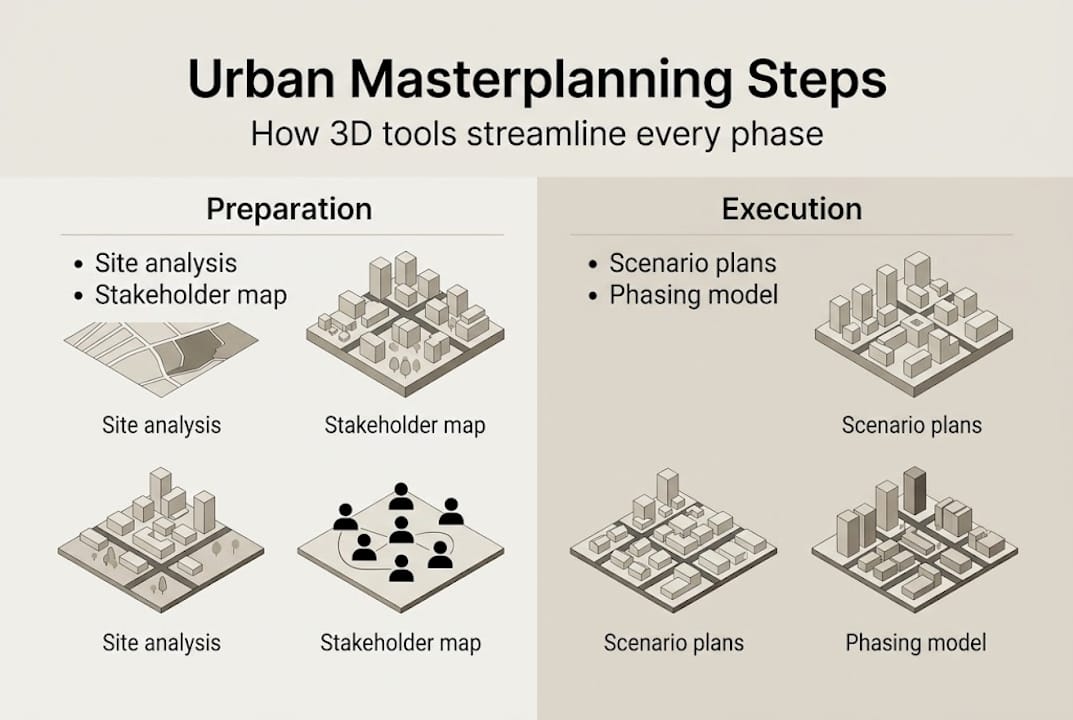
Laying the groundwork: Preparation and baseline assessment
Having set the scene for why a structured approach is essential, the next stage is preparing a robust foundation for masterplanning. Every robust masterplan begins well before a single design sketch is drawn. The first priority is understanding the site and its context with precision, drawing on spatial, socio-economic, environmental, and infrastructural data to build a credible picture of existing conditions.
The incremental, participatory planning process described by UN-Habitat’s Our City Plans establishes four phases: Assessment, Plan, Operationalisation, and Implementation. The assessment phase is foundational because poor data at this stage compounds into costly misalignments later. The sequence used in evidence-based urban planning follows a clear logic: data collection leads to spatial analysis, which informs decision-making. No step can be skipped without undermining the integrity of what follows.
The following data layers are typically required at baseline:
- Geographic and cadastral data: Parcel boundaries, topography, existing land use, and ownership records.
- Demographic and socio-economic data: Population density, income distributions, employment zones, and growth projections.
- Environmental layers: Flood risk, green infrastructure, air quality, and ecological sensitivity.
- Infrastructure inventory: Road networks, utilities, public transport coverage, and connectivity gaps.
| Prerequisite | Data type | Tool or source | Stakeholder relevance |
|---|---|---|---|
| Site analysis | Spatial/GIS | GIS platforms, satellite imagery | Planners, engineers |
| Socio-economic context | Statistical | Census, local authority data | Policy leads, developers |
| Environmental constraints | Environmental | Remote sensing, ecology surveys | Sustainability advisors |
| Infrastructure mapping | Engineering | BIM, utility databases | Infrastructure managers |
| Stakeholder mapping | Qualitative | Workshops, interviews | Community groups, investors |
Stakeholder identification should happen in parallel with data gathering, not after it. Early engagement prevents the common failure mode where technically sound plans meet community resistance at consultation. Use structured participatory methods such as focus groups, digital surveys, and online 3D visualisation sessions to capture local knowledge that no dataset can replicate.
Those interested in creating masterplans with 3D technology will find that setting up your 3D tools at this early stage also pays dividends. Importing base layers into your platform from the outset ensures all subsequent design decisions sit on a single, consistent digital model.
Pro Tip: Agree on a common coordinate reference system and data standard across all teams before any data is collected. Inconsistent projections and file formats are one of the most avoidable causes of delay and rework in large-scale masterplanning projects.
Design and scenario development: Planning with layers
Once the foundational data and stakeholder mapping are established, effective masterplanning hinges on dynamic scenario development and integrated design processes. This is where raw information becomes spatial strategy.
Multi-layer, integrated overlays across transport, housing, utilities, public realm, and environmental sectors are the engine of this phase. No single layer tells the full story. It is the relationship between layers, for example, how a new transit corridor affects housing density potential or how flood risk shapes buildable land, that generates the insights planners need.
Here is a structured approach to scenario development in a 3D environment:
- Define scenario parameters: Establish clear variables for each scenario, such as population growth rates, density targets, infrastructure investment levels, and climate resilience requirements.
- Set up overlay analysis: Import all baseline data layers into your 3D platform and configure spatial overlays to identify conflicts, opportunities, and constraints across sectors.
- Generate design alternatives: Develop at least three distinct spatial scenarios representing low, medium, and high intervention levels. Each should be testable against your defined performance indicators.
- Run iterative stakeholder reviews: Share 3D visualisations of each scenario with stakeholder groups. Use real-time model adjustments during sessions to respond to feedback immediately rather than between meeting cycles.
- Score and compare: Use a weighted scoring matrix to evaluate each scenario against objectives, balancing long-term sustainability goals with near-term deliverability.
| Scenario approach | Strength | Limitation | Best suited for |
|---|---|---|---|
| Incremental growth | Lower risk, phased delivery | May underestimate long-term demand | Constrained sites or budgets |
| Transformative redesign | High impact, future-proof | Requires strong political mandate | City centre regeneration |
| Hybrid phasing | Balances ambition and pragmatism | Complex to sequence | Mixed-use masterplans |
Pro Tip: Save every scenario version with a clear naming convention and timestamp in your 3D platform. Stakeholders frequently revisit earlier options, and the ability to restore a previous scenario quickly demonstrates professional rigour and saves significant time during review meetings.
For teams looking at streamlining design workflows, the move to real-time collaborative 3D reviews is one of the highest-value changes a practice can make. Those seeking broader context should also consider the range of top urban design strategies available for modern planning practices.

From plan to action: Operationalisation and phasing
Having refined scenarios and spatial plans, the next challenge is moving from vision to practical actions and efficiently sequencing these steps. This is where many masterplans lose momentum. Without clear instruments and phased delivery milestones, even the most analytically rigorous plan sits on a shelf.
The operationalisation phase in UN-Habitat’s Our City Plans framework is specifically focused on instruments and actions for implementation. It translates spatial decisions into enforceable and fundable commitments, assigning responsibilities, timelines, and measurable outputs to each component of the masterplan.
Common implementation instruments include:
- Land use codes and zoning orders: Legally defining permitted uses, densities, and design standards across plan zones.
- Financial models and funding structures: Establishing public-private funding mechanisms, infrastructure levies, and phased grant applications.
- Community engagement channels: Creating formal and informal routes for ongoing participation as development progresses.
- Partnership agreements: Formalising roles between local authorities, developers, utility providers, and community bodies.
A phased roll-out structure helps teams avoid overcommitting resources and allows early wins to build political and public confidence in the masterplan. Consider structuring delivery in three horizons:
- Quick wins (0 to 2 years): Public realm improvements, meanwhile uses, and utility upgrades that demonstrate visible progress and generate community trust.
- Medium-term projects (2 to 7 years): Residential and commercial development parcels, transport links, and schools or health facilities that require planning consents and procurement.
- Long-term vision (7 to 20 years): Strategic infrastructure, city-level connectivity, and large mixed-use quarters dependent on demand maturation and external funding cycles.
In practice, use your 3D planning tool to model each phase as a distinct temporal layer. This capability, often described as 4D planning, allows you to visualise how the urban environment transforms over time and to identify sequencing conflicts before they occur on site. Exploring an efficient 3D planning workflow is particularly valuable during operationalisation, and integrating GIS tools for urban planners ensures that spatial data underpins every delivery decision.
Closing the feedback loop: Monitoring and adaptive review
Planning and execution alone are not enough; sustained success relies on monitoring changes and readiness to recalibrate strategies. This phase is often the least resourced and yet the most determinative of long-term masterplan success.
Effective monitoring means defining clear indicators at the outset and measuring them consistently over time. Relevant metrics typically include land use change rates, housing delivery against targets, transport mode share, green space access, air quality, and accessibility for vulnerable populations. Without pre-agreed baselines and measurement intervals, reviewing plan performance becomes subjective and contested.
Modern approaches use satellite imagery, machine learning, and GIS to benchmark performance objectively. Modelled urban growth accuracy comparing masterplan projections to observed satellite data now regularly exceeds 80% when ML and GIS are properly integrated. That is a significant step forward from the anecdotal performance reviews that characterised planning practice a decade ago.
“Empirical benchmarking of master plan performance, using satellite imagery and machine learning with GIS, can achieve model accuracy above 80% when comparing projected urban growth to actual outcomes.”
Adaptive review means acting on what monitoring reveals. Discrepancies between modelled and actual outcomes are not failures; they are data points that guide plan recalibration. Build scheduled review cycles into your governance framework from day one, not as an afterthought.
Best practices for adaptive review include:
- Annual indicator reporting: Produce a standardised dashboard comparing current performance against masterplan targets.
- Scenario recalibration: When cumulative drift from projections reaches a defined threshold, trigger a formal scenario update in your 3D platform.
- Governance alignment sessions: Hold quarterly cross-agency reviews to ensure all delivery partners remain aligned with current plan priorities.
- Community feedback integration: Create accessible reporting formats that allow community members to understand progress and contribute observations.
Those committed to sustainable urban masterplanning will recognise that adaptive review is not bureaucratic overhead; it is how resilience is built into the fabric of cities over time. As noted in modern masterplanning strategies, plans increasingly fail due to the implementation and feedback gap, making monitoring a professional imperative.
Masterplanning in the real world: What theory misses
Having detailed the nuts and bolts of step-by-step masterplanning, it is worth stepping back to consider what happens outside the neat textbook workflow. In practice, the plans that endure are rarely those with the most sophisticated scenario models. They are the plans that retain flexibility and command genuine stakeholder commitment through each phase of delivery.
The uncomfortable reality is that model effectiveness discrepancies between intended and actual outcomes are almost universal. Empirical accuracy, however impressive, only reflects how well a model mirrors the world as it was when the assumptions were set. Cities change faster than model cycles.
The contrarian insight here is this: treat every scenario model as a testable hypothesis, not a definitive answer. The most resilient masterplans we have seen succeed not because their initial data was perfect, but because their governance structures were built to absorb surprise and adapt without losing strategic coherence. Stakeholder engagement is not a box to tick; it is the mechanism that keeps the plan legitimate when the numbers shift.
Explore how urban planning cases translate these principles into real-world outcomes.
Pro Tip: Build a structured but explicitly flexible review mechanism into your masterplan governance from the very first stakeholder agreement. Flexibility is not weakness; it is the engineering that prevents brittle plans from fracturing under real-world pressure.
Advance your urban masterplanning with cutting-edge 3D tools
For urban planners and developers ready to elevate their projects, cutting-edge technology makes a measurable difference at every stage described in this guide.
3D Cityplanner solutions bring together automatic building generation, sightline visualisation, sound impact simulation, and 4D phasing timelines within a single platform, purpose-built for the professionals delivering complex masterplans. From baseline data import through to adaptive monitoring, every phase of the step-by-step process outlined here is supported by tools designed for real project demands. If you are ready to see how it works in practice, explore urban masterplanning with 3D technology and discover what your next project could look like.
Frequently asked questions
What are the essential phases in step-by-step urban masterplanning?
The four core phases are assessment, planning, operationalisation, and implementation, each with specific actions and deliverables. This four-phase process is described by UN-Habitat as incremental and participatory by design.
Why is evidence-based planning important for urban masterplans?
It ensures decisions are grounded in reliable data and integrated spatial analysis rather than assumption. Evidence-based planning follows a clear sequence from data collection through spatial analysis to informed decision-making, producing more defensible and effective outcomes.
How can masterplan effectiveness be measured in practice?
By benchmarking projected land-use expansion against modelled or observed growth patterns using GIS, remote sensing, and machine learning. Model accuracy above 80% is now achievable when satellite data and ML are properly integrated with GIS analysis.
What role do 3D tools play in successful urban masterplanning?
3D tools enable planners to visualise complex scenarios, test alternatives in real time, and facilitate meaningful stakeholder collaboration across all phases of the masterplanning process.
What is the main cause of masterplan failure?
Plans most commonly falter due to gaps in implementation and the absence of ongoing monitoring and review cycles. Addressing the implementation and feedback gap is now central to contemporary masterplanning practice.
Recommended
- How to create an urban masterplan with 3D technology – 3D Urban Development
- Urban Development Workflow for Efficient 3D Planning – 3D Urban Development
- 3d Building Modeling Tutorial for Efficient Urban Planning – 3D Urban Development
- Urban design workflow guide 2026: cut project time 20% – 3D Urban Development


