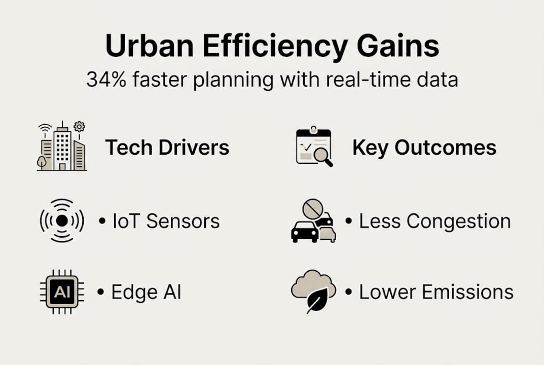
Real-time data in urban planning: 34% efficiency gains

Most cities still plan using data that is months or years out of date. That gap between static snapshots and living urban reality is where efficiency is lost, congestion builds, and infrastructure falls behind demand. Real-time data changes that equation entirely. By integrating continuous sensor feeds, IoT networks, and AI-driven analytics into the planning process, urban professionals can move from reactive problem-solving to proactive city management. This article covers the core benefits, key technologies, real-world results, and honest challenges of real-time data in urban planning, giving you a practical foundation for applying these methods to your own projects.
Key Takeaways
| Point | Details |
|---|---|
| Adaptive planning boost | Cities using real-time data achieve major increases in efficiency, mobility, and emissions reduction. |
| Technology drives success | Integrating AI, edge computing, and robust sensor fusion is vital for effective real-time urban systems. |
| Evidence from global cities | Barcelona, Kanpur, and Chinese cities demonstrate concrete, measurable benefits from real-time methods. |
| Address data challenges | For lasting gains, cities must tackle governance, privacy, and technical integration hurdles directly. |
How real-time data transforms urban planning
Traditional urban planning operates on periodic data reviews. A traffic study here, a land-use survey there, each producing a snapshot that is already ageing by the time it informs a decision. This approach made sense when data collection was expensive and slow. Today, it is a structural limitation.
Real-time data systems replace those snapshots with continuous streams. Sensors embedded in roads, buildings, and public spaces feed live information into planning platforms. IoT networks connect infrastructure assets into a single, observable system. AI algorithms interpret the incoming data and surface actionable insights, often within milliseconds. The result is a planning environment that mirrors the city as it actually behaves, not as it behaved last quarter.
The performance gains are significant. Multi-modal data fusion delivers a 34.2% increase in space use efficiency and nearly 29% improvement in pedestrian flow. These are not marginal improvements. They represent a fundamental shift in what urban infrastructure can achieve when it is managed dynamically rather than statically.
Cities that adopt this approach also shift their operational rhythm. Rather than waiting for annual data reviews, planning teams can operate on a continual sense-plan-act loop, responding to emerging conditions in near real time. That loop is what separates adaptive cities from those still working from last year’s figures.
“The most resilient cities are not those with the best masterplans. They are the ones that can read and respond to change faster than the city itself evolves.”
The core benefits of this shift include:
- Adaptability: Planning decisions reflect current conditions, not historical averages
- Resilience: Systems can respond to disruptions such as flooding or sudden population shifts without waiting for a new planning cycle
- Efficiency: Resources are allocated where they are actually needed, reducing waste
- Proactive management: Problems are identified before they escalate into crises
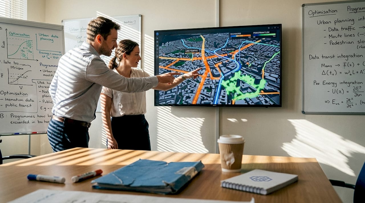
Exploring digital twins in urban planning offers a useful lens for understanding how these real-time feeds are brought together into a coherent, interactive model of the city. Paired with real-time data visualisation tools, planners gain a live, navigable view of how the city is performing at any given moment.
Methodologies and technologies powering real-time urban intelligence
Understanding the adaptive shift is one thing. Knowing which technologies make it work at city scale is another. The architecture behind real-time urban intelligence is layered and precise.
At the foundation sits multi-modal data fusion. This approach combines traffic counts, weather feeds, social media signals, utility consumption data, and infrastructure sensor readings into a unified analytical layer. No single data stream tells the full story. Together, they create a dynamic picture of urban behaviour that no static dataset could replicate.
Above that foundation, hierarchical fusion and spatio-temporal networks apply reinforcement learning to continuously update traffic and resource flows. These systems achieve sub-100ms response times, meaning the city’s digital model updates faster than most human decision cycles. That speed is what enables genuinely proactive management rather than rapid reaction.
Edge AI and low-latency infrastructure are equally critical. Processing data at the edge, closer to where it is generated, reduces the bottlenecks that centralised systems create. It also improves reliability. If a central server goes offline, edge nodes continue operating independently.
Here is a summary of the key technology layers and their functions:
| Technology layer | Primary function | Key benefit |
|---|---|---|
| Multi-modal data fusion | Combines heterogeneous data streams | Holistic situational awareness |
| Spatio-temporal networks | Models spatial and temporal patterns | Accurate predictive modelling |
| Reinforcement learning | Optimises decisions through feedback | Continuous performance improvement |
| Edge AI | Processes data locally at source | Low latency, high resilience |
| Digital twin platforms | Mirrors physical city in real time | Integrated planning and simulation |
For teams building or upgrading their data infrastructure, a practical implementation sequence helps:
- Audit existing data sources and identify gaps in sensor coverage
- Select a fusion architecture that supports heterogeneous inputs
- Deploy edge processing nodes at high-priority locations such as major junctions and utility hubs
- Integrate outputs into a visualisation and simulation platform
- Establish feedback loops that allow model outputs to inform operational decisions
Pro Tip: Prioritise architectures that include built-in uncertainty quantification and drift correction mechanisms. Without these, model accuracy degrades silently as sensor conditions change, and you may not notice until decisions have already been affected.
For teams seeking solutions for real-time data integration, or exploring AI collaboration in urban design, the technology landscape is maturing rapidly and practical options are now accessible at various budget levels.
Real-world impact: City case studies and performance benchmarks
Theory and architecture matter, but results are what justify investment. Several cities have now generated credible, measurable outcomes from real-time data implementations.
| City or region | Intervention | Key outcome |
|---|---|---|
| Barcelona | IoT-based traffic and emissions monitoring | 30% congestion reduction, 20% emissions cut |
| Kanpur | Adaptive signal control and sensor network | 30% congestion reduction, 18% delay reduction |
| China (100+ cities) | AI-driven mobility and emissions management | 31.73 million tonnes CO2 saved annually |
These are not pilot-scale results. Barcelona’s system operates across the city’s full road network. China’s programme spans more than one hundred urban centres. The scale of deployment confirms that real-time data approaches are operationally viable, not just theoretically promising.
Several consistent trends emerge across these case studies:
- Cities using adaptive signal systems consistently outperform those relying on fixed-cycle controls
- Emissions reductions correlate directly with reduced idle time at junctions, a product of smarter flow management
- Investment ROI improves when real-time data is used to defer or eliminate infrastructure spending that turns out to be unnecessary
- Pedestrian and cycling infrastructure benefits disproportionately, as real-time data reveals underused routes and capacity constraints invisible to periodic surveys
The CO2 figure from China’s programme deserves particular attention. Deep learning for traffic optimisation at scale is now demonstrably a climate intervention, not just a mobility one. For planning teams working under sustainability mandates, this reframes real-time data investment as a direct contribution to emissions targets.
For those exploring how digital twin urban planning platforms support these outcomes, the connection between live data feeds and simulation environments is where much of the practical value is generated.
Challenges, nuances, and emerging frontiers in urban data
The results above are compelling. But real-time urban data systems also introduce genuine complexities that planning teams must navigate carefully.
The core barriers include:
- Data standardisation: Sensors from different manufacturers often produce incompatible formats, requiring significant integration work before data becomes usable
- Privacy and governance: Continuous monitoring of public spaces raises legitimate concerns about surveillance and data ownership that require clear policy frameworks
- Interoperability: Legacy infrastructure systems were not designed to share data, creating integration challenges that can be costly and time-consuming to resolve
- Upfront investment: High infrastructure costs and integration complexity remain significant barriers, particularly for smaller municipalities
Sensor reliability is a subtler but equally important issue. Low-cost sensors improve deployment scale but frequently lack adequate metadata and drift monitoring. A sensor that gradually miscalibrates over six months can corrupt planning models without triggering any obvious alert. The data looks plausible. The decisions it informs are quietly wrong.
Emergent urban behaviours add another layer of unpredictability. Real-time systems are trained on historical patterns, but cities generate genuinely novel behaviours, new mobility modes, sudden demographic shifts, unexpected land-use changes, that no historical dataset anticipated. Systems without adaptive retraining mechanisms will degrade in accuracy over time.
The sensor interoperability challenges facing most cities are not purely technical. They reflect the fragmented procurement histories of urban infrastructure, where different departments bought different systems from different vendors over decades.
Pro Tip: When adding new sensor types to an existing network, build in metadata tracking and standardised correction layers from day one. Retrofitting these mechanisms later is significantly more expensive and disruptive than designing them in at the outset.
For a thorough grounding in how these challenges play out in practice, the digital twin city guide offers a useful reference for planning teams at any stage of implementation.
A new mindset for city planners: Embracing dynamic adaptation
Here is the uncomfortable reality that the technology conversation often obscures: the biggest barrier to real-time urban intelligence is not technical. It is cultural.
Static masterplans feel authoritative. They represent months of work, stakeholder consultation, and political consensus. Treating them as living documents that should be continuously revised feels, to many planning teams, like admitting they were wrong. That instinct is understandable but counterproductive.
Real-time data drives adaptive, resilient planning cycles precisely because cities do not behave as predicted. A plan that cannot incorporate new evidence is not a strength. It is a liability. The planners who will define the next generation of urban development are those who treat iteration as professional rigour, not as failure.
This requires a shift in how planning teams are structured and how success is measured. Continuous feedback loops demand analysts who can interpret live data, not just process historical surveys. Decision frameworks need to accommodate rapid updates without triggering full consultation cycles every time conditions change. The urban digital twins guide illustrates how simulation environments support exactly this kind of iterative, evidence-based planning culture.
The future belongs to planners who iterate and adapt. Not those who predict and commit.
Bringing real-time intelligence to your urban projects
The evidence is clear: real-time data delivers measurable gains in efficiency, emissions, and mobility outcomes for cities willing to invest in the right infrastructure and workflows.
3D Cityplanner gives urban planning professionals the tools to put these principles into practice. The platform combines digital twin environments, live data visualisation, and 4D timeline planning into a single, accessible workspace. Whether you are modelling traffic interventions, simulating infrastructure scenarios, or coordinating multi-stakeholder projects, the 3D Cityplanner platform connects real-time data inputs to actionable planning outputs. Explore the full feature list to see how each capability maps to the challenges and opportunities covered in this article, and start a trial without any upfront commitment.
Frequently asked questions
What is the main benefit of using real-time data in urban planning?
Real-time data allows cities to adapt instantly to changing conditions, with research showing up to 34.2% better space use and 30% traffic reductions compared to static planning approaches.
Which cities have demonstrated the impact of real-time data on congestion and emissions?
Barcelona, Kanpur, and over 100 Chinese cities have all reported significant results, with Barcelona cutting congestion by 30% and emissions by 20% through IoT-based adaptive systems.
What are the biggest technical challenges when working with real-time urban data?
Integrating heterogeneous data streams, managing sensor drift and lack of standardisation, and addressing privacy concerns are the most significant hurdles for cities building robust real-time systems.
How can decision-makers get started with real-time data tools?
Begin with scalable platforms offering data fusion, live visualisation, and digital twin capabilities, and ensure hybrid data platforms with proper governance are in place before scaling deployment across the city network.


