How to optimise city layouts with advanced 3D tools

Urban congestion costs cities billions each year, and poorly planned layouts quietly erode quality of life for millions of residents. Yet many planning teams still rely on outdated, intuition-based methods that cannot account for the complexity of modern urban systems. The good news is that advanced 3D planning tools, combined with data-driven strategies, are making it possible to redesign city layouts with measurable, lasting impact. This guide walks you through the core problems, the right digital foundations, and a structured workflow to help you achieve genuinely better outcomes for the cities and communities you serve.
Table of Contents
- Identifying the core problems in city layout design
- Preparing for digital optimisation: Tools and prerequisites
- Step-by-step process to optimise a city layout
- Avoiding common pitfalls and ensuring successful implementation
- Why human-focused digital planning is the true game-changer
- Take your city planning further with advanced 3D solutions
- Frequently asked questions
Key Takeaways
| Point | Details |
|---|---|
| Data-driven outcomes | Utilising analytics and digital modelling substantially reduces congestion and boosts satisfaction. |
| Right tools and skills | Successful optimisation requires robust software, accurate data, and the ability to interpret spatial analytics. |
| Stakeholder engagement matters | Involving end-users and running scenario tests ensure your layout solutions work in practice. |
| Balance technology with humanity | The best urban layouts combine technical efficiency with liveable, people-focused spaces. |
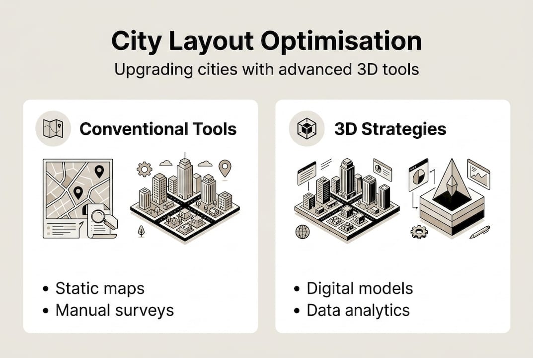
Identifying the core problems in city layout design
To understand how to optimise, first identify the major pitfalls in current city design. Most urban inefficiencies are not random. They follow predictable patterns rooted in fragmented planning, siloed data, and a failure to model how people actually move through and use urban space.
Common problems include:
- Traffic congestion caused by poorly distributed road networks and misaligned land use zoning
- Long commute times resulting from residential areas disconnected from employment and services
- Poor air quality linked to high vehicle density in under-planned corridors
- Lack of green space in high-density zones, reducing liveability and mental wellbeing
- Underutilised land that creates dead zones and reduces economic vitality
These issues are not simply aesthetic. They carry real economic and social costs. Research confirms that big data analysis reduces congestion by 38.79% and commuting time by 22.97% when applied to city layout optimisation. That is a significant, quantifiable improvement that traditional planning methods simply cannot match.
Conventional approaches rely heavily on manual surveys, static maps, and professional judgement. While experience matters, these methods cannot simulate the cascading effects of a single zoning change across an entire district. They also struggle to incorporate real-time data on traffic flows, population movement, or environmental conditions.
The principles of good urban design emphasise balance, connectivity, and human scale. Achieving these qualities consistently requires tools that can model complexity at scale. Understanding these limitations is the first step toward meaningful urban project optimisation and the foundation for every decision that follows. When you optimise city planning with the right evidence base, the results speak clearly.
Preparing for digital optimisation: Tools and prerequisites
With the problems defined, the next step is to ensure you have the right digital foundations. Jumping into optimisation without the correct tools and data is one of the most common reasons projects stall or produce unreliable results.
Here is a summary of the essential tools and datasets you will need:
| Tool or dataset | Purpose |
|---|---|
| 3D modelling software | Visualise and test spatial configurations |
| GIS platforms | Analyse spatial relationships and land use |
| Big data analytics platforms | Process traffic, demographic, and environmental data |
| Environmental datasets | Assess air quality, noise, and green coverage |
| Traffic and mobility data | Model movement patterns and congestion hotspots |
Beyond tools, your team needs a specific set of skills to make the most of these platforms. Key competencies include:
- Statistical analysis and data interpretation
- Spatial data visualisation using GIS and 3D environments
- Familiarity with collaborative digital platforms for multi-stakeholder projects
- Basic understanding of simulation modelling and scenario testing
Data integrity is non-negotiable. Incomplete or outdated datasets will produce misleading models, leading to decisions that look sound on screen but fail in practice. Platforms that leverage advanced 3D technology in planning help teams maintain data accuracy throughout the project lifecycle. AI tools for urban planning can further automate data validation and flag inconsistencies before they affect your models.

Planners using big data platforms report satisfaction increases of 21.51% among residents and stakeholders. That figure underlines why investing in the right digital infrastructure pays off well beyond the planning phase. City planning case studies from UN-Habitat also demonstrate how cities that invested in digital tools early achieved more cohesive, sustainable outcomes.
Pro Tip: Start with a pilot project in a single district before rolling out optimisation tools city-wide. This limits risk, builds team confidence, and generates real data to refine your approach before scaling.
Step-by-step process to optimise a city layout
Once preparations are complete, optimising city layouts involves a structured, data-rich approach. Following a clear sequence prevents costly rework and ensures every decision is traceable and evidence-based.
- Data collection — Gather traffic flows, demographic data, land use records, environmental measurements, and infrastructure condition reports. The richer your dataset, the more reliable your model.
- Digital modelling — Build a 3D representation of the existing layout using your GIS and modelling platforms. This becomes your baseline for all subsequent analysis.
- Simulation and scenario analysis — Run multiple layout scenarios using advanced algorithms. Techniques such as PCA (principal component analysis), cluster analysis, random forest modelling, and NSGA-III genetic algorithms each contribute specific analytical value.
- Stakeholder feedback — Present simulated scenarios to residents, local authorities, and developers. Collect structured feedback and integrate it into the model.
- Final adjustments — Refine the preferred layout based on combined analytical and stakeholder input, then validate against your original performance benchmarks.
The choice of algorithm matters significantly. Here is a comparison of approaches:
| Method | Best use case | Key advantage |
|---|---|---|
| Traditional planning | Simple, low-density areas | Low technical barrier |
| Random forest | Predicting land use outcomes | Handles complex variables |
| Cluster analysis | Grouping similar spatial zones | Reveals hidden patterns |
| NSGA-III genetic algorithm | Multi-objective public space design | Balances competing priorities |
NSGA-III is particularly powerful for public space and safety planning. Research shows it improves satisfaction by 32.8% and reduces safety risks by up to 63.2%. Those are outcomes that justify the additional analytical effort. Teams looking to plan city layouts faster will find that algorithmic tools dramatically reduce the iteration time between concept and validated design. Pairing this workflow with strong urban design strategies and sustainable city design principles ensures your optimised layout serves both present and future needs.
Pro Tip: Always simulate at least three distinct layout variations before selecting a preferred option. A single simulation rarely reveals the full range of trade-offs between density, mobility, and green space.
Avoiding common pitfalls and ensuring successful implementation
Despite powerful tools, several recurring issues can threaten optimisation success. Recognising these pitfalls early gives your team the best chance of delivering results that hold up over time.
The most frequent problems include:
- Poor stakeholder engagement — Layouts designed without community input often face resistance during implementation, delaying projects and increasing costs
- Incomplete data — Missing traffic or demographic records create blind spots in your model, producing layouts that underperform in real conditions
- Failure to simulate alternatives — Committing to a single design too early removes the opportunity to discover better-performing configurations
- Overreliance on technology — Algorithms inform decisions; they do not replace professional judgement or lived community knowledge
Never finalise layouts without robust scenario testing. Missing this step can undermine safety and satisfaction rates by over 30%.
The most effective mitigation strategy is early and sustained stakeholder involvement. Bring residents, transport planners, environmental officers, and developers into the process from the outset. Regular data audits, ideally at each project milestone, prevent errors from compounding across the model. Cross-discipline collaboration is not optional; it is the mechanism through which technical outputs become practical, liveable places.
City-wide strategies supported by UN-Habitat case studies consistently demonstrate that compact, connected urban forms outperform sprawling layouts on every liveability metric. Reviewing these case studies before finalising your approach can save significant rework. Explore urban development strategies for 2026 and consider how sustainable urban planning principles can be embedded into your implementation framework from day one.
Why human-focused digital planning is the true game-changer
With the technical route mapped, consider what really sets leading cities apart. The honest answer is not the sophistication of their algorithms. It is the degree to which their planning processes remain anchored in human experience.
Technology amplifies what planners already know. But when the human dimension is treated as secondary to data outputs, layouts can achieve strong technical scores while failing the people who actually live in them. Spaces that look optimal on a model can feel sterile, unsafe, or disconnected in practice.
New York City’s approach is instructive here. Its principles of good urban design place human-scale design and balanced public spaces at the centre of every planning decision. This is not sentiment. It is a recognition that liveability drives long-term economic and social returns. Cities that combine AI-powered planning with genuine community insight consistently outperform those that treat optimisation as a purely technical exercise.
The most enduring city layouts are not the most algorithmically perfect ones. They are the ones where data and human experience were treated as equal inputs throughout the entire process.
Take your city planning further with advanced 3D solutions
For those ready to put these optimisation strategies into action, advanced integrated tools make the process significantly more manageable and precise.
3D Cityplanner offers a powerful suite of tools designed specifically for urban planners and real estate developers. From automatic building generation and line-of-sight visualisations to sound simulation and 4D timeline planning, the platform brings every stage of your optimisation workflow into a single, collaborative environment. Whether you are running scenario analyses or presenting layouts to stakeholders, the future of urban development is built on platforms that connect data, design, and decision-making seamlessly. Explore the full capabilities of our city planning tool and start a free trial to see the difference advanced 3D planning makes in practice.
Frequently asked questions
What is the biggest benefit of using 3D planning tools for city layouts?
3D planning tools improve visualisation and stakeholder engagement while delivering measurable outcomes: digital planning tools reduced congestion by 38.79% and commute times by 22.97%, and NSGA-III improves safety by up to 63.2% in public space design.
How can digital optimisation improve satisfaction in urban areas?
Combining big data with advanced algorithms raises resident satisfaction significantly. NSGA-III increases satisfaction by 32.8% and social interaction by 71.2%, making it one of the most impactful tools available to urban planners today.
Which prerequisites are essential before starting digital city optimisation?
Urban planners need reliable spatial data, 3D modelling software, GIS platforms, and statistical analysis skills. Big data tools and training are equally essential to ensure that optimisation models produce actionable, trustworthy results.
What common mistakes slow down effective city layout optimisation?
Relying on incomplete data and skipping scenario analysis are the primary pitfalls. Missing scenario testing consistently undermines project outcomes, leading to layouts that underperform on safety, mobility, and resident satisfaction.
How do human factors influence successful city optimisation?
Layout success depends on balancing advanced analytics with human-scale thinking. NYC urban design principles show that prioritising liveability and public space quality alongside technical modelling produces the most enduring and well-regarded city layouts.
Recommended
- Why optimise city planning: 3D tools for better design – 3D Urban Development
- How to Plan City Layouts with 20% Faster Project Completion – 3D Urban Development
- Urban project optimisation with advanced 3D tools in 2026 – 3D Urban Development
- Urban Development Workflow for Efficient 3D Planning – 3D Urban Development


