Data-driven urban design: 34% better space efficiency

Achieving a 34.2% increase in space utilisation efficiency is no longer a theoretical ambition. It is a documented outcome of data-driven urban design, and it is reshaping how professionals approach every stage of a project. The assumption that experienced intuition and legacy planning methods can match today’s analytically enhanced tools is increasingly difficult to defend. This guide covers the core methodologies behind data-driven urban design, the measurable results it delivers globally, the genuine pitfalls you need to anticipate, and the actionable strategies that translate all of this into better project outcomes for planners, architects, and developers working with advanced 3D technology.
Table of Contents
- Data-driven urban design: definition, principles, and core methodologies
- Quantifiable outcomes: evidence and real-world impact
- Limits, pitfalls, and hybrid approaches: navigating data challenges
- Applying data-driven methods to your projects: strategies for urban professionals
- Why the future of urban design is neither fully data-driven nor intuition-led
- Partner with advanced 3D urban design technology
- Frequently asked questions
Key Takeaways
| Point | Details |
|---|---|
| Proven efficiency gains | Data-driven urban design delivers measurable improvements in city space use, mobility, and sustainability. |
| Hybrid models are best | Combining data analytics with professional judgement and community input yields the strongest urban outcomes. |
| 3D technology is pivotal | Advanced digital twins and real-time modelling are now essential tools for leading-edge urban projects. |
| Practical strategies available | Urban professionals can adopt clear, actionable steps to integrate data-driven solutions into projects of any scale. |
Data-driven urban design: definition, principles, and core methodologies
At its most practical, data-driven urban design means making spatial decisions based on quantifiable, real-time evidence rather than assumption or precedent alone. It is the shift from instinct-guided layouts to iterative, model-tested configurations that respond to measurable conditions on the ground.
Data-driven urban design research shows this field draws on a cluster of interrelated tools and methods. According to recent findings, it uses multi-modal sensing, generative design with multi-objective optimisation (MOO), digital twins, and purpose-built tools such as StreetSeen to model and evaluate urban environments at scale. Each of these methods serves a distinct function within the design process.
The core tools and methods include:
- 3D digital twins: Living simulation environments that mirror physical urban spaces, allowing planners to test interventions before committing resources. Explore how digital twins in urban design are transforming planning workflows.
- AI-fused sensing: Sensor networks combined with machine learning to capture pedestrian flows, traffic patterns, noise levels, and microclimatic data in real time.
- Generative algorithms with MOO: Computational tools that generate and evaluate thousands of design configurations simultaneously, optimising for multiple objectives such as walkability, cost, and carbon output.
- GIS integration: Spatial data layers that contextualise design decisions within existing infrastructure, demographics, and environmental constraints.
A critical principle underpins all of these methods: design must be informed by quantifiable, real-time feedback and model iterations rather than a single fixed analysis. Digital twin technology for city planning enables exactly this kind of iterative responsiveness, making it one of the most valuable assets in a modern planner’s toolkit.
Pro Tip: Before selecting any technology, define your project’s specific optimisation objectives. Are you prioritising pedestrian flow, carbon reduction, or cost efficiency? The answer should determine your tool selection, not the other way around.
Quantifiable outcomes: evidence and real-world impact
With a solid understanding of methodologies, the next question is straightforward: what do these approaches actually deliver? The evidence is substantial.
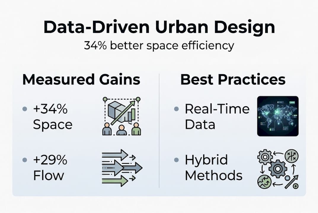
Empirical benchmarks from recent research confirm 34.2% space utilisation gains, a 28.7% enhancement in pedestrian flow, a 22.3% reduction in operational costs, and measurable reductions in CO2 emissions. These are not isolated pilot results. They reflect consistent patterns across multiple city contexts.

| Performance metric | Improvement recorded |
|---|---|
| Space utilisation efficiency | +34.2% |
| Pedestrian flow enhancement | +28.7% |
| Operational cost reduction | 22.3% |
| CO2 emissions (traffic signals) | 31.73 million tonnes saved annually |
The CO2 figure warrants attention. Big-data traffic signals reduce CO2 by 31.73 million tonnes annually across China’s 100 most congested cities. That single application demonstrates the scale at which data-driven methods can operate when deployed systematically.
Global case studies reinforce these numbers:
- Barcelona: The city’s data-driven walkability project used real-time pedestrian data and spatial modelling to redesign street networks, improving walkability scores and reducing car dependency across key districts.
- Singapore: Digital mapping initiatives saved an estimated $29 million by eliminating redundant infrastructure surveys and enabling precise urban redevelopment with digital twins.
- Orlando: Smart sensor integration across public spaces improved space utilisation and informed real-time maintenance scheduling, reducing operational overhead significantly.
The most significant impact categories across these cases are:
- Efficiency: Reduced design iteration time and faster regulatory approvals through simulation-backed proposals.
- Sustainability: Lower emissions from optimised transport networks and energy-efficient building configurations.
- Walkability: Measurable improvements in pedestrian accessibility and public realm quality.
- Cost performance: Savings realised through infrastructure mapping with 3D technology and reduced physical survey requirements.
These outcomes are not accidental. They are the direct product of structured, data-informed decision-making applied consistently across project phases.
Limits, pitfalls, and hybrid approaches: navigating data challenges
These impressive results do not come without limitations. Pure data-driven methods carry real risks, and understanding them is essential for any professional serious about applying these tools responsibly.
The core critiques of big data in urban design are well documented. Quality issues, bias, overfitting, and over-reliance on algorithmic outputs are the most common failure modes. Data collected in one urban context rarely transfers cleanly to another. Algorithms trained on high-density city centres can produce deeply inappropriate recommendations for mid-density or historically sensitive areas.
Hybrid epistemologies are now considered best practice, particularly in edge cases where local context, cultural nuance, or equity considerations are paramount. The comparison below illustrates why:
| Approach | Strengths | Limitations |
|---|---|---|
| Pure data-driven | Scalable, fast, objective | Context-blind, bias-prone, equity gaps |
| Hybrid evidence-based | Context-aware, inclusive, robust | Slower, requires skilled facilitation |
| Intuition-led | Creatively flexible | Not reproducible, hard to evaluate |
To successfully integrate qualitative perspectives alongside quantitative models, follow these steps:
- Define the context first: Conduct stakeholder mapping and site analysis before loading any data model.
- Audit your data sources: Check for demographic gaps, temporal biases, and missing populations in your datasets.
- Run parallel qualitative research: Community surveys, expert interviews, and ethnographic observation should run alongside your modelling work.
- Cross-validate outputs: Test algorithmic recommendations against local knowledge and professional judgement before presenting to clients or authorities.
- Iterate with feedback: Build formal review checkpoints into the project timeline where both data outputs and stakeholder responses are assessed together.
The evidence-based design process literature consistently supports this structured approach. Reviewing digital twin urban planning frameworks alongside qualitative methods gives you the most defensible and effective project foundation. For a deeper grounding, the guide to digital twin cities is a useful reference.
Pro Tip: Never skip context. Measure and iterate with feedback from both data outputs and stakeholder voices. The most robust urban designs are those where algorithms inform, but people decide.
Applying data-driven methods to your projects: strategies for urban professionals
With an awareness of pitfalls and best practices, the focus shifts to practical application. How do you actually integrate these methods into your next project?
Selecting the right 3D or digital twin tool starts with matching platform capability to your city’s specific data infrastructure. Not every platform supports the same data formats, sensor integrations, or simulation fidelities. Evaluate tools against your project’s scale, the availability of local datasets, and the technical capacity of your team. Methodologies now prioritise scalability, real-time adaptation, and multi-objective optimisation, so your chosen platform should reflect those priorities.
The five most effective project-level strategies for integrating data-driven methods are:
- Start with a data audit: Identify what spatial, demographic, and environmental data already exists for your project area before commissioning new surveys.
- Use 3D simulation for stakeholder engagement: Visual, interactive models built with urban digital twins for planning make complex trade-offs accessible to non-technical stakeholders.
- Apply MOO for design iteration: Use generative design tools to evaluate multiple configurations simultaneously, reducing the time spent on manual alternatives.
- Integrate real-time performance monitoring: Connect sensor data to your model post-construction to validate design assumptions and identify operational improvements.
- Document your methodology: Transparent, reproducible processes strengthen planning applications and build trust with regulatory bodies.
Edge cases require particular attention. High-density retrofits present data challenges because existing building stock often lacks digital records, making digital urban planning tools that support model imports and automated building generation especially valuable. Equity and accessibility gaps are another critical concern. Ensuring that equity in data-driven planning is actively addressed means deliberately seeking out data on underrepresented communities and designing for their needs, not just the majority user.
Pro Tip: Data-driven does not mean ‘set and forget’. Monitor performance continuously and use real-time feedback loops to refine your design assumptions. The most successful projects treat deployment as the beginning of the data cycle, not the end.
Why the future of urban design is neither fully data-driven nor intuition-led
There is a temptation, especially as algorithmic tools become more powerful, to let the data do the designing. It is an understandable impulse. When a model can evaluate 10,000 configurations in the time it takes to sketch three, the efficiency argument is compelling. But cities are not optimisation problems. They are layered, contested, and deeply human environments.
Attempts to let big data algorithms design the city risk producing spaces that are statistically efficient but experientially hollow. The metrics tell you where pedestrians walk. They do not tell you why a particular street corner matters to a community, or why a certain view corridor carries cultural weight.
The most robust urban design processes are those where data-driven methods inform expert judgement rather than replace it, and where stakeholder engagement shapes the questions the data is asked to answer.
Creativity, ethics, negotiation, and local knowledge remain irreplaceable. The professionals who will lead the next generation of urban projects are not those who use data most aggressively, but those who use it most wisely. Explore how fresh approaches with digital twins can support this balanced, iterative practice. Champion evidence-based frameworks in your work, and treat every dataset as one input among many, not as the final word.
Partner with advanced 3D urban design technology
The strategies outlined in this guide are most effective when supported by tools built specifically for professional urban design workflows. Now is the right moment to explore platforms that combine real-time 3D simulation, digital twin functionality, and multi-objective analysis in a single, accessible environment.
Discover 3D Cityplanner and see how its features, including automatic building generation, line-of-sight visualisation, sound simulation, and 4D timeline planning, support the kind of iterative, data-informed design this guide describes. Whether you are managing a high-density retrofit or a greenfield masterplan, explore digital twin options designed for forward-thinking professionals who need both analytical rigour and practical flexibility.
Frequently asked questions
What is data-driven urban design?
Data-driven urban design uses real-time data, advanced 3D models and analytics to create more efficient, adaptable, and sustainable city spaces. It relies on methodologies such as multi-modal sensing and digital twins to inform every stage of the design process.
How do 3D digital twins boost urban design outcomes?
3D digital twins enable planners to model, simulate and optimise urban spaces before any physical intervention, leading to better decisions and measurable improvements in efficiency, cost and emissions. They function as real-time responsive environments that evolve alongside the project.
What are the risks of relying too much on big data in urban planning?
Over-reliance on big data can introduce bias, overfitting, and context loss, so hybrid approaches that combine algorithmic outputs with professional judgement and stakeholder input are strongly advised.
Can data-driven design help with making cities more equitable?
Yes, but only when planners actively address data gaps and accessibility for marginalised communities alongside the technology, ensuring the design process reflects the full diversity of urban populations.
Recommended
- Urban project optimisation with advanced 3D tools in 2026 – 3D Urban Development
- Why optimise city planning: 3D tools for better design – 3D Urban Development
- 6 Top Urban Design Strategies for Modern Planners – 3D Urban Development
- Urban design workflow guide 2026: cut project time 20% – 3D Urban Development


