Master urban infrastructure mapping with 3D and 4D tech

Most urban planners still believe traditional 2D maps provide sufficient accuracy for infrastructure projects. This assumption costs cities millions in inefficiencies and errors annually. Advanced 3D and 4D technologies transform infrastructure mapping by integrating semantic data, real-time simulations, and digital twin platforms that deliver unprecedented precision. Urban professionals who adopt these tools gain competitive advantages in project optimisation, cost reduction, and stakeholder collaboration. This guide explores practical applications of these technologies for urban infrastructure projects in 2026.
Table of Contents
- The Evolution Of Urban Infrastructure Mapping Technologies
- Sources And Methods For Comprehensive 3D Data Acquisition
- Integrating 3D And 4D Technologies For Urban Infrastructure Optimisation
- Benefits And Challenges In Deploying Advanced Urban Infrastructure Mapping
- Explore 3D Cityplanner For Your Urban Infrastructure Projects
Key takeaways
| Point | Details |
|---|---|
| 3D and 4D mapping enhances precision | Advanced technologies enable centimetre-level accuracy and temporal analysis for infrastructure projects. |
| CityGML 3.0 enables semantic integration | The standard supports complex geometric and semantic data for comprehensive urban modelling. |
| Drone mapping reduces collection time | Aerial capture delivers detailed 3D models in weeks rather than months whilst increasing resolution. |
| BIM integration improves maintenance | Building Information Modelling streamlines construction oversight and lifecycle management. |
| Real-time simulations support decisions | Digital twins enable proactive traffic management and infrastructure optimisation. |
The evolution of urban infrastructure mapping technologies
Traditional 2D mapping dominated urban planning for decades, but its limitations become glaring when managing complex metropolitan infrastructure. Roads, bridges, and utilities exist in three dimensions, yet planners historically relied on flat representations that sacrificed critical elevation and spatial relationship data.
CityGML 3.0 serves as an integration standard for semantic 3D streetspace modelling, enabling urban planners to incorporate roads, bridges, tunnels, and utilities into unified digital representations. Munich’s implementation demonstrates this capability, where semantic 3D models now support autonomous vehicle testing and infrastructure maintenance planning. The standard’s versatility extends beyond visualisation to include functional attributes like traffic capacity, structural conditions, and maintenance histories embedded within geometric data.
Modern CityGML 3D city models integrate multiple data sources:
- Building Information Modelling (BIM) provides detailed structural specifications
- Geographic Information Systems (GIS) contribute spatial context and relationships
- Point cloud data delivers precise geometric representations from laser scanning
- Semantic annotations enable automated analysis and scenario modelling
This convergence creates digital twin urban planning environments where infrastructure behaves as intelligent objects rather than static drawings. Traffic engineers simulate congestion patterns, utility managers visualise underground networks in context, and construction teams coordinate across multiple projects with spatial awareness impossible in 2D environments. The shift from descriptive mapping to predictive modelling fundamentally changes how cities approach infrastructure challenges.
Sources and methods for comprehensive 3D data acquisition
Data acquisition technology determines the quality and usability of urban infrastructure models. Multiple capture methods exist, each offering distinct advantages for specific project requirements.
Drone-based photogrammetry revolutionised infrastructure data collection, with platforms now achieving 5 cm accuracy across 150 km² in under a month. Weinan City’s recent mapping project exemplifies this efficiency, delivering comprehensive urban models that previously required six months using ground-based surveying. Drones excel at capturing building facades, road networks, and terrain whilst reducing costs by 60% compared to traditional methods. Weather dependencies and airspace restrictions remain considerations, but processing algorithms now compensate for varied lighting and atmospheric conditions.

Terrestrial laser scanning (TLS) integrated with BIM enhances bridge structural inspection accuracy by capturing millimetre-level detail of existing conditions. The methodology transforms maintenance planning by comparing as-built point clouds against design models to identify deviations, structural anomalies, and deterioration patterns. Bridge engineers using this approach report 37% improvement in anomaly detection whilst reducing diagnostic time by 42%. TLS particularly suits confined spaces, tunnels, and intricate structural elements where drone access proves challenging.
Multi-source data fusion presents technical challenges:
- Spatiotemporal heterogeneity requires alignment of datasets captured at different times and resolutions
- Semantic discrepancies emerge when combining BIM, GIS, and point cloud formats with inconsistent attribute schemas
- Processing demands scale exponentially with dataset size, necessitating distributed computing resources
- Quality control workflows must validate geometric accuracy and semantic consistency across sources
Pro tip: Establish data acquisition protocols early that specify coordinate systems, accuracy tolerances, and semantic standards to streamline downstream integration when creating 3D city models.
Successful projects combine acquisition methods strategically. Use drones for broad area coverage and building exteriors, deploy TLS for critical infrastructure and interior spaces, and supplement with mobile laser scanning for street-level detail. This layered approach balances coverage, precision, and cost whilst ensuring comprehensive representation. The 3D Cityplanner features accommodate diverse input formats, enabling planners to leverage optimal capture methods for each project component.
Integrating 3D and 4D technologies for urban infrastructure optimisation
Raw 3D data becomes actionable intelligence when integrated into platforms that support analysis, simulation, and lifecycle management. Modern urban infrastructure projects demand tools that transform spatial information into operational insights.
Building Information Modelling combined with digital twin technology enables lifecycle management for urban road construction, improving accuracy and intelligence throughout project phases. The approach links design intent with construction progress and operational performance, creating feedback loops that identify discrepancies before they escalate into costly rework. Construction managers overlay real-time sensor data onto 3D models to monitor settlement, structural loads, and material performance against design specifications.
Real-time traffic simulation platforms built on Unity frameworks process 1,500 vehicles concurrently with sub-meter accuracy whilst achieving 47% CPU savings and 53% GPU efficiency gains compared to traditional simulators. These digital twin urban development systems enable traffic engineers to test signal timing changes, evaluate road diet scenarios, and predict congestion impacts before physical implementation. The sub-meter positioning accuracy allows detailed analysis of pedestrian interactions, bicycle lane conflicts, and public transport efficiency at individual intersection levels.
| Capability | Performance Metric | Integration Method |
|---|---|---|
| Positioning accuracy | Sub-meter precision | GPS and LiDAR fusion |
| Concurrent vehicles | 1,500 simultaneous entities | Distributed computing architecture |
| CPU efficiency gain | 47% reduction in processing | Optimised rendering algorithms |
| GPU savings | 53% lower memory usage | Level-of-detail streaming |
| Data update frequency | Real-time synchronisation | IoT sensor integration |
Semantic and spatiotemporal integration challenges persist despite technological advances. Reconciling temporal data from traffic sensors, construction schedules, and maintenance records requires sophisticated data architectures that preserve relationships whilst enabling efficient queries. Layered approaches separate static geometric data from dynamic operational information, allowing selective updates without rebuilding entire models. Urban planning GIS integration bridges traditional planning workflows with advanced 3D capabilities, maintaining familiar analytical tools whilst adding spatial intelligence.
Pro tip: Implement version control for 3D infrastructure models analogous to software development practices, enabling teams to track changes, test scenarios, and revert problematic modifications without losing work.
Benefits and challenges in deploying advanced urban infrastructure mapping
Advanced mapping technologies deliver measurable improvements in urban infrastructure project outcomes. Bridge Information Modelling methodologies improve structural anomaly detection by 37% whilst reducing diagnostic time by 42%, translating to earlier intervention and lower lifecycle costs. Maintenance teams identify deterioration patterns invisible to visual inspection, prioritising repairs based on structural criticality rather than surface conditions. Predictive maintenance scheduling reduces emergency repairs by 28% in municipalities adopting these approaches.
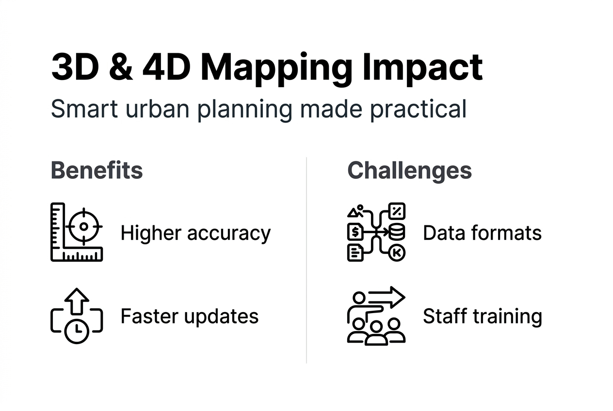
Cost reductions extend beyond maintenance. Drone-based mapping decreases data collection expenses by 60% compared to traditional surveying whilst delivering higher resolution and faster turnaround. Construction coordination improves through clash detection in integrated BIM models, preventing costly field conflicts. Traffic simulation enables virtual testing of infrastructure changes, avoiding expensive trial implementations.
| Benefits | Challenges |
|---|---|
| 37% improvement in anomaly detection | Data heterogeneity across acquisition sources |
| 42% reduction in diagnostic time | Privacy restrictions for aerial imaging |
| 60% lower data collection costs | Weather dependencies affecting capture schedules |
| Sub-meter positioning accuracy | Urban canyon effects on GPS accuracy |
| Real-time simulation capabilities | Technical skill requirements for operation |
| Predictive maintenance scheduling | Diverse 3D model standards complicating exchange |
Challenges temper these advantages. Data heterogeneity complicates integration when combining legacy GIS databases with modern point clouds and BIM models. Privacy regulations restrict drone operations near sensitive facilities, requiring ground-based alternatives. Weather interrupts aerial data capture, extending project timelines during unfavourable seasons. Urban canyons degrade GPS accuracy in dense city centres, necessitating supplementary positioning methods.
Common pitfalls include:
- Inadequate data harmonisation protocols leading to semantic inconsistencies
- Insufficient computing infrastructure for processing large point cloud datasets
- Regulatory restrictions on drone operations constraining data capture windows
- Staff training gaps preventing effective utilisation of advanced features
- Unrealistic expectations regarding automation requiring extensive manual refinement
Governments face adoption barriers beyond technical considerations. Diverse 3D model standards fragment the market, with proprietary formats limiting interoperability between planning tools. Training existing staff demands time and budget allocation competing with operational priorities. Benefits of 3D city models accumulate over project lifecycles, making return on investment calculations complex for organisations accustomed to immediate payoffs.
Pro tip: Allocate 15% of technology implementation budgets to staff training and workflow development rather than focusing exclusively on software and hardware acquisition.
Successful implementations start with pilot projects demonstrating value before enterprise-wide deployment. Select infrastructure projects with clear success metrics and manageable scope to build organisational confidence. Examples of 3D city models from European municipalities provide implementation roadmaps adaptable to local contexts. Early investment in standardised data schemas and collaborative platforms pays dividends by preventing costly later migrations.
Explore 3D Cityplanner for your urban infrastructure projects
Transitioning from traditional mapping to advanced 3D and 4D technologies requires platforms designed specifically for urban infrastructure workflows. 3D Cityplanner integrates semantic city models with digital twin functionalities, offering urban planners and architects comprehensive tools for infrastructure project optimisation.
The platform combines GIS and BIM integration with real-time simulation support through intuitive interfaces requiring minimal training. Import diverse data formats including point clouds, CityGML models, and CAD drawings into unified project environments. Semantic attributes enable automated analysis identifying conflicts, optimisation opportunities, and regulatory compliance issues before construction begins.
Core capabilities include:
- Digital twin platform supporting temporal simulations and scenario modelling
- Semantic 3D city modelling with CityGML 3.0 standard compliance
- Real-time data layers integrating traffic sensors, environmental monitors, and construction progress
- Collaboration tools enabling multi-stakeholder coordination across project phases
- Advanced visualisation supporting stakeholder presentations and public consultations
3D Cityplanner demo registration provides hands-on access to explore how these technologies improve infrastructure project outcomes. Experiment with traffic simulations, test design alternatives, and evaluate maintenance scenarios using sample datasets representing typical urban conditions.
Pro tip: Leverage the Structure Planner tool for construction stage visualisation, enabling contractors to sequence work optimally whilst minimising public disruption.
The 3D Cityplanner digital twin functionality supports ongoing infrastructure management beyond initial construction, creating living models that evolve with cities. Update infrastructure conditions based on inspection data, simulate maintenance impacts, and evaluate expansion proposals within existing contexts. This lifecycle approach maximises technology value whilst supporting evidence-based decision-making throughout infrastructure asset lifespans.
FAQ
What is urban infrastructure mapping with 3D and 4D technologies?
Urban infrastructure mapping with 3D and 4D technologies captures spatial and temporal data to model infrastructure networks comprehensively. The approach integrates geometric precision with semantic attributes describing infrastructure functions, conditions, and relationships. Temporal dimensions enable simulation of construction sequences, traffic patterns, and maintenance schedules.
How do drones improve urban infrastructure mapping?
Drones capture high-resolution aerial imagery rapidly, generating detailed 3D models with centimetre-level accuracy in weeks rather than months. They reduce data collection costs by 60% compared to ground surveying whilst accessing difficult locations. Processing algorithms convert drone imagery into point clouds and textured meshes suitable for infrastructure analysis.
What are the main challenges when adopting 3D city models?
Data format heterogeneity complicates integration when combining BIM, GIS, and point cloud sources with inconsistent schemas. Semantic discrepancies require harmonisation workflows reconciling attribute definitions across systems. Processing large datasets demands substantial computing resources and technical expertise. Regulatory considerations around privacy and airspace restrict data capture methods.
How do digital twins support urban traffic simulation?
Digital twins create dynamic 3D representations processing real-time traffic data to simulate congestion, evaluate signal timing, and predict intervention impacts. Sub-meter positioning accuracy enables detailed intersection analysis and pedestrian conflict identification. Real-time synchronisation with IoT sensors provides current conditions for predictive modelling.
Where can I try advanced 3D urban planning tools?
3D Cityplanner demo access enables exploration of digital twin and semantic modelling capabilities tailored for infrastructure workflows. Sample datasets allow testing of traffic simulations, design alternatives, and maintenance scenarios. The platform accommodates diverse input formats whilst providing intuitive interfaces requiring minimal training.
Recommended
- Master 4D planning in urban design for 25% faster projects – 3D Urban Development
- Why urban planners use 4D simulation in 2026 – 3D Urban Development
- Master urban space modelling with advanced 3D tools in 2026 – 3D Urban Development
- Urban Development Workflow for Efficient 3D Planning – 3D Urban Development


