The role of 3D models in architecture and urban planning

Three-dimensional models have evolved from optional visualisation aids to mission-critical infrastructure for architectural and urban planning projects in 2026. Recent empirical datasets demonstrate high-accuracy building modelling benchmarks covering 31 million structures, whilst bi-directional morphology metrics now enable automated performance-driven design at unprecedented scale. This article explores evidence-based insights into how 3D models enhance design accuracy, sustainability analysis, and multi-stakeholder coordination, equipping urban planners, architects, and developers with practical workflows to leverage these technologies effectively across complex projects.
Table of Contents
- The Evolution Of 3D Models In Architecture And Urban Planning
- Core Capabilities And Empirical Benchmarks Of 3D Models In Architecture
- Advanced Methodologies And Hybrid Workflows For Integrating 3D Models
- Practical Applications And Strategic Benefits Of 3D Models In Urban Development
- Explore 3D Cityplanner For Cutting-Edge Architecture And Urban Planning
Key takeaways
| Point | Details |
|---|---|
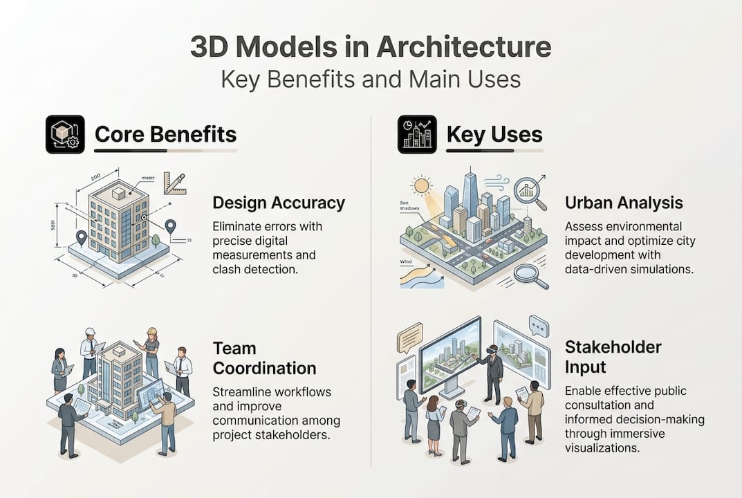
| Enhanced design accuracy | 3D models integrate Building Information Modelling and CityGML standards to support data-driven workflows and large-scale coordination across architecture and urban planning disciplines. |
| Empirical benchmarking | Datasets like CMAB provide statistical validation for 31 million buildings, enabling continuous quality improvements and machine learning applications in architectural practice. |
| Hybrid workflows | Combining automated generation with manual expertise optimises efficiency for complex heritage sites and irregular architectural forms requiring nuanced intervention. |
| Sustainability integration | Performance metrics embedded in 3D models facilitate evidence-based sustainability assessments, spatial analysis, and stakeholder communication throughout project lifecycles. |
| Multi-disciplinary coordination | Digital twins and integrated platforms streamline collaboration between architects, urban planners, and real estate developers, improving planning approvals and project outcomes. |
The evolution of 3D models in architecture and urban planning
The architectural profession has undergone a fundamental transformation from traditional two-dimensional drawings to sophisticated digital representations that capture spatial, temporal, and performance dimensions simultaneously. Building Information Modelling emerged as the dominant paradigm for individual structures, whilst CityGML standards enabled city-scale coordination across infrastructure, buildings, and urban systems. Urban development workflows now integrate these technologies to manage complexity that would overwhelm conventional planning methods.
Empirical validation has become central to advancing three-dimensional modelling practices. The CMAB dataset exemplifies this shift, providing benchmarks for 31 million buildings with quantified accuracy metrics for height, floor count, and room configurations. For practitioners, prioritising BIM for coordination and CityGML for urban scale modelling creates coherent workflows, whilst researchers utilise datasets like CMAB for machine learning benchmarks that drive continuous improvement. This evidence-based approach distinguishes contemporary practice from earlier speculative implementations.
The practical benefits of this technological evolution manifest across multiple dimensions:
- Design coordination improvements reduce conflicts between architectural, structural, and mechanical systems through clash detection and spatial validation before construction commences.
- Data integration capabilities connect geometric representations with performance attributes, enabling sustainability analysis, cost estimation, and lifecycle management within unified digital environments.
- Quality assurance benchmarking establishes measurable standards for model accuracy, detail levels, and semantic richness that support procurement specifications and regulatory compliance.
- Stakeholder communication enhancement provides intuitive visualisations that bridge technical and non-technical audiences, facilitating consensus-building and informed decision-making throughout planning processes.
These capabilities have transformed three-dimensional models from presentation tools into analytical infrastructure that underpins evidence-based design decisions. The shift reflects broader trends towards data-driven urbanism where quantitative validation complements professional judgement, creating accountability mechanisms that were impossible with purely analogue workflows.
Core capabilities and empirical benchmarks of 3D models in architecture
Statistical validation provides the foundation for trusting three-dimensional representations in high-stakes architectural and planning decisions. The CMAB dataset covers 31 million buildings across China with mean absolute errors below 0.5 metres for building heights and 0.3 floors for storey counts, establishing quantitative baselines that enable practitioners to assess model fitness for specific applications. Similarly, 3D City Index improvements averaged 2.5 points from 2022 to 2025, indicating rapid quality gains as automated generation techniques mature and validation protocols strengthen.
Comparative analysis reveals the scale and precision now achievable in building-level modelling:
| Dataset characteristic | CMAB benchmark | Typical urban model | Quality improvement |
|---|---|---|---|
| Building count | 31 million structures | 50,000-500,000 | 62x-620x coverage |
| Rooftop area accuracy | ±2.1 square metres MAE | ±5-10 square metres | 2.4x-4.8x precision |
| Height accuracy | ±0.47 metres MAE | ±1-3 metres | 2.1x-6.4x precision |
| Floor count accuracy | ±0.31 floors MAE | ±1 floor | 3.2x precision |
These benchmarks demonstrate that contemporary automated techniques achieve accuracy levels previously requiring manual surveying, fundamentally altering the economics of large-scale 3D building modelling for urban planning applications.
Core technical capabilities that leverage this empirical foundation include:
- Automated generation algorithms that derive building geometries from LiDAR, photogrammetry, and cadastral data with statistically validated accuracy levels.
- Morphology metric integration connecting three-dimensional forms with performance indicators for daylight, views, density, and spatial configuration.
- Sustainability evaluation frameworks embedding energy, carbon, and environmental assessments directly within geometric representations.
- Semantic enrichment protocols adding attribute data for materials, construction dates, occupancy types, and regulatory classifications to spatial geometries.
Pro Tip: Combine automated modelling techniques with manual refinement for heritage buildings and architecturally complex structures where irregular forms, historical details, or unique materials exceed the pattern recognition capabilities of current generation algorithms.
The strategic value of 3D city models extends beyond visualisation to enable quantitative analysis that informs policy development, investment decisions, and regulatory frameworks. Empirical benchmarks provide the confidence necessary for these high-consequence applications, transforming speculative representations into evidence-based planning infrastructure.

Advanced methodologies and hybrid workflows for integrating 3D models
Bi-directional morphology metrics bridge the evaluation and generation gap in computational urban design, enabling practitioners to both analyse existing urban forms and generate new configurations that optimise performance criteria. This methodological advancement represents a fundamental shift from purely descriptive modelling towards generative workflows where three-dimensional representations actively support design exploration rather than merely documenting predetermined solutions. The integration of performance metrics with geometric generation accelerates iterative refinement whilst maintaining quantitative validation throughout the design process.
Hybrid workflows that combine automated speed with manual expertise have emerged as the pragmatic solution for real-world projects spanning diverse building typologies and complexity levels:
| Workflow characteristic | Fully automated approach | Hybrid automated-manual approach |
|---|---|---|
| Processing speed | 100-1000x faster than manual | 10-50x faster than manual |
| Heritage building accuracy | 60-70% accuracy | 90-95% accuracy |
| Irregular form handling | Struggles with unique geometries | Accommodates architectural complexity |
| Quality control requirements | Extensive post-processing validation | Targeted expert review |
| Optimal application | Standard typologies, large datasets | Mixed portfolios, heritage sites |
The practical benefits of hybrid methodologies become particularly evident when managing architectural portfolios that include both contemporary standardised construction and historically significant structures requiring preservation-grade documentation.
Implementation strategies for hybrid workflows include:
- Typology-based routing that directs standard building forms through automated pipelines whilst flagging irregular geometries for expert intervention.
- Confidence scoring algorithms that quantify automated generation reliability, enabling practitioners to allocate manual review resources where they provide maximum value.
- Iterative refinement protocols combining machine learning pattern recognition with human judgement to progressively improve automated accuracy for project-specific building types.
- Quality assurance checkpoints integrating statistical validation, visual inspection, and domain expertise at defined workflow stages.
Pro Tip: Combine BIM coordination capabilities for detailed architectural projects with CityGML standards for urban-scale integration, creating seamless information flows across project scales whilst maintaining appropriate detail levels for each application context.
The importance of manual intervention persists despite automation advances, particularly for heritage-sensitive designs where historical authenticity, material specificity, and architectural character require expert interpretation that exceeds current algorithmic capabilities. Modern 3D modelling approaches recognise this reality, positioning automation as augmentation rather than replacement for professional expertise.
Methodological sophistication in creating 3D city models increasingly determines competitive advantage for planning practices, as clients demand both comprehensive coverage and validated accuracy across entire urban portfolios. Hybrid workflows deliver this combination by leveraging automation’s scale advantages whilst preserving quality through strategic expert intervention.
Practical applications and strategic benefits of 3D models in urban development
Three-dimensional models facilitate sustainability analysis, performance-driven design, and multi-stakeholder coordination at urban scale, transforming abstract planning concepts into quantifiable metrics that support evidence-based decision-making. Contemporary applications span regulatory compliance, investment analysis, community engagement, and operational management, reflecting the technology’s maturation from specialised visualisation to core planning infrastructure. Real estate developers particularly benefit from accurate, data-rich models that reduce uncertainty in feasibility studies, planning approvals, and asset valuations.
Strategic applications delivering measurable value include:
- Sustainability assessment frameworks quantifying energy performance, carbon footprints, and environmental impacts across building portfolios and neighbourhood scales.
- Urban form generation tools creating design alternatives that optimise daylight access, view corridors, density targets, and spatial configuration simultaneously.
- Spatial performance analytics measuring accessibility, walkability, public realm quality, and infrastructure capacity to inform policy development.
- Coordinated design review processes enabling multi-disciplinary teams to identify conflicts, validate compliance, and refine proposals collaboratively before construction.
- Planning approval acceleration providing regulatory authorities with comprehensive documentation that reduces information requests and expedites decision timelines.
Practical integration strategies for incorporating three-dimensional modelling into existing workflows require careful attention to data standards, software interoperability, and team capabilities. Successful implementations typically begin with pilot projects that demonstrate value whilst building organisational competence, then scale systematically as confidence and expertise develop. Efficient 3D planning workflows emphasise incremental adoption rather than wholesale transformation, reducing implementation risk whilst maintaining project delivery continuity.
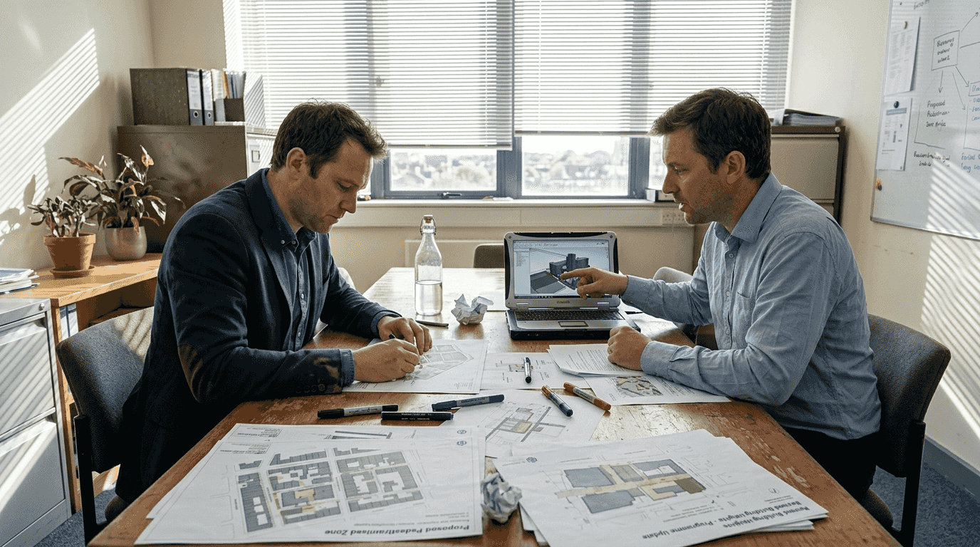
Multi-disciplinary coordination represents perhaps the most transformative benefit, as three-dimensional models create shared reference environments where architects, engineers, planners, and developers collaborate around common spatial representations. This coordination reduces miscommunication, identifies conflicts early, and enables integrated optimisation that would be impossible with discipline-specific two-dimensional drawings. The resulting efficiency gains compound throughout project lifecycles, from initial feasibility through construction and into operational management.
Stakeholder communication improvements extend beyond professional teams to include community engagement, political decision-making, and public consultation processes. Intuitive three-dimensional visualisations make complex planning proposals accessible to non-technical audiences, supporting informed participation and reducing conflicts arising from misunderstanding rather than substantive disagreement. Selecting appropriate 3D modelling software becomes crucial for maximising these communication benefits, as user interface design and visualisation capabilities vary significantly across platforms.
The strategic imperative for adopting advanced three-dimensional modelling reflects both competitive pressures and regulatory expectations that increasingly assume digital workflows as baseline professional practice. Practices lacking these capabilities face growing disadvantages in procurement competitions, regulatory interactions, and client relationships as the technology transitions from innovation to standard practice across the architecture and urban planning professions.
Explore 3D Cityplanner for cutting-edge architecture and urban planning
Transforming the insights explored throughout this article into practical project outcomes requires sophisticated software platforms purpose-built for contemporary architectural and urban planning challenges. 3D Cityplanner delivers integrated tools specifically designed for professionals seeking to implement evidence-based workflows, digital twin capabilities, and performance-driven design methodologies at building and city scales.
The platform combines automated generation efficiency with manual refinement flexibility, supporting hybrid workflows that balance speed and accuracy across diverse project portfolios. Comprehensive city planning tools enable sustainability assessment, spatial analysis, and multi-stakeholder coordination within unified digital environments, whilst urban development capabilities integrate four-dimensional timeline visualisation for phased project management. Explore how 3D Cityplanner can enhance your architectural practice and urban planning projects with cutting-edge technology that translates research advances into practical professional tools.
FAQ
What is the role of 3D models in architecture?
Three-dimensional models provide detailed spatial representations that support design coordination, performance evaluation, and sustainability assessment throughout architectural project lifecycles. They facilitate collaboration among architects, urban planners, and developers by improving accuracy, enabling clash detection, and creating shared reference environments for multi-disciplinary teams. Modern 3D city models integrate semantic data with geometric representations, transforming visualisation tools into analytical infrastructure for evidence-based decision-making.
How do bi-directional morphology metrics enhance urban design?
Bi-directional metrics bridge evaluation and generation gaps in computational urban design by enabling both analysis of existing forms and creation of new configurations that optimise performance criteria simultaneously. These methodologies accelerate design iteration whilst maintaining quantitative validation, supporting evidence-based exploration of alternatives. Complex heritage forms and architecturally unique structures may still require manual review to ensure historical authenticity and material specificity that exceed current algorithmic pattern recognition capabilities.
What software tools support 3D modelling in urban planning?
Popular platforms include Building Information Modelling systems for architectural coordination, CityGML-compliant tools for urban-scale integration, and specialised 3D modelling software designed specifically for planning applications. Integration with geographic information systems and digital twin platforms enhances analytical capabilities, enabling sustainability assessment, infrastructure planning, and operational management within unified environments. Selecting appropriate software depends on project scale, complexity requirements, collaboration needs, and interoperability with existing organisational systems, with Autodesk urban planning solutions representing one established option among diverse market offerings.
How accurate are automated 3D building models in 2026?
Contemporary automated techniques achieve mean absolute errors below 0.5 metres for building heights and 0.3 floors for storey counts across large datasets, representing accuracy levels previously requiring manual surveying. Empirical benchmarks from datasets covering tens of millions of structures demonstrate that standard building typologies can be modelled reliably through automated workflows. Heritage buildings, irregular architectural forms, and structures with unique materials typically require hybrid approaches combining automated generation with expert manual refinement to achieve preservation-grade documentation accuracy exceeding 90 percent.
What are the main benefits of 3D models for real estate developers?
Three-dimensional models reduce uncertainty in feasibility studies by enabling accurate volume calculations, density assessments, and regulatory compliance validation before significant investment commitments. They accelerate planning approval processes through comprehensive documentation that addresses authority requirements systematically, reducing information requests and decision timelines. Performance analytics embedded in models support sustainability certifications, energy efficiency optimisation, and lifecycle cost projections that enhance asset valuations and investment returns whilst facilitating stakeholder communication throughout development processes.