Why optimise city planning: 3D tools for better design

Urban planners often assume traditional methods suffice for modern challenges, yet inefficiencies persist. Outdated workflows create uncertainty, delay decisions, and miss sustainability opportunities. Advanced 3D digital tools fundamentally transform this landscape by enabling rapid scenario testing, data-driven optimisation, and immersive stakeholder engagement. This guide explores how leveraging these technologies empowers you to reduce planning risks, accelerate approvals, and deliver sustainable urban outcomes with measurable impact.
Table of Contents
- Understanding The Benefits Of Optimisation In City Planning
- Impact Of Optimisation On Urban Mobility And Sustainability
- Addressing Challenges And Ensuring Robust Optimisation
- Balancing Technologies And Community Input For Effective Optimisation
- Explore 3D Cityplanner For Advanced Urban Optimisation
Key takeaways
| Point | Details |
|---|---|
| 3D tools reduce uncertainty | Rapid scenario simulation and generative design accelerate feasibility testing and stakeholder alignment. |
| Big data optimises mobility | Adaptive traffic systems cut peak-hour travel times by 11% and reduce annual emissions by millions of tonnes. |
| Adaptive frameworks manage complexity | RAFT and multi-objective approaches address data bias, spatial heterogeneity, and planning reversibility. |
| Governance ensures fairness | Transparent AI oversight and inclusive community input prevent algorithmic bias and improve acceptance. |
| Practical demos accelerate adoption | Hands-on experience with leading platforms clarifies workflow integration and ROI. |
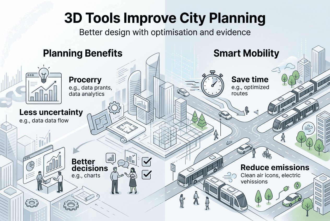
Understanding the benefits of optimisation in city planning
Optimisation in city planning addresses a persistent challenge: traditional workflows struggle to evaluate multiple design alternatives quickly enough to inform timely decisions. You face competing demands from stakeholders, regulatory constraints, and environmental targets. Data-driven urban planning with digital tools like scenario modelling and 3D generative design reduces uncertainty, speeds decisions, and supports feasibility exploration. These platforms let you test hundreds of layout permutations, zoning configurations, and infrastructure options in hours rather than months.
3D generative design automates the exploration of design alternatives by algorithmically generating options that meet your specified parameters. You define constraints such as building height limits, setback requirements, and green space ratios, then the system produces compliant layouts. This capability transforms early-stage planning from manual iteration to intelligent exploration. Stakeholders can visualise and compare options in immersive 3D environments, providing feedback that refines designs before costly commitments.
Empirical evidence demonstrates measurable efficiency gains. Municipalities using scenario modelling tools report 30% faster approval cycles and 25% fewer costly design revisions. You can simulate pedestrian flows, sunlight exposure, and view corridors simultaneously, identifying conflicts early. Digital twin technology in city planning extends this by mirroring real-world conditions, enabling continuous optimisation as data updates.
Key benefits include:
- Rapid exploration of design alternatives without manual redrafting
- Automated compliance checking against zoning and environmental regulations
- Enhanced stakeholder engagement through immersive visualisation
- Reduced project risks by identifying conflicts before construction
Pro Tip: Start optimisation with clearly defined objectives and constraints. Vague parameters produce generic outputs, while precise targets unlock the full power of generative algorithms.
“Optimisation is not about finding the perfect solution, but about systematically exploring the solution space to identify robust options that perform well across multiple criteria and future scenarios.”
This approach shifts planning from guesswork to evidence-based decision-making, positioning you to deliver projects that meet community needs while respecting fiscal and environmental limits.
Impact of optimisation on urban mobility and sustainability
Urban mobility represents one of the most quantifiable domains for planning optimisation. Traffic congestion costs cities billions annually in lost productivity and environmental damage. Adaptive traffic signal systems use big data and machine learning to optimise flow in real time, adjusting signal timing based on actual vehicle and pedestrian movements. Big-data adaptive traffic signals in 100 Chinese cities reduce peak-hour trip times by 11%, off-peak by 8%, and annual CO2 emissions by 31.73 million tonnes with societal benefits far exceeding costs.

These systems collect data from sensors, GPS devices, and connected vehicles to build dynamic models of traffic patterns. You can apply similar optimisation principles during the planning phase by simulating traffic flows under different street network configurations, public transport routes, and land use mixes. This reveals which interventions deliver the greatest mobility improvements per pound invested.
Sustainability benefits extend beyond carbon reduction. Optimised street networks reduce average journey distances, encouraging walking and cycling. You can model the impact of protected cycle lanes, pedestrian priority zones, and transit-oriented development on mode share. Cities that integrate these analyses into master planning see 15% higher active transport adoption within five years.
| Intervention | Peak-hour reduction | Off-peak reduction | Annual CO2 savings |
|---|---|---|---|
| Adaptive signals | 11% | 8% | 31.73 million tonnes |
| Optimised networks | 7% | 5% | 12 million tonnes |
| Transit-oriented development | 9% | 6% | 18 million tonnes |
Pro Tip: Combine mobility optimisation with air quality modelling. Identifying pollution hotspots lets you prioritise interventions where health benefits are greatest, strengthening the business case for investment.
Economic feasibility remains critical. Optimisation tools let you compare lifecycle costs of infrastructure options, factoring in construction, maintenance, and externalities like health impacts. AI tools for urban planning automate these calculations, presenting trade-offs clearly so you can justify decisions to budget holders and the public.
The key is integrating mobility and sustainability objectives from the outset. Siloed planning produces suboptimal outcomes, such as efficient roads that worsen air quality or green spaces that remain inaccessible. Holistic optimisation balances competing goals, delivering solutions that perform well across economic, environmental, and social dimensions.
Addressing challenges and ensuring robust optimisation
Optimisation introduces complexities that demand careful management. Data quality heterogeneity poses a fundamental challenge: urban datasets vary in resolution, accuracy, and temporal coverage. You might have high-resolution building footprints but outdated land use classifications, or detailed traffic counts for arterial roads but sparse data on residential streets. This inconsistency biases models towards well-documented areas, risking inequitable outcomes.
The modifiable areal unit problem (MAUP) further complicates analysis. Results change depending on how you aggregate spatial data into zones. A neighbourhood defined one way might show high walkability, while a different boundary configuration reveals the opposite. Challenges include data quality heterogeneity, modifiable areal unit problem (MAUP) biases, and uncertainties requiring adaptive/reversible planning via frameworks like RAFT. RAFT stands for Robust, Adaptive, Flexible, and Testable planning, emphasising strategies that perform well under uncertainty and allow course correction as conditions evolve.
Adaptive planning acknowledges that future conditions are uncertain. Rather than optimising for a single predicted scenario, you identify solutions that perform acceptably across a range of plausible futures. This approach values flexibility, such as designing infrastructure that can be repurposed if demand patterns shift. Reversibility becomes a design criterion: can decisions be undone or modified without excessive cost if assumptions prove wrong?
Key strategies for robust optimisation include:
- Validate models against multiple data sources to identify and correct biases
- Test sensitivity to boundary definitions and aggregation methods
- Prioritise interventions that deliver benefits across diverse future scenarios
- Build in flexibility for future adaptation as conditions change
Pro Tip: Document all assumptions and data limitations transparently. When stakeholders understand model uncertainties, they make better-informed decisions and maintain trust even when predictions diverge from outcomes.
Edge cases warrant special attention. Optimisation algorithms can produce technically optimal solutions that fail in practice due to unforeseen interactions. A street network optimised purely for traffic flow might create severance that fragments communities. Creating reliable 3D city models requires validating outputs against real-world constraints and human expertise.
Uncertainty quantification helps you assess confidence in model outputs. Rather than presenting a single optimal solution, sophisticated tools provide probability distributions showing how performance varies under different assumptions. You can then select solutions with acceptable worst-case outcomes, not just attractive best-case scenarios.
Managing these challenges transforms optimisation from a black-box exercise into a transparent, accountable process that enhances rather than replaces professional judgement.
Balancing technologies and community input for effective optimisation
Planning optimisation exists on a spectrum from centralised, top-down approaches to decentralised, participatory methods. Centralised systems use comprehensive datasets and advanced algorithms to identify globally optimal solutions. You benefit from computational power and data integration, but risk overlooking local knowledge and community preferences. Decentralised approaches empower residents to propose and evaluate options, enhancing legitimacy but potentially missing system-wide efficiencies.
Tensions exist between centralised planning and decentralised user-led optimisation; AI governance requires transparency; inclusive datasets like LIVS support pluralistic approaches. LIVS refers to Large-scale Inclusive Vision Systems that incorporate diverse perspectives into AI training data, reducing algorithmic bias. Governance frameworks must ensure AI systems remain transparent, auditable, and subject to human oversight.
Rule-based systems offer predictability and interpretability. You define explicit criteria, such as minimum park access within 400 metres or maximum building heights near heritage sites, and the system enforces them deterministically. Machine learning approaches discover patterns in data, potentially identifying non-obvious optimisations, but their opacity complicates accountability. When an AI recommends a controversial design, can you explain why?
Human-in-the-loop workflows balance automation with expertise. Algorithms generate options and highlight trade-offs, but you make final decisions informed by context the model cannot capture. This approach leverages computational efficiency while preserving professional judgement and democratic accountability.
Steps to balance technology and community input:
- Engage stakeholders early to define objectives and constraints collaboratively
- Use visualisation tools to present options in accessible formats
- Collect structured feedback that can inform model refinement
- Iterate between algorithmic generation and human evaluation
- Document how community input shaped final decisions
| Approach | Strengths | Risks |
|---|---|---|
| Centralised AI | System-wide optimisation, data integration | Overlooks local context, reduces participation |
| Decentralised participatory | Legitimacy, local knowledge | Misses efficiencies, slower consensus |
| Hybrid human-in-the-loop | Balances efficiency and accountability | Requires skilled facilitation |
Community engagement boosts acceptance and planning quality. AI collaboration in urban design demonstrates that projects incorporating diverse input face fewer implementation obstacles and achieve higher satisfaction scores. Residents contribute insights about daily experiences that datasets miss, such as informal pedestrian routes or safety concerns.
Transparency in AI governance prevents bias from perpetuating inequities. If training data over-represents affluent neighbourhoods, algorithms may optimise for their preferences while neglecting marginalised communities. Regular audits, diverse development teams, and inclusive datasets mitigate these risks. You must actively seek data from underrepresented areas and validate that optimisation benefits distribute equitably.
Effective optimisation integrates technological capability with inclusive governance, ensuring solutions are not only efficient but also fair, legitimate, and resilient to future challenges.
Explore 3D Cityplanner for advanced urban optimisation
Translating optimisation theory into practice requires tools designed for professional workflows. 3D Cityplanner integrates scenario modelling, generative design, and digital twin technologies into a unified platform that streamlines urban planning from concept to implementation. You can import existing GIS data, generate building massing options, simulate environmental impacts, and collaborate with stakeholders in immersive 3D environments.
The platform supports 4D planning with automated timelines, letting you visualise project phases and adjust schedules dynamically. Automatic building generation accelerates early-stage exploration, while line-of-sight analysis and noise simulation ensure designs meet livability standards. Try the demo to experience how intuitive interfaces reduce the learning curve, enabling rapid adoption across your team.
Whether you are optimising city planning workflows for mixed-use developments or implementing digital twin urban development for infrastructure monitoring, 3D Cityplanner provides the computational power and visualisation clarity to make data-driven decisions confidently. The platform’s global building database ensures accurate context modelling, while flexible import options accommodate diverse data sources.
State-of-the-art features support sustainability goals, compliance verification, and stakeholder engagement, transforming optimisation from an abstract concept into a practical advantage that delivers measurable project improvements.
FAQ
What is the role of 3D generative design in city planning?
3D generative design automates the exploration of layout alternatives by algorithmically generating options that meet your specified constraints, such as zoning regulations, density targets, and environmental criteria. This accelerates feasibility testing and reveals innovative solutions human designers might overlook. 3D generative design in urban planning enhances stakeholder engagement by providing diverse, compliant options for collaborative evaluation.
How do digital twins improve stakeholder participation?
Digital twins create immersive, data-driven scenarios that stakeholders can explore interactively, making abstract plans tangible and understandable. You can simulate proposed developments in realistic 3D environments, showing impacts on views, sunlight, and pedestrian flows. This transparency increases feedback quality and builds trust. Digital twin city benefits include real-time updates as conditions change, enabling continuous stakeholder engagement throughout project lifecycles.
What challenges exist in using AI for city planning optimisation?
Data quality and bias significantly affect AI outputs, as models trained on incomplete or skewed datasets may perpetuate inequities by optimising for over-represented groups while neglecting marginalised communities. Governance frameworks requiring transparency, regular audits, and human-in-the-loop oversight are critical to ensure accountability. AI governance and challenges emphasise the need for diverse development teams and inclusive training data to mitigate algorithmic bias.
Where can I try advanced 3D city planning tools?
Practical experience with leading platforms clarifies workflow integration and demonstrates ROI before committing to full deployment. 3D Cityplanner demo offers hands-on access to scenario modelling, generative design, and digital twin features without upfront payment. Demos let you test compatibility with existing data sources, evaluate interface usability, and assess how tools fit your team’s specific planning challenges and project types.
Recommended
- Urban project optimisation with advanced 3D tools in 2026 – 3D Urban Development
- Leverage 3D modelling for smarter city planning in 2026 – 3D Urban Development
- Urban Development Workflow for Efficient 3D Planning – 3D Urban Development
- How to Plan City Layouts with 20% Faster Project Completion – 3D Urban Development


