Milieuzonering VNG: 3D Twins Cut Cumulative Errors for Dutch Planners

The VNG handreiking Activiteiten en milieuzonering, published in 2024, replaces the 2009 “Bedrijven en milieuzonering” and now forms the practical backbone for milieuzonering under the Omgevingswet. The core change is structural: activity lists give way to zones defined by milieugebruiksruimte, capped at a limited number of noise and odour zones. Municipalities must reflect this in the omgevingsplan by referencing Bkl values directly and prioritising site-specific assessment for locations where old distance tables no longer apply cleanly.
TL;DR:Municipalities now work with zones defined by milieugebruiksruimte rather than fixed activity lists, requiring site-specific assessment and direct Bkl references.Planners must explicitly link zone boundaries to specific milieuwaarden and document the measurement points and distances from actual activity locations.Three assessment options are available: direct criterion-based testing, using the outdated 2009 distance tables as indicators, or targeted full investigations, with caution advised on defaulting to the tables.3D modelling can improve accuracy by visualizing contours and effects, reducing errors in cumulative impact assessments and allowing detailed scenario testing.The primary guidance and tools from VNG should be used to ensure plan rules are precise, consistent, and legally robust from the start.
Table of Contents
- What does milieuzonering vng actually change in practice?
- How does this reshape your omgevingsplan and VTH workflow?
- Which of the three assessment options fits your case?
- How can 3D modelling reduce cumulative-impact mistakes?
- Where to find the primary VNG guidance and supporting tools
- A planner’s checklist for getting this right the first time
- Sources
- FAQ
What does milieuzonering vng actually change in practice?
The old system worked from a fixed list: look up an activity in the Staat van Bedrijfsactiviteiten, read off a richtafstand, done. The 2024 handreiking dismantles that logic. There is no longer a legally binding activity list. Instead, municipalities work with milieugebruiksruimte: the environmental space an activity is permitted to occupy, expressed through zones rather than a single fixed number.
This is inwaartse zonering in action. Rather than starting from a business and projecting outward, the method starts from the boundary of a site and works inward, layering zones of decreasing environmental impact as distance from a sensitive receptor increases. The 2024 VNG handreiking caps this at a limited number of zones for noise and odour, avoiding the sprawling gradations that made the 2009 tables cumbersome to apply.
The practical anchor is a base sound level at a standard distance, tied directly to Bkl articles 5.69 and 5.93, which set the instruction rules municipalities must translate into binding milieuwaarden. This scope covers:
- Bedrijventerreinen, where zone stacking is most common and where additional plan rules typically apply.
- Other work sites outside designated industrial areas, assessed case by case.
- Gemengd gebied, where the handreiking explicitly permits tighter zoning given the closer mix of functions.
The result is a system that asks planners to justify distance through activity-specific reasoning tied to legal values, not to consult a table and stop thinking.
How does this reshape your omgevingsplan and VTH workflow?
Translating milieugebruiksruimte into a workable omgevingsplan means making three decisions explicit: which milieuwaarden apply, where extra rules kick in, and how limits get documented for enforcement later. Vague zone references invite appeals; precise ones save VTH teams hours during permit review.
- Set zone rules with direct Bkl references. Every zone boundary in the plan should point back to the specific milieuwaarde it enforces, not a paraphrased distance.
- Flag additional rules for bedrijventerreinen and other work sites. These areas often carry supplementary conditions beyond the base zoning, and the plan needs to say so explicitly rather than assume it.
- Choose contour-based representation over rigid polygons where possible. The plan does not need to fix a site’s boundary; it needs to reference where the measured distance from the activity applies, which is better shown as a contour than a static outline.
- Address functiemenging directly. Where mixed uses sit close together, specify mitigation measures, construction requirements, and technical conditions rather than relying on a generic buffer.
- Build in transitional provisions. Existing lawful environmental loads generally continue under overgangsrecht, often with a continuation period of several years, and the plan should specify applicable information obligations.
Documentation matters more than under the old system. A practitioner note on transition documentation flags that officials often under-record which receptor point and distance baseline they used for a contour. The rules expect that distance to be measured from the activity’s actual location, not an assumed plot centre, so record it every time.
Which of the three assessment options fits your case?
VNG’s servicedocument sets out three routes for testing inpasbaarheid, and choosing the wrong one is the single most common way municipalities create legal risk for themselves.
- Option 1: criterion-based estimate. Apply the noise and odour thresholds directly against the proposed activity. This is fast and suits routine, low-risk applications where the activity’s footprint is well understood and receptors are not unusually sensitive.
- Option 2: transposed 2009 table as indication. The servicedocument converts the old distance table into an indicative reference. It is useful for a quick sanity check, but it carries no legal weight on its own; treat it as a starting point rather than a final test.
- Option 3: targeted investigation. Commission a full noise or odour study when a site borders rustig woongebied, involves cumulative context with neighbouring activities, or where Option 1 leaves genuine doubt.
A short checklist helps decide which route applies: project scale, sensitivity of nearby receptors, whether cumulative effects from other permitted activities are already in play, how much legal risk the municipality is willing to carry, and whether the case needs a BOPA or maatwerk decision rather than a standard plan rule.
Pro Tip: Don’t let Option 2 quietly become your default. It is fast, but a table built for 2009 activity categories does not reliably represent contemporary mixed-use sites. Use it to triage, then verify anything borderline with Option 1 or 3.
Cumulative reasoning deserves particular care. DGMR’s commentary on the handreiking points out that the system prescribes per-activity assessment, not area-wide cumulative scoring, so stacking multiple sources into one combined figure can misrepresent what the rules actually require.
How can 3D modelling reduce cumulative-impact mistakes?
A distance table tells you a number. It does not show you where the school playground sits relative to a loading bay, or whether a warehouse extension pushes a noise contour across a residential garden three streets away. That gap is where per-activity contours get modelled wrong, and where a digital twin earns its place in the workflow.
A practical sequence works well for feasibility-stage checks:
- Import the GIS base layer, including cadastral boundaries and existing land use.
- Overlay the relevant Bkl values as contour bands rather than static buffers.
- Model each activity’s contour separately, keeping outputs non-cumulative unless the handreiking specifically calls for combination.
- Run visibility, sunlight, and parking checks in the same scenario, since a contour rarely exists in isolation from the rest of the site’s constraints.
3D Cityplanner supports exactly this kind of layered testing, letting planners embed contour maps and massing studies directly into omgevingsplan documentation or BOPA evidence files. Practitioner guidance on integrating the handreiking with visualisation tools backs this approach for testing inwaartse zonering in ways flat tables cannot show. A typical operational example: set up the site in the platform, run an Option 1 estimate against the base contour, and if the result sits close to a sensitive boundary, escalate straight to an Option 3 study using the same 3D model as the evidence base.
Where to find the primary VNG guidance and supporting tools
Start with the primary source rather than a secondary summary. The VNG handreiking PDF is the document to cite directly in an omgevingsplan, alongside the VNG publication page for context and updates.
- The servicedocument with the transposed 2009 table, useful strictly as an indicative reference.
- VNG netwerksessie slides for briefing colleagues on the practical changes.
- The VNG news announcement summarising why the shift happened.
- A step-by-step noise analysis walkthrough for planners preparing an Option 3 study.
A planner’s checklist for getting this right the first time
Get three things right early and most of the risk disappears: align your omgevingsplan rules to the Bkl values, map every zone with a documented receptor point, and test the ambiguous cases with a digital twin before committing to plan language.
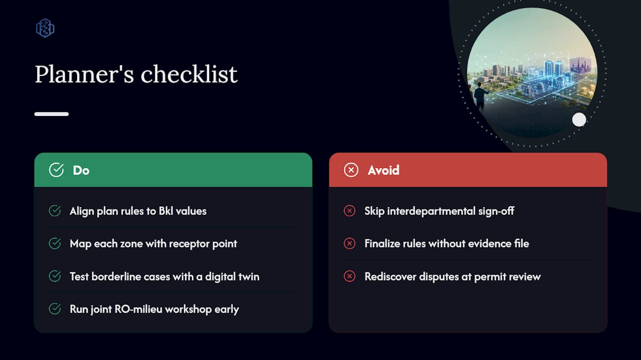
The single most valuable habit is interdepartmental, not technical. Schedule a joint RO-milieu workshop before drafting plan rules, and build one shared evidence file that both the spatial planners and the milieu specialists sign off on, since that same file becomes your BOPA substantiation later. Municipalities that skip this step tend to rediscover the disagreement during permit review, which is a far more expensive place to have it.
If you want to see how quickly a borderline case resolves with proper contour modelling, try a 3D Cityplanner demo against one of your own bedrijventerrein sites.
— Anne Dullemond
Sources
- VNG-handreiking Activiteiten en milieuzonering | VNG
- Handreiking activiteiten en milieuzonering (VNG PDF)
- Servicedocument activiteiten en milieuzonering Omgevingswet (consultatie)
- Nieuw: VNG handreiking activiteiten en milieuzonering | VNG
FAQ
What is milieuzonering nieuwe stijl?
It is the system introduced by the 2024 VNG handreiking, which replaces fixed richtafstanden with zones defined by milieugebruiksruimte, capped at a limited number of noise and odour zones per activity.
What is VNG’s role in environmental zoning legislation?
VNG (Vereniging van Nederlandse Gemeenten) publishes non-binding practical guidance, such as the handreiking, that helps municipalities translate Omgevingswet and Bkl requirements into workable omgevingsplan rules.
How do I determine which milieucategorie my business falls under?
The 2009 activity-category system no longer applies as a legal test; instead, assess your activity’s noise and odour impact against the Bkl-based milieuwaarden using Option 1’s criterion-based method, checking the transposed 2009 table only as an indication.
What are the VNG’s richtafstanden and are they still used?
The original richtafstanden came from the 2009 “Bedrijven en milieuzonering” list and now survive only as an indicative reference within the servicedocument’s transposed table, not as a binding legal standard.