How to plan urban redevelopment with 3D digital twins

Urban redevelopment demands sophisticated planning to balance economic viability, environmental sustainability, and community needs. Traditional approaches struggle with the complexity of integrating multiple data streams, stakeholder perspectives, and long-term operational considerations. Digital twin technology offers urban planners and developers an advanced framework for visualising, simulating, and optimising redevelopment scenarios before committing resources. This guide outlines a structured methodology for leveraging 3D digital twin platforms to enhance decision-making accuracy, reduce project risks, and deliver measurable improvements in cost efficiency and sustainability outcomes for complex urban regeneration initiatives.
Table of Contents
- Understanding 3D Digital Twin Technology In Urban Redevelopment
- Preparing For Urban Redevelopment: Prerequisites And Data Integration
- Executing The Urban Redevelopment Plan With Digital Twin Tools
- Verifying Outcomes And Optimising Post-Redevelopment Operations
- Explore 3D Cityplanner Solutions For Advanced Urban Redevelopment
- How To Plan Urban Redevelopment: Frequently Asked Questions
Key takeaways
| Point | Details |
|---|---|
| Digital twin efficiency | 3D digital twin technology improves planning accuracy and construction efficiency whilst reducing environmental impact in urban projects. |
| Structured approach | A four-phase methodology covering assessment, design, monitoring, and optimisation delivers systematic redevelopment planning outcomes. |
| Data integration | Combining BIM, GIS, IoT sensors, and demographic datasets creates comprehensive baseline models for informed decision-making. |
| Community engagement | Immersive 3D visualisation enables stakeholders to experience proposed changes and provide meaningful feedback during planning stages. |
| Cost reduction | Digital twin applications can substantially decrease project delivery timelines and overall redevelopment expenditure through simulation and optimisation. |
Understanding 3D digital twin technology in urban redevelopment
Digital twin technology creates dynamic virtual replicas of physical urban environments, enabling planners to test interventions and predict outcomes before implementation. These systems integrate real-time data from multiple sources to maintain synchronisation between digital models and actual conditions. Digital twin technology can significantly improve planning science, construction efficiency, and operation intelligence of urban renewal by providing continuous feedback loops between virtual simulations and physical reality.
The architecture supporting digital twin urban planning comprises five interconnected layers. A layered framework covers perception, data, platform, application, and user layers integrating IoT sensors, 3D modelling capabilities, and big data analytics. The perception layer captures real-world conditions through sensors and monitoring devices. Data layers aggregate and standardise information from diverse sources. Platform layers provide computational infrastructure for processing and analysis. Application layers deliver specific planning tools and simulation capabilities. User layers present interfaces for planners, developers, and stakeholders to interact with models and generate insights.
Key capabilities distinguish advanced digital twin systems from basic 3D visualisation:
- Real-time synchronisation between physical assets and virtual representations
- Predictive analytics for infrastructure performance and maintenance requirements
- Scenario modelling for comparing alternative redevelopment approaches
- Multi-criteria decision analysis integrating economic, environmental, and social factors
- Stakeholder collaboration tools enabling distributed teams to work within shared models
Pro Tip: Establish clear data governance protocols at project inception to ensure consistent quality and accessibility across all digital twin components throughout the redevelopment lifecycle.
For urban redevelopment specifically, digital twins enable planners to simulate pedestrian flows, energy consumption patterns, microclimate effects, and infrastructure loads under various design alternatives. This capability transforms decision-making from intuition-based judgements to evidence-driven selections backed by quantitative performance metrics. Digital twin city applications extend beyond individual projects to district-scale regeneration programmes, creating comprehensive platforms for coordinating multiple interventions across time and space.
Preparing for urban redevelopment: prerequisites and data integration
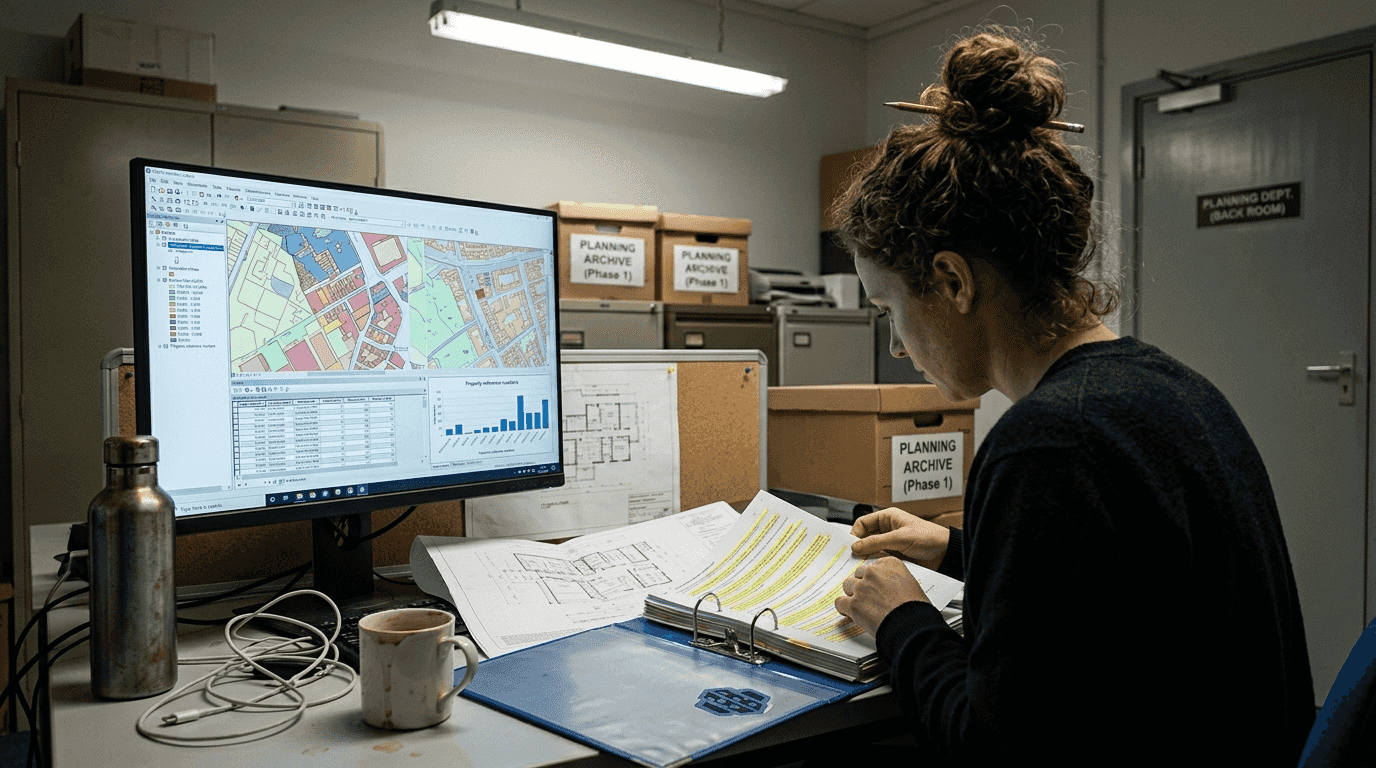
Successful digital twin deployment requires systematic collection and integration of baseline datasets characterising existing conditions. Effective integration of multisource datasets forms the foundation for accurate simulation systems supporting renewal design decisions. Four primary data categories underpin comprehensive urban digital twins:
| Data type | Sources | Application |
|---|---|---|
| Architectural | Building surveys, CAD drawings, historical records | Structural analysis, heritage preservation, spatial planning |
| Environmental | Climate stations, air quality monitors, noise sensors | Sustainability assessment, impact mitigation, regulatory compliance |
| Demographic | Census data, mobility patterns, socioeconomic indicators | Community needs analysis, service provision planning, equity evaluation |
| Infrastructure | Utility networks, transport systems, energy grids | Capacity planning, system integration, resilience modelling |
Integration methodologies determine how effectively disparate datasets combine into unified digital representations. An effective approach to geometric and semantic BIM/GIS integration underpins urban digital twin accuracy by reconciling architectural detail with geographic context. BIM models provide rich building-level information including materials, systems, and performance characteristics. GIS platforms contribute spatial relationships, terrain data, and regional context. Sensor networks deliver real-time operational data reflecting current conditions and usage patterns.
Implement these preparation steps sequentially:
- Define redevelopment objectives and key performance indicators requiring monitoring
- Identify existing data assets and gaps in coverage or quality
- Establish data collection protocols ensuring compatibility with chosen digital twin platform
- Develop semantic models mapping relationships between different dataset types
- Create validation procedures confirming accuracy of integrated baseline model
- Document data lineage and update frequencies for ongoing maintenance
Pro Tip: Prioritise data collection efforts based on sensitivity analysis identifying which variables most significantly influence redevelopment outcomes and decision criteria.
The initial status quo assessment phase establishes baseline conditions against which future scenarios are compared. This assessment captures not only physical characteristics but also operational patterns, user behaviours, and system interdependencies. Urban planning data sources must encompass both static attributes and dynamic processes to enable meaningful simulation of redevelopment impacts. Temporal data revealing seasonal variations, peak demand periods, and long-term trends proves particularly valuable for stress-testing proposed interventions under diverse conditions.
Technical interoperability challenges arise when combining proprietary formats and coordinate systems. Adopt open standards such as IFC for building models, CityGML for urban geometries, and standardised APIs for sensor data exchange. These choices preserve flexibility for future platform migrations whilst enabling collaboration across organisations using different software ecosystems. Investment in robust digital twin infrastructure during preparation phases prevents costly rework and data conversion efforts later in project timelines.
Executing the urban redevelopment plan with digital twin tools
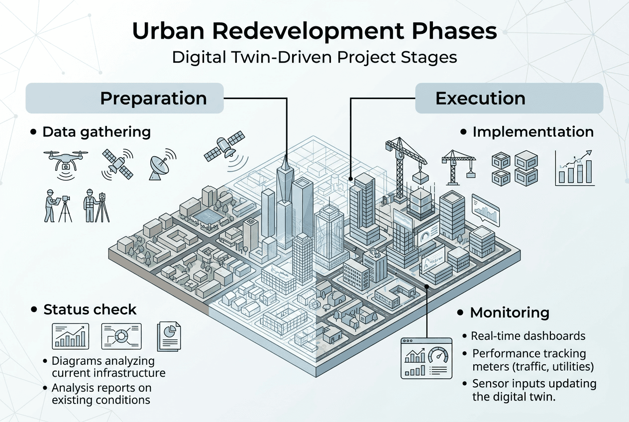
Implementation follows a structured four-phase application path: status quo assessment, programme design, implementation monitoring, and operation optimisation that systematically progresses from analysis through delivery. Each phase leverages specific digital twin capabilities to address distinct planning challenges and decision requirements.
Programme design constitutes the most analytically intensive phase, where planners generate and evaluate alternative redevelopment scenarios. Multi-criteria decision analysis (MCDA) frameworks integrated with digital twin simulations enable systematic comparison across economic, environmental, and social dimensions. Analytical Hierarchy Process (AHP) methods structure stakeholder preferences into weighted criteria reflecting community values and policy priorities. Planners iterate through design variations, adjusting parameters such as building heights, land use mixes, green space allocation, and transport connectivity whilst observing resulting performance metrics.
Key steps in programme design:
- Generate initial design concepts reflecting strategic objectives and site constraints
- Model each scenario within digital twin environment with full geometric and semantic detail
- Execute simulations predicting performance across defined criteria
- Conduct sensitivity analysis identifying design variables with greatest impact
- Refine promising alternatives through iterative optimisation
- Present comparative visualisations enabling stakeholder review and selection
Implementation monitoring activates during construction phases when Internet of Things and digital platforms enable real-time monitoring and construction optimisation during redevelopment. Sensors track progress, material deliveries, equipment utilisation, and site conditions. Deviations from planned sequences trigger alerts enabling rapid corrective action. Digital twins maintained in parallel with physical construction provide as-built documentation automatically, eliminating traditional survey and drawing update processes. This live connection between site and model supports coordination amongst contractors, reduces rework from conflicts, and maintains schedule adherence.
| Aspect | Traditional approach | Digital twin-enabled approach |
|---|---|---|
| Design validation | Physical mockups, 2D drawings | Immersive 3D simulations, performance analytics |
| Stakeholder engagement | Static presentations, limited scenarios | Interactive exploration, multiple alternatives |
| Construction coordination | Weekly meetings, paper-based updates | Real-time monitoring, automated conflict detection |
| Change management | Manual impact assessment, delayed decisions | Instant simulation of modifications, rapid approval |
| Handover documentation | Retrospective compilation, incomplete records | Continuous as-built capture, verified accuracy |
Pro Tip: Establish clear protocols for updating the digital twin during construction to ensure the model remains an accurate representation, avoiding the common pitfall where digital and physical assets diverge.
Benefits realised through digital urban planning execution include:
- Reduction in design errors and construction conflicts through early detection
- Improved cost predictability via detailed quantity take-offs and resource scheduling
- Enhanced sustainability outcomes from optimised energy systems and material selection
- Accelerated approval processes through clear communication of proposals to regulators
- Stronger community support resulting from transparent, accessible visualisation of impacts
Operation and maintenance optimisation extends digital twin value beyond project delivery into long-term asset management. Facility managers inherit comprehensive models documenting systems, components, and maintenance requirements. Predictive maintenance algorithms analyse sensor data to forecast failures before they occur. Energy management systems optimise HVAC, lighting, and other building services based on actual usage patterns and occupancy. Digital twins city planning platforms aggregate data across multiple buildings and infrastructure assets, revealing district-level optimisation opportunities invisible at individual asset scale.
Verifying outcomes and optimising post-redevelopment operations
Performance validation confirms whether implemented redevelopment achieves intended objectives and identifies opportunities for enhancement. Dynamic simulations within digital twins enable comparison between predicted and actual performance across key indicators. Multi-criteria evaluation frameworks assess outcomes against economic viability, environmental sustainability, social equity, and operational efficiency dimensions. Discrepancies between modelled and observed behaviour reveal areas requiring calibration of simulation parameters or physical adjustments to built assets.
Digital twin-based simulation and decision-making frameworks reduce carbon emissions and improve sustainability in urban renewal schemes by enabling precise optimisation of energy systems, material selections, and operational strategies. Post-occupancy monitoring quantifies actual energy consumption, waste generation, water usage, and other environmental indicators. Comparative analysis against baseline conditions and alternative scenarios validates the effectiveness of sustainability interventions. This evidence base supports reporting for green building certifications, carbon accounting frameworks, and sustainability disclosure requirements.
Post-operation optimisation methods include:
- Continuous calibration of building management systems based on occupancy patterns and weather conditions
- Adaptive scheduling of maintenance activities informed by condition monitoring and predictive analytics
- Stakeholder feedback mechanisms capturing user experience and identifying improvement opportunities
- Benchmarking performance against comparable developments to identify best practices
- Scenario planning for future adaptations responding to changing needs or climate conditions
Pro Tip: Establish key performance indicators with clear measurement protocols before redevelopment completion to enable objective evaluation and avoid retrospective disputes about success criteria.
Financial and timeline benefits prove substantial when digital twin methodologies are properly implemented. Digital twin technology can significantly reduce project delivery time and costs in urban revitalisation projects, as demonstrated in major regeneration programmes. The Manaus urban revitalisation initiative achieved notable efficiencies through comprehensive digital twin deployment, validating the business case for technology investment in complex redevelopment contexts.
Implementing digital twin technology in urban redevelopment delivers measurable returns through reduced design iterations, fewer construction conflicts, optimised resource allocation, and enhanced operational efficiency. These benefits compound over asset lifecycles, with early technology investment yielding decades of improved performance and reduced operating costs.
Long-term value creation extends beyond immediate project metrics to encompass enhanced adaptability for future needs. Leverage 3D modelling for smarter city planning approaches that maintain living digital twins enable planners to continuously test potential modifications, assess climate adaptation strategies, and optimise district-scale systems as conditions evolve. This capability transforms redevelopment from discrete interventions into ongoing processes of urban improvement guided by evidence and responsive to emerging challenges.
Explore 3D Cityplanner solutions for advanced urban redevelopment
Transforming urban redevelopment planning requires platforms specifically designed for the complexity and scale of regeneration projects. 3D Cityplanner provides comprehensive digital twin capabilities tailored to the needs of urban planners, architects, and developers managing sophisticated renewal initiatives. The platform integrates automatic building generation, sightline analysis, noise impact simulation, and 4D timeline visualisation within a unified environment supporting collaborative decision-making.
Experience these capabilities firsthand through 3D Cityplanner demo registration, offering hands-on exploration of tools addressing real-world planning challenges. Discover how 3D Cityplanner features streamline data integration, scenario comparison, and stakeholder engagement throughout redevelopment lifecycles. Whether addressing site planning and urban development at neighbourhood scale or coordinating district-wide regeneration programmes, the platform delivers the analytical depth and visualisation clarity essential for confident decision-making in complex urban contexts.
How to plan urban redevelopment: frequently asked questions
What is a digital twin in urban redevelopment?
A digital twin creates a dynamic virtual replica of urban environments, synchronising real-time data from sensors and systems with 3D models to enable simulation and analysis. In redevelopment contexts, digital twin urban planning platforms integrate architectural, environmental, and operational data to test design alternatives and predict outcomes before physical implementation. These systems maintain continuous connections between digital models and built assets throughout project lifecycles.
How does digital twin technology reduce redevelopment costs?
Digital twins reduce costs through early detection of design conflicts, optimised resource scheduling, and reduced construction rework. Simulation capabilities enable testing of alternatives virtually rather than through expensive physical mockups or mid-construction changes. Real-time monitoring during implementation identifies issues immediately when corrections are least costly. Post-completion, predictive maintenance and operational optimisation deliver ongoing savings throughout asset lifecycles.
Can digital twins support community engagement?
Immersive 3D visualisation enables community members to experience proposed redevelopment scenarios from street-level perspectives, understanding impacts on views, sunlight, and neighbourhood character. Interactive platforms allow stakeholders to explore alternatives, compare options, and provide informed feedback. This transparency builds trust and identifies concerns early when design modifications are still feasible, reducing opposition and delays in approval processes.
What data sources feed urban digital twins?
Urban digital twins integrate BIM models from architectural designs, GIS datasets providing geographic context, IoT sensor networks capturing real-time conditions, demographic data reflecting community characteristics, and infrastructure records documenting utility networks and transport systems. Successful implementations establish data governance frameworks ensuring quality, compatibility, and accessibility across these diverse sources throughout project timelines and operational phases.
How to start integrating 3D modelling in existing planning workflows?
Begin with pilot projects of manageable scope to build organisational capability and demonstrate value before scaling to larger initiatives. Identify specific pain points in current workflows where visualisation or simulation would improve decisions. Invest in staff training and establish clear data standards ensuring compatibility with existing systems. Partner with technology providers offering implementation support and choose platforms with open standards enabling future flexibility as needs evolve.
Recommended
- Digital Twin Technology: Transforming City Planning Impact – 3D Urban Development
- 3D Cityplanner, Digital Twin City, Digital Twin Cities, Urban Development, data driven urban development, Geo design, Urban Planning - StrateGis | Groep
- digital twin urban planning | 3D Cityplanner
- digital twin city | 3D Cityplanner


