3D City Models: 30+ EU Cities Use CityGML Standard

Choosing the right 3D city model can feel overwhelming when standards, accuracy levels, and integration capabilities vary so widely across Europe. Urban planners and architects need clarity on which models deliver the precision, interoperability, and features their projects demand. This article breaks down essential evaluation criteria, showcases leading EU 3D city model examples, and provides tailored recommendations to help you select the ideal solution for urban development and real estate analysis.
Table of Contents
- Selection Criteria For Evaluating 3D City Models
- Examples Of Leading 3D City Models
- Comparison Of 3D City Models Based On Key Factors
- Pricing And Accessibility Of 3D City Models
- Situational Recommendations For Urban Planners And Architects
- Discover 3D Cityplanner For Effective Urban Development
- FAQs About 3D City Models In European Urban Planning
Key Takeaways
| Point | Details |
|---|---|
| Standards Matter | CityGML and INSPIRE compliance ensure interoperability and legal adherence across EU jurisdictions. |
| Accuracy Varies by Source | Lidar-based models deliver 20-30% higher spatial precision than photogrammetry-only approaches. |
| Integration Capabilities Differ | Models vary significantly in BIM/GIS compatibility, urban analysis tools, cost structures, and public accessibility. |
| Leading EU Options | Berlin, Amsterdam, Helsinki, NavVis, and Esri CityEngine represent distinct strengths for different planning scenarios. |
| Match Model to Need | Tailored selection based on accuracy requirements, temporal simulation, indoor-outdoor context, budget, and design flexibility optimizes project outcomes. |
Selection Criteria for Evaluating 3D City Models
Before you commit to a specific 3D city model, you need a clear framework for evaluation. The right model depends on multiple technical and practical factors that directly impact your project’s success.
Standard compliance sits at the foundation of any EU-focused selection. CityGML is a widely adopted open standard for storing and exchanging 3D city models in the EU and globally, supporting detailed semantic information about urban features. The INSPIRE Directive mandates EU-wide geospatial data standards, significantly advancing the adoption of interoperable 3D city models across member states. Without these standards, you risk data silos and compatibility headaches when collaborating across borders or jurisdictions.
Data source directly determines spatial accuracy. Lidar technology captures precise elevation and surface detail, while photogrammetry relies on image processing that can introduce measurement variance. Models combining both sources often balance cost with acceptable accuracy, but pure lidar datasets typically win for infrastructure design where millimeter precision matters.
Integration capabilities shape your daily workflow efficiency. Does the model import smoothly into your existing BIM software? Can you overlay it with GIS datasets for spatial analysis? Models that play well with Autodesk, ArcGIS, or QGIS save countless hours of manual data conversion and reduce error introduction.
Urban planning features add immediate value beyond basic geometry. Look for built-in tools like noise simulation, shadow analysis, sightline visualization, and timeline animation. These capabilities transform static models into decision-support systems that communicate complex planning scenarios to stakeholders.
Cost and accessibility determine feasibility at scale. Open data models eliminate licensing barriers but may lack advanced features or recent updates. Proprietary platforms demand budget but often include technical support, regular updates, and specialized analytical tools. Understanding total cost of ownership, including training and maintenance, prevents budget surprises mid-project.
Key evaluation factors include:
- Standard compliance with CityGML and INSPIRE for EU interoperability
- Data source quality comparing lidar versus photogrammetry accuracy
- Integration with BIM and GIS platforms you already use
- Urban analysis features like noise mapping and temporal simulation
- Licensing costs, accessibility restrictions, and update frequency
Examples of Leading 3D City Models
Several prominent 3D city models serve EU urban planners and architects, each with distinct technical approaches and strengths. Understanding these options helps you match capabilities to your specific project needs.
Berlin’s 3D City Model sets a high bar for spatial accuracy. Berlin’s 3D city model uses high-accuracy lidar data with 1m resolution and supports LOD2/LOD3 detail including roofs. The model covers the entire city with semantic data on building use, construction year, and height. It integrates well with standard GIS tools and provides exceptional detail for infrastructure planning, though access requires navigating municipal data portals.
Amsterdam takes a different approach by prioritizing accessibility and data fusion. Amsterdam’s model fuses lidar, photogrammetry, and cadastral data, providing free access with rich semantic attributes. The city makes its 3D model available via open data portals with minimal restrictions, encouraging innovation and analysis. This multi-source approach balances accuracy with coverage, making it ideal for projects that need city-wide context without licensing costs. The benefits of 3D city models become immediately apparent when exploring Amsterdam’s freely available dataset.
Helsinki stands out for temporal simulation capabilities. The city’s 4D model enables planners to visualize project phases over time, showing how developments evolve from concept through construction to completion. This feature proves invaluable for communicating complex urban transformation projects to citizens and decision makers, reducing opposition through clear visualization of phased impacts.
NavVis IndoorViewer fills a unique niche by combining precise indoor mapping with outdoor city context. For projects requiring asset management across building interiors and urban surroundings, NavVis delivers seamless indoor-outdoor integration. Facilities managers and real estate developers gain complete spatial awareness, though the platform requires specialized scanning equipment and technical expertise.
Esri CityEngine excels at procedural generation, enabling rapid creation of customizable urban scenarios. Architects and planners can define rule-based parameters to automatically generate building masses, street networks, and urban layouts. This capability accelerates concept development and what-if scenario testing, particularly for greenfield projects or large-scale redevelopment zones.
Prominent EU 3D city model options:
- Berlin: Lidar-based precision with LOD2/LOD3 detail for infrastructure design
- Amsterdam: Free, multi-source fusion optimizing accessibility and semantic richness
- Helsinki: 4D temporal simulation for phased project visualization
- NavVis: Indoor-outdoor integration for comprehensive asset context
- Esri CityEngine: Procedural generation enabling parametric urban design
Comparison of 3D City Models Based on Key Factors
Direct comparison reveals how these models stack up across the criteria that matter most to your selection decision.
| Model | Spatial Accuracy | CityGML/INSPIRE | BIM/GIS Integration | Cost | Best Use Case |
|---|---|---|---|---|---|
| Berlin 3D | High (lidar 1m) | Full compliance | Strong GIS support | Municipal access | Infrastructure planning requiring precision |
| Amsterdam 3D | Medium-High (multi-source) | INSPIRE compliant | Standard GIS formats | Free/Open | City-wide analysis on limited budgets |
| Helsinki 3D | Medium (photogrammetry) | CityGML support | Basic GIS export | Municipal access | Temporal project visualization |
| NavVis IndoorViewer | Very High (indoor scan) | Limited standards | Proprietary + GIS | License required | Indoor-outdoor asset management |
| Esri CityEngine | Variable (generated) | Export to CityGML | Native Esri integration | Annual license | Procedural urban design scenarios |
Spatial accuracy differences stem directly from data capture methods. Lidar-based 3D city models have 20-30% higher spatial accuracy than photogrammetry-only models, a critical distinction when designing infrastructure that must align with existing utilities or transport networks. Berlin’s lidar foundation delivers this precision, while Helsinki’s photogrammetric approach trades some accuracy for broader coverage and lower cost.
Standards compliance impacts long-term data utility. Full CityGML and INSPIRE compliance ensures your model remains interoperable as EU regulations evolve and neighboring jurisdictions develop their own datasets. Amsterdam and Berlin lead here, while proprietary platforms like NavVis prioritize specialized features over open standard conformance.
Integration capabilities determine daily workflow friction. Native support for your existing 3D city modeling software eliminates conversion headaches and preserves semantic data through the import process. Esri CityEngine integrates seamlessly with the ArcGIS ecosystem but may require additional plugins for other BIM platforms.
Cost structures vary dramatically. Amsterdam’s open data model eliminates acquisition costs but may require internal expertise to process and analyze. Enterprise licenses for Esri CityEngine or NavVis demand significant annual investment, justified by advanced features and vendor support that accelerate complex projects.
Application suitability depends on your specific scenario. Detailed infrastructure projects need Berlin’s precision, while concept studies benefit from CityEngine’s rapid scenario generation. Indoor facility management uniquely requires NavVis capabilities, and public engagement projects gain from Helsinki’s temporal visualization.
Pricing and Accessibility of 3D City Models
Understanding licensing models and access restrictions prevents budget surprises and ensures your selected model remains viable throughout project timelines.
Open data models like Amsterdam provide free access with minimal restrictions, ideal when budget constraints limit commercial software investment. You download datasets directly from municipal portals, import them into your preferred tools, and begin analysis immediately. However, update frequency depends on municipal resources, and technical support comes from community forums rather than dedicated vendors.
Proprietary platforms require careful cost evaluation. Esri CityEngine licenses start at several thousand euros annually per user, with enterprise agreements scaling based on organization size. NavVis pricing follows a similar enterprise model, often bundled with scanning hardware and services. These costs buy regular software updates, technical support, and advanced features unavailable in open alternatives.
Some public 3D city models impose usage restrictions despite free access. Berlin’s data, for example, may limit commercial application or require attribution in published materials. Always review licensing terms before committing to a model, particularly for projects involving private development or commercial real estate analysis.
Hidden costs accumulate beyond initial acquisition. Training staff on new platforms, maintaining software licenses, and periodically updating datasets all demand ongoing investment. Models requiring specialized hardware, like NavVis indoor scanning systems, add capital equipment costs that small firms may struggle to justify.
Budget planning should account for:
- Initial acquisition: free (open data) to €5,000-15,000 annually (enterprise licenses)
- Training and onboarding: 40-80 hours per team member for complex platforms
- Hardware requirements: standard workstations for most models, specialized scanners for indoor systems
- Update cycles: quarterly (commercial) to annual (municipal open data)
- Technical support: community-based (open) versus dedicated vendor support (commercial)
Understanding these cost dynamics helps you select a model that fits both immediate project needs and long-term organizational capabilities. The cheapest option today may prove expensive tomorrow if it lacks critical features or requires extensive customization. For more guidance on creating 3D city models within budget constraints, consider both acquisition and lifecycle costs.
Situational Recommendations for Urban Planners and Architects
Matching 3D city models to specific project scenarios ensures you get the functionality you need without paying for capabilities you won’t use.
For high-accuracy infrastructure design, prioritize Berlin’s lidar-based model or similar municipal datasets with sub-meter precision. When you’re designing transit alignments, utility networks, or structural interventions that must fit precisely within existing urban fabric, spatial accuracy outweighs all other factors. The extra effort navigating municipal data portals pays off in reduced field verification and construction conflicts.
Dynamic project visualization demands temporal simulation capabilities. Helsinki’s 4D model excels when you need to show stakeholders how a development evolves from excavation through construction to occupancy. This capability proves particularly valuable for controversial projects requiring public consultation or when coordinating multi-phase developments with complex dependencies.
Indoor-outdoor integration scenarios uniquely favor NavVis IndoorViewer. Real estate asset managers tracking building systems, space utilization, and facility conditions need seamless context from interior rooms to surrounding streetscapes. The investment in specialized scanning makes sense for portfolio-scale projects where comprehensive digital twins drive ongoing operational decisions.
Budget-conscious projects benefit from Amsterdam’s open data model, which balances semantic richness with zero licensing costs. Small municipalities, academic research, and preliminary feasibility studies gain sufficient detail for analysis without depleting limited budgets. Combine this foundation with targeted data collection in critical areas to optimize resource allocation.
Custom procedural design workflows call for Esri CityEngine’s parametric capabilities. When exploring multiple urban design alternatives, rule-based generation lets you test scenarios rapidly. Adjust building heights, setbacks, or street widths through parameters rather than manual modeling, accelerating concept development from weeks to days.
Pro Tip: You don’t need to choose just one model. Combining open municipal data for city-wide context with detailed lidar in your project area optimizes both coverage and accuracy while controlling costs. Export common formats like CityGML to move data between platforms as project needs evolve.
Selection recommendations:
- Infrastructure precision: Berlin or municipal lidar models with LOD2/LOD3 detail
- Temporal visualization: Helsinki 4D or platforms supporting timeline animation
- Indoor-outdoor context: NavVis IndoorViewer for comprehensive asset management
- Budget optimization: Amsterdam open data with targeted detailed capture
- Procedural design: Esri CityEngine for rapid scenario generation
- Standards compliance: Any CityGML/INSPIRE-certified model for cross-border projects
Understanding why use 3D city models in your specific context helps prioritize these factors. Match model strengths to your project’s critical success factors, and don’t hesitate to use different models for different project phases. Explore 3D city modeling tool features that align with your analysis requirements before committing to a platform.
Discover 3D Cityplanner for Effective Urban Development
Selecting the right 3D city model solves only part of the urban planning puzzle. You also need powerful tools to analyze, visualize, and communicate your designs effectively.
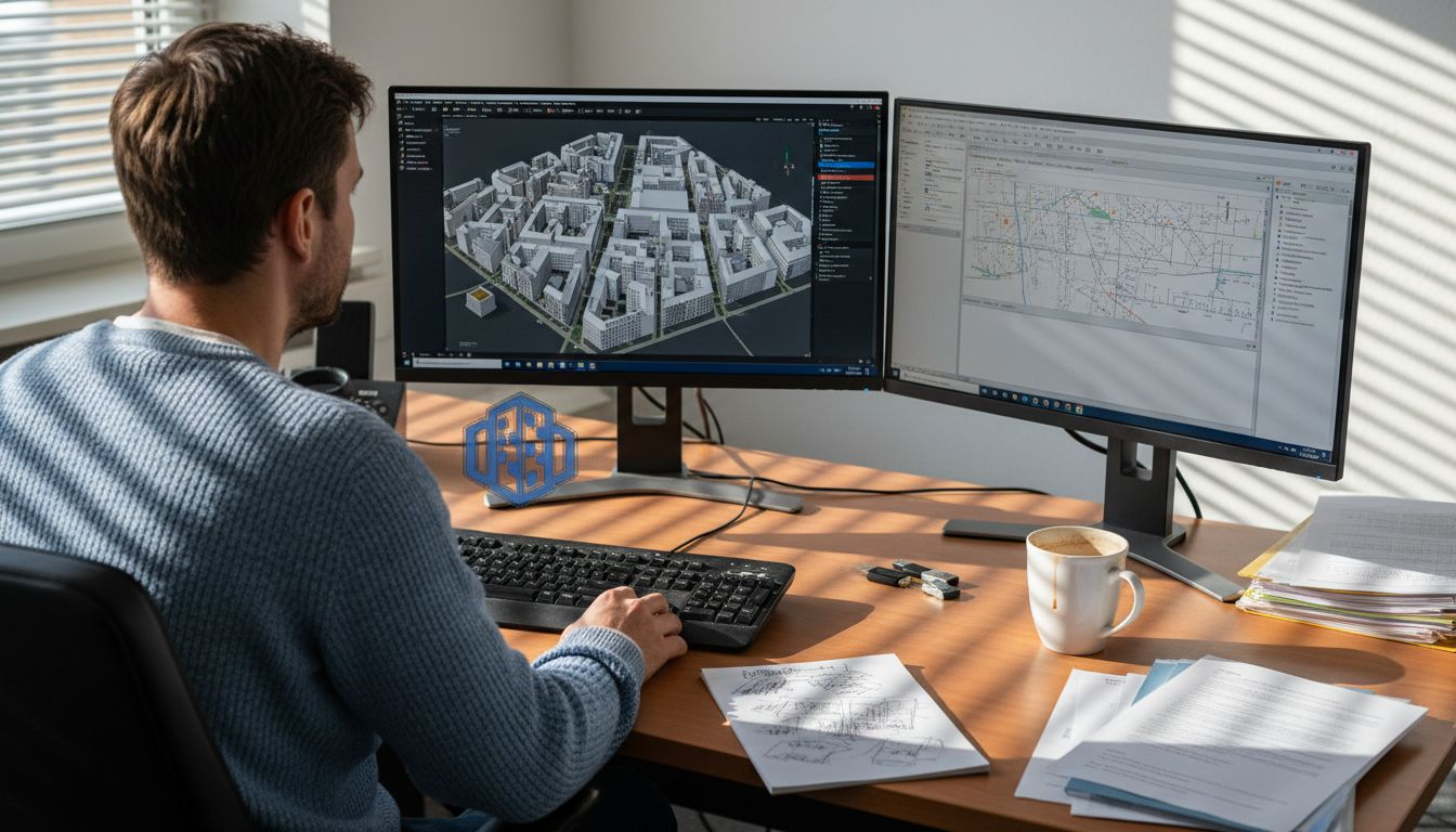
3D Cityplanner delivers an integrated platform specifically designed for EU urban planners and architects working with advanced 3D city models. The software combines precise modeling capabilities with BIM/GIS integration, timeline simulations, and customizable urban design tools. Whether you’re working with Berlin’s lidar datasets, Amsterdam’s open data, or creating procedural scenarios, 3D Cityplanner provides the analytical depth and visualization clarity your projects demand. Request a demo to experience how data-driven workflows accelerate decision-making, optimize designs, and enhance stakeholder communication. The platform’s compatibility with CityGML and INSPIRE standards ensures your work remains interoperable as regulations evolve. Explore the 3D City Modeling Tool features that transform raw 3D city data into actionable urban intelligence, from noise simulation to sightline analysis. Data-driven urban development with 3D Cityplanner becomes achievable for teams of any size, with flexible licensing that scales from individual practitioners to municipal planning departments.
FAQs about 3D City Models in European Urban Planning
How frequently are 3D city models updated to ensure data freshness?
Update frequency varies significantly by source and municipality. Commercial platforms like Esri update software quarterly, but underlying municipal datasets may refresh annually or less frequently. Amsterdam updates its open data model approximately every two years, while Berlin targets annual updates for core districts. Always verify the vintage of any dataset before relying on it for current conditions analysis.
How do CityGML and INSPIRE standards impact project compliance?
CityGML and INSPIRE compliance ensures your 3D city model data remains interoperable with other EU geospatial systems and meets legal requirements for cross-border projects. INSPIRE mandates specific metadata and formats for spatial datasets shared among member states. Using compliant models simplifies regulatory approval and enables seamless data exchange with government agencies and partner organizations.
Are 3D city models compatible with common European BIM and GIS tools?
Most leading 3D city models export to standard formats like CityGML, IFC, or shapefile that import into Autodesk Revit, ArcGIS, QGIS, and other mainstream platforms. However, semantic data preservation varies by export format. Test your specific workflow with sample datasets before committing to a model, particularly if you rely on detailed building attributes or custom classifications that may not survive format conversion.
Which models work best for small municipal projects versus large-scale developments?
Small municipal projects with limited budgets benefit from open data models like Amsterdam’s, supplemented with targeted field survey in critical areas. Large-scale developments justify investment in high-precision lidar models like Berlin’s or commercial platforms like Esri CityEngine that accelerate scenario testing. The key is matching data resolution and analytical capabilities to decision complexity rather than project physical size.
How do I access free versus licensed 3D city model data?
Free 3D city model data typically comes from municipal open data portals or national geospatial agencies. Search for your city name plus “3D model” or “open data” to locate available datasets. Licensed data requires contacting commercial vendors or specialized municipal offices. Review uses of 3D city models to determine whether free options meet your needs before investing in commercial licenses. Be aware that free data often carries attribution requirements or restrictions on commercial use, while licensed data typically permits broader application but costs significantly more. For guidance on creating 3D city models from various sources, consider both data acquisition options and the processing expertise available within your organization.


