4 Step 3D Participation Process for Dutch Planners
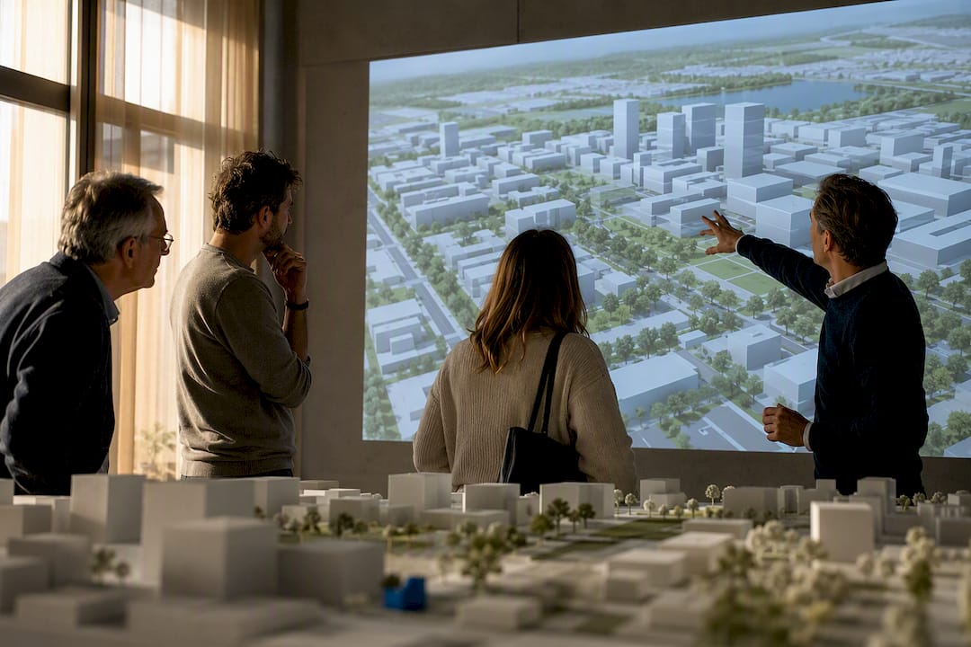
Digital participation in 3D works when it replaces flat plans with something residents can walk through, question and respond to. Practitioner reports from Witteveen+Bos link 3D visualisation to fewer formal objections and faster decision cycles. Planners running these sessions typically see better spatial understanding, more constructive feedback, and iteration loops that close in days rather than months.
TL;DR:3D visualizations lead to fewer formal objections and quicker decision-making by enabling residents to better understand spatial impacts through realistic views.Interactive formats such as scenario polling and VR walkthroughs are most effective at different planning stages, from testing density preferences to refining design options.Selecting tools with browser-based access, scenario comparison, and accessibility features is crucial for engagement, while governance settings protect data privacy and process integrity.Running a participatory 3D session requires clear preparation, guided interaction, prompt feedback, and transparent updates to build trust and demonstrate responsiveness.Integrating 3D models with accurate data sources like 3D BAG, GIS layers, and LiDAR ensures credible visualizations, especially when paired with a digital twin approach fostering iterative participation.
3D CityplannerMake Planning Easier to UnderstandExplore a browser-based 3D platform for comparing development scenarios, analysing spatial impacts, and communicating plans with stakeholders.Explore 3D Cityplanner
Table of Contents
- What digitale participatie 3D delivers: benefits and practical uses
- What capabilities to expect from 3D tools and platforms
- How do you run a 3D participatory process step by step?
- Common pitfalls and how to manage expectations
- Practitioner evidence and short case examples
- A practical checklist: running a 3D participation session
- Making 3D participation routine, not a one-off event
- How 3D Cityplanner supports your next participation session
- Sources
- FAQ
What digitale participatie 3D delivers: benefits and practical uses
A 3D model closes the gap between a technical drawing and what a resident actually sees standing on their street. Eye-level views of proposed massing, sightlines from a neighbour’s window, or a sunlight study showing how a new block shadows a garden at 4pm in October, all communicate consequences that a site plan cannot. That comprehension gap is the real driver behind fewer bezwaarschriften: people object less to what they understand, even when they disagree with it.
The operational payoff follows directly.
In practice, this shows up as:
- Public information pages with a navigable 3D viewer instead of static renders
- Interactive scenario polling, where residents compare two or three massing options side by side
- VR walkthroughs for immersive, human-scale review of a proposed street or square
- Co-design workshops where a facilitator adjusts a 3D city model live in response to the room
Each format suits a different stage. Polling works early, when you are testing appetite for density or building height. Workshops work later, once the scenario space has narrowed to two or three credible options.
What capabilities to expect from 3D tools and platforms
Choosing a platform matters less than choosing the right feature set for your participation goal. Procurement guidance from Kennisknooppuntparticipatie stresses aligning tool selection to accessibility, privacy and the actual objective of the session, not the flashiest demo.
The core technical requirements are consistent across use cases:
- Browser-based viewing with no plugin or heavy install, so residents can join from a shared library computer or their own phone
- Scenario comparison, letting participants toggle between building heights, footprints or green space allocations
- Simple massing editors and sunlight and visibility tools that show impact rather than just geometry
- GIS layer control, so planners can switch between zoning, cadastral boundaries and infrastructure overlays
User experience decides whether people actually finish a session. Mobile and desktop parity matters because many residents will only ever open the link on a phone. Accessibility options, such as high contrast modes and clear language, extend reach beyond digitally confident users.
Governance is the part planners underestimate until something goes wrong. Data residency within the EEA, version control on scenario edits, and user roles that separate who can comment from who can edit the model, all protect both the process and the participants’ trust in it.
How do you run a 3D participatory process step by step?
A workable sequence has four stages, and skipping the last one is the most common reason participation feels hollow to residents.
- Prepare. Assemble your 2D plans and base data, import 3D BAG geometry or LiDAR data where available, and set clear scenario goals and the level of detail participants actually need to see.
- Engage. Decide the format: an online viewer for broad reach, a VR lab for immersive review, or a physical maquette for a neighbourhood meeting. Recruit a representative group and send simple, jargon-free instructions beforehand.
- Interact. Run guided tours through the model, set targeted tasks such as marking areas of concern, and allow limited, trackable edits. Collect feedback in a structured format rather than open comment boxes alone.
- Respond. Publish an update log showing which suggestions were accepted, rejected or modified, and why. This step closes the loop and is what determines whether residents trust the next round.
Pro Tip: Keep the “respond” step visible on the same platform residents used to give feedback. A separate PDF report buried on a municipal website rarely gets read, and residents notice the disconnect.
Common pitfalls and how to manage expectations
The most damaging mistake is letting a photorealistic model look finished when the design is still open. Residents interpret a highly rendered building with textured brick and landscaping as a done deal, even when the massing is genuinely still negotiable. Label drafts clearly and show at least one alternative option alongside the preferred one.
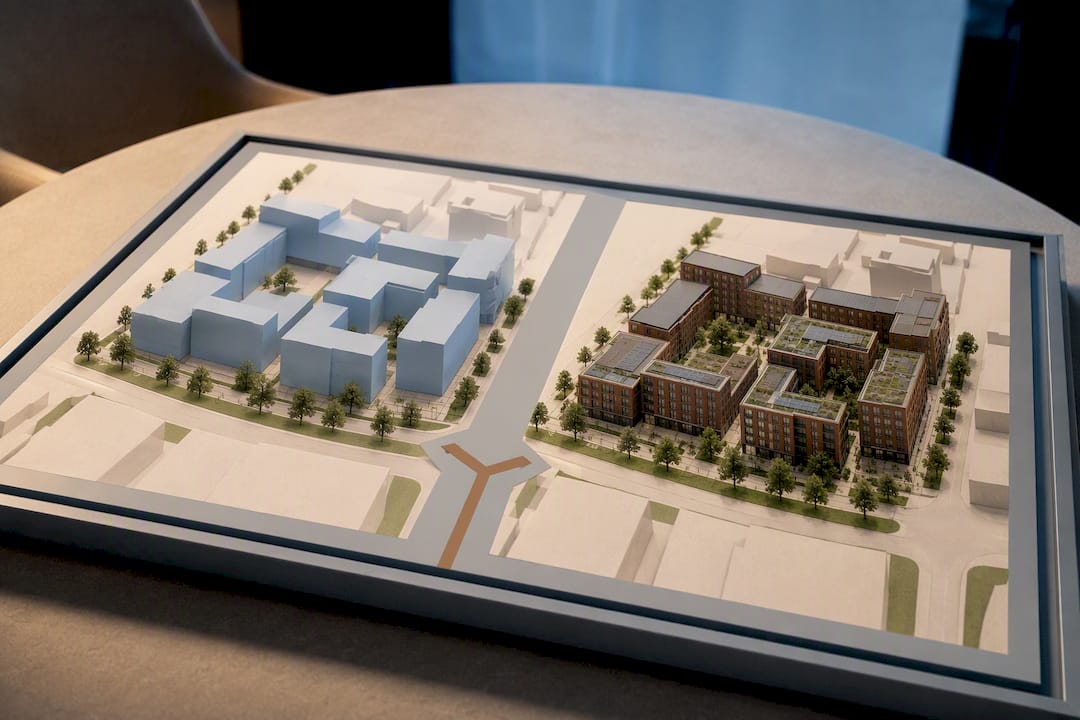
Overly polished renders create a second problem: they read as marketing rather than dialogue. Interactive, browser-based models tend to feel more transparent precisely because residents can change the viewpoint and test scenarios themselves, rather than being shown a single flattering angle. Where trust is fragile, a modular physical maquette can still outperform a slick digital render, as experience from 3D Maquettes shows in tangible, face-to-face settings.
Digital inclusion needs deliberate attention:
- Offer offline or facilitated alternatives for residents without reliable internet access or a suitable device
- Provide simple, in-person navigation help at a physical session rather than assuming everyone can self-serve a VR headset
- Store participant data on EEA servers and publish a short privacy note before the session opens
Pro Tip: Run a five-minute “how to use this” walkthrough at the start of every VR or interactive session. Skipping it disproportionately excludes older residents and anyone unfamiliar with the interface.
Practitioner evidence and short case examples
The clearest signal comes from practice, not theory. Witteveen+Bos reports that projects using 3D visualisation see substantially fewer formal objections and faster decision cycles, because residents can ask specific, constructible questions instead of raising general concerns.
A 2022 study of a Dutch redevelopment project involving 62 participants found that 3D tools increased engagement and helped residents visualise proposed designs, but cautioned that technology alone cannot resolve entrenched socioeconomic or political barriers to participation.
That caution matters as much as the headline finding. A municipal VR pilot in Groningen used 3D city data to help residents understand proposed changes and gather spatially specific, actionable feedback. Similar approaches piloted in Haarlem and Eindhoven point to the same lesson: 3D tools work best when paired with facilitated sessions, not left as a self-service link.
A practical checklist: running a 3D participation session
Print this before your next session and adapt the timing to your project’s scale.
- Confirm data readiness, device access, an accessibility plan and a clear facilitator role before the session opens.
- Publish a short privacy note explaining what feedback data is collected and where it is stored.
- Script guided tasks with fixed timing, decide how comments and edits will be captured, and have a contingency plan for technical failures.
- Publish results promptly, update the model to reflect accepted changes, and state clearly which items will be acted on next.
Making 3D participation routine, not a one-off event
The planners who get real value from 3D participation treat it as standard practice, not a showcase for a single flagship project. That means small pilots, basic training for the team running sessions, and a handful of tracked KPIs, such as objection rates or feedback turnaround time, rather than a single glossy demonstration that never gets repeated.
The bigger shift is cultural. Participation that broadcasts a finished design invites resistance; participation that invites residents into the model, even with modest editing rights, invites collaboration. Platforms built for scenario comparison, such as 3D Cityplanner, support that shift precisely because they let planners hold several live options open at once rather than presenting one polished outcome.
— Anne Dullemond
How 3D Cityplanner supports your next participation session
3D Cityplanner gives planning teams a direct route from raw data to a session-ready model, without the licensing overhead of desktop CAD or GIS suites. The platform runs entirely in the browser, imports 3D BAG geometry and municipal GIS layers directly, and lets you build scenario comparisons, sunlight studies and visibility checks that residents can explore themselves rather than watch on a screen.
If your team is preparing an Omgevingswet-era participation round, the practical next step is to test the workflow on a real site. Use the urban design platform to build a first scenario from your own base data, or start with the free trial to see how quickly a rough massing model becomes something you can put in front of residents. A small pilot on one project is usually enough to judge whether it fits your process before scaling it across a department.
Sources
Building a credible 3D participation model starts with the right data, not the prettiest render. 3D BAG provides building geometry for the whole of the Netherlands and remains the most practical starting point for accurate massing. Municipal GIS layers add zoning and land use context, while LiDAR or drone photogrammetry fills in terrain and vegetation detail where the base data falls short. Watch for projection mismatches and inconsistent level-of-detail between datasets. A model that mixes a detailed cadastral layer with a coarse terrain mesh looks inconsistent and undermines confidence in the whole exercise.
National coordination is moving in a helpful direction here. The VNG’s Totaal Driedimensionaal initiative is standardising 3D data capture and reuse across municipalities, which should make cross-project model reuse easier over time. The Omgevingswet, in force since 2023, sets expectations around early and meaningful participation, which makes the timing of a 3D session as important as its content.
Practical integration advice:
- With a good 3D model, stakeholders can really get involved | Witteveen+Bos
- Study on 3D digital participatory planning (2022)
- Groningen supports participation with virtual reality
A digital twin approach helps here because it treats the model as a living reference rather than a one-off export, which matters when a project runs through multiple participation rounds.
FAQ
What is digitale participatie 3D?
It refers to using three-dimensional digital models, viewers or VR environments to let residents explore and respond to proposed urban development, rather than reviewing flat plans or renders.
Does 3D participation actually reduce formal objections?
Practitioner experience from Witteveen+Bos links 3D visualisation to fewer formal objections and faster decision cycles, largely because residents raise specific, constructible feedback instead of general opposition.
Can 3D tools replace in-person or physical participation methods?
No. A 2022 Dutch study found 3D tools increase engagement but cannot resolve entrenched socioeconomic or political barriers alone, and physical maquettes remain effective for building trust in face-to-face settings.
What data do I need to build a 3D participation model?
3D BAG building geometry, municipal GIS layers, and LiDAR or drone photogrammetry cover most cases, provided you check coordinate consistency and level-of-detail across sources.
How does 3D Cityplanner fit into a participation workflow?
3D Cityplanner imports GIS and 3D BAG geometry and lets you build scenario comparisons, sunlight studies and visibility checks that residents can explore themselves during a session.